
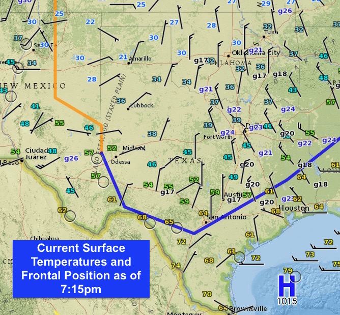
Today’s cold front has made good progress across the state this afternoon and is currently approaching south central Texas. Winds behind the front are gusting into the 20mph range leaving it feeling quite bitter out compared to earlier this morning. This will be the first of two fronts that impact us before the weekend. A second Arctic front will arrive early Thursday which will drop temperatures even further than today’s front, but thankfully not quite as cold as our last Arctic front back in December.
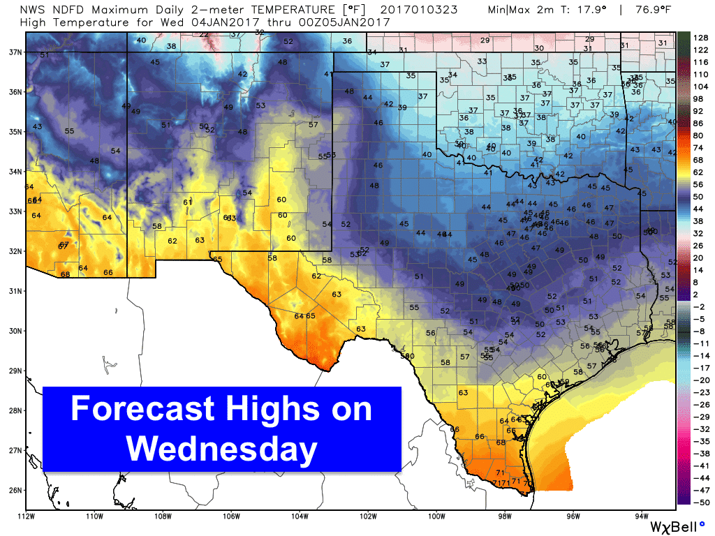
Lows tonight will drop into the teens across the panhandle, 20s for much of western north Texas, low 30s across northeast, central and far western Texas with 40s further south along the coast. Highs tomorrow will be quite mild and pleasant for folks in far western Texas and the Rio Grande Valley region…but elsewhere, we’ll see highs ranging from the upper 30s to low 50s. 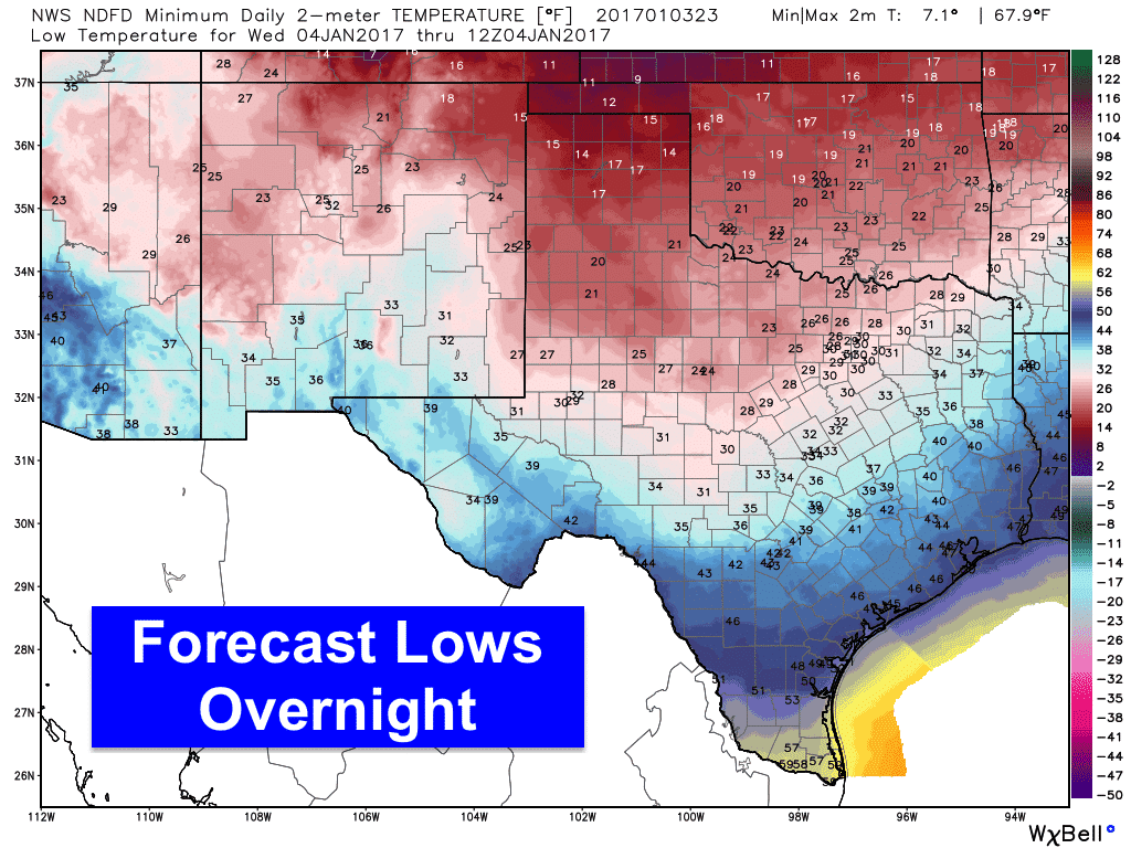
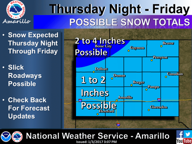
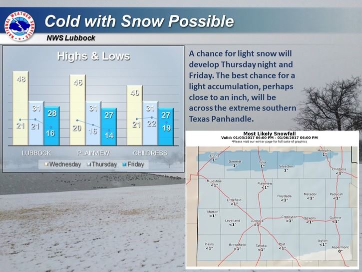
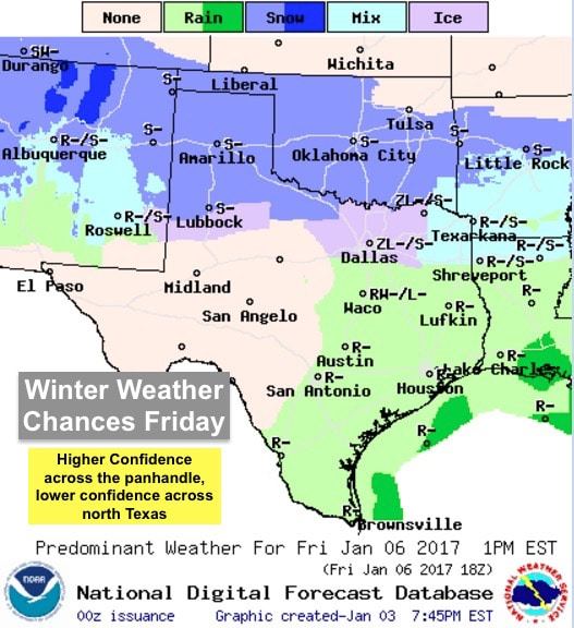
The next Arctic front will arrive early Thursday pushing through the state during the late morning/early afternoon hours arriving along the upper coast by around midnight. I’m sure the big question on everyone’s mind is the chance for winter weather behind the next front. Unfortunately, last night’s model data, which was analyzed this morning, did not yield any greater confidence in the wintry weather forecast for Thursday and Friday for residents across north Texas. For the panhandle region, snow is a pretty good bet with the current forecast calling for light snow across portions of the panhandle late Thursday through Friday with accumulations generally in the 1 to 2 inch range around Amarillo, with lesser amounts around 1/2 inch further south towards Lubbock.
For north Texas, confidence remains sketchy with regard to winter weather chances. It’s likely that counties up along the Red River could see some light snow, but for areas further south, including the Dallas/Ft. Worth metro area, we’re going to have to wait until there’s consistency in the forecast models. Currently, a light mix of freezing rain and sleet looks possible for folks in the DFW Metro up towards the Red River, but confidence in that happening is not very high at this moment. Hopefully data coming in overnight will help to clarify things a bit, so be sure to check back tomorrow and the rest of the week for additional updates!


0 Comments