
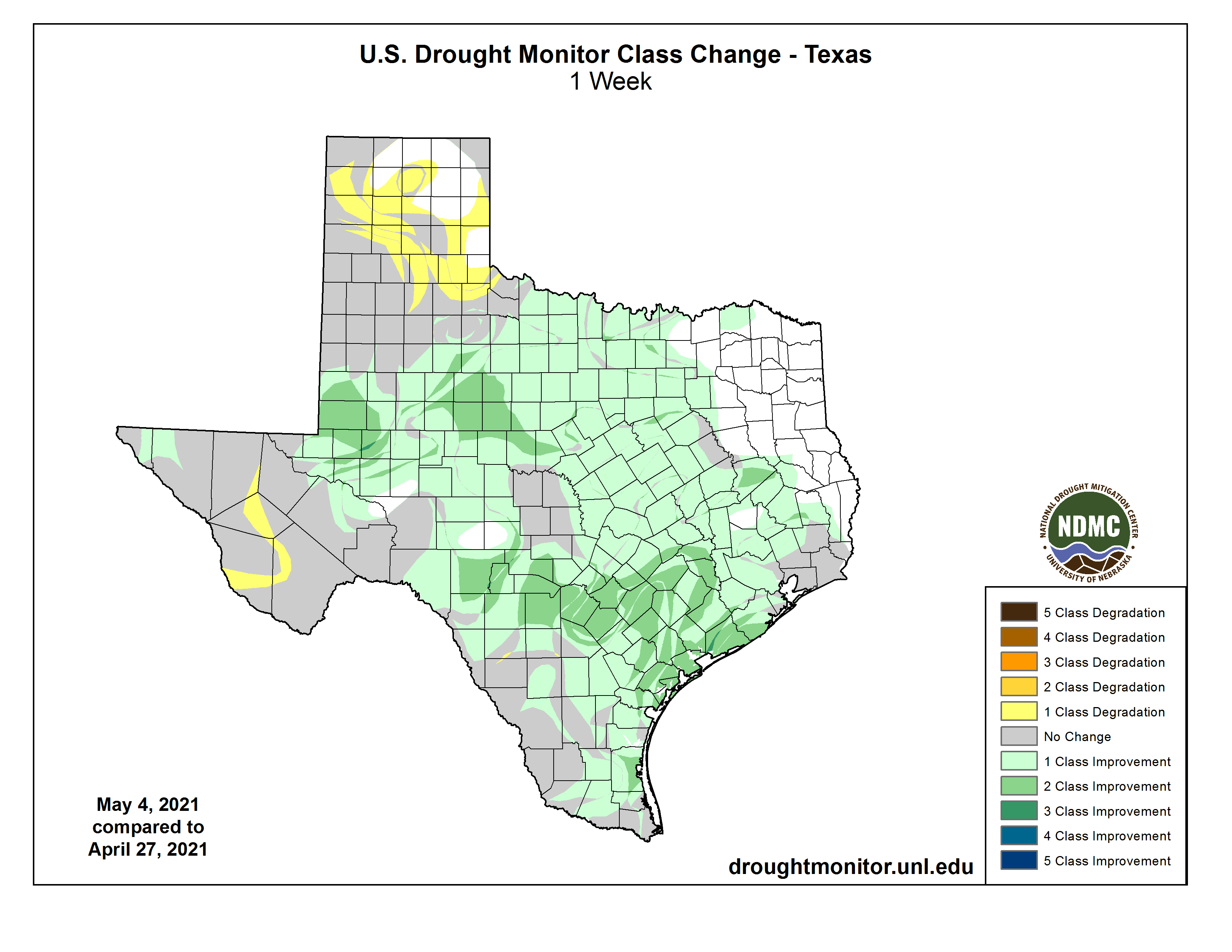
Last week’s thunderstorms resulted in beneficial rains across the eastern two-thirds of Texas. We’re now getting to see those improvements reflected in the new Texas drought monitor.
One week of rain won’t typically eliminate a long-duration drought (and no, that isn’t a challenge to Mother Nature). Still, it is good to see widespread reductions in drought intensity. The news is not all good, though, with some degradation noted in the Texas Panhandle and Far Southwest Texas.

Extreme to exceptional drought continues across the Borderland, Trans-Pecos, Far West Texas, and the South Texas Plains. Moderate to severe drought conditions are observed in the Edwards Plateau, Hill Country. The threat for wildfires will continue to increase as we trend toward summer.
More isolated ‘pinpoint’ drought conditions are noted across North-Central Texas, Southeast Texas, and the Coastal Plains. Many of these regions were in more widespread drought conditions before last week’s rainfall.
Precipitation Outlook
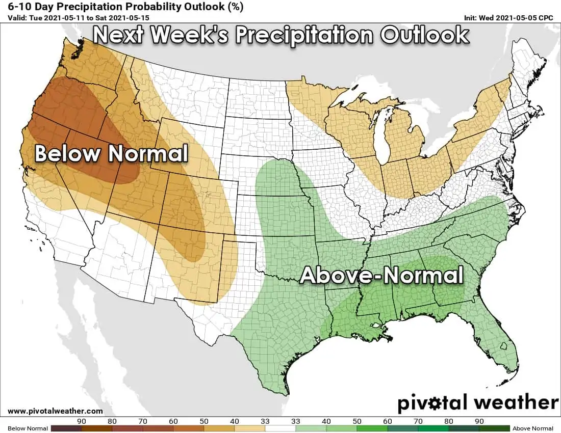
Outside of isolated dryline storms in far western Texas, we’re expecting mostly dry weather through Saturday. A wetter weather pattern begins to set up shop on Sunday, with another late-season cool front moving south. More rain is expected across the eastern half of Texas at times next week.
Depending on where the heaviest rains set up, we might have to deal with localized flooding. Unfortunately, the worst-off in the drought department across western Texas continues to look mostly dry.


0 Comments