
Oh, the weather outside is frightful, But the fire is sure delightful. That does seem to be a relatively accurate description of the weather across Texas this week. It’s cool and rainy, or we’ve got fields burning. We’ll add another lyric to the song tomorrow when we introduce snow and freezing drizzle into the fray. A significant winter storm is not anticipated tomorrow, but we are likely to see problematic travel conditions develop in parts of Texas.
Specifically, our focus for tomorrow’s snow and ice mischief will be across the Texas Panhandle, West Texas, the Permian Basin, the Trans-Pecos, the Davis Mountains, and into West-Central Texas. For those unfamiliar with Texas regional terminology, we’re talking about the western third of Texas, excluding the Far Western parts of Texas closer to El Paso.
Areas of freezing drizzle will be ongoing late tonight across the higher elevations of the Guadalupe and Davis Mountains, northeast into West Texas. Appreciable precipitation may not occur, but a trace of ice may accumulate on exposed objects. A little ice can turn bridges and overpasses into skating rinks, if not surface roads. Keep that in mind tomorrow.
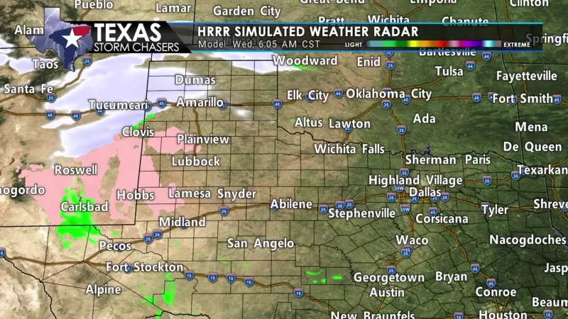
We’ll see snow move across the Texas Panhandle tomorrow morning and through the early afternoon hours. Light snow will move east into Northwest Texas tomorrow afternoon, changing over to rain where temperatures are above freezing.
We may see a brief period of light snow in West Texas tomorrow morning as well, on top of the freezing drizzle (which I’m nicknaming as freezing garbage). Precipitation coverage will diminish late tomorrow afternoon and evening across Northwest Texas and Texoma.
Don’t let all the pretty colors on the map fool you because most of what falls will melt thanks to warm ground temperatures as precipitation moves east into Northwest Texas, the Big Country, and Texoma.
Accumulation Forecast
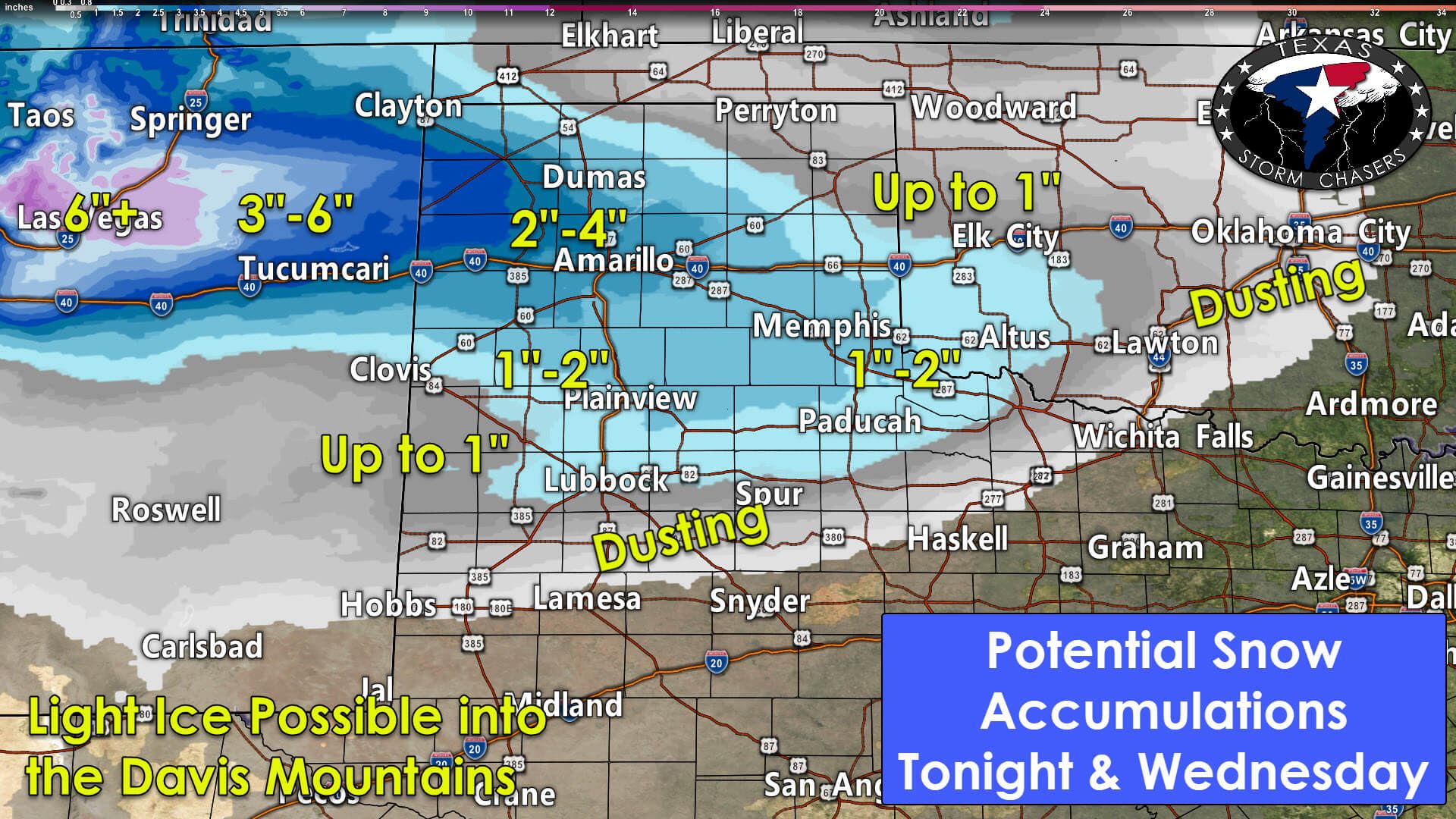
The heaviest snow accumulations are likely to set up in the western Texas Panhandle. We anticipate two to four inches of snow west of a line from Dalhart to Dumas to Amarillo. Where the heaviest snow axis sets up is still up the air, but it’ll likely be in that general region. One to two inches of snow are possible across the remainder of the Panhandle, south to Highway 82 in West Texas, and east to around Childress in Northwest Texas. We may see a dusting of snow north of a line from near Hobbs, New Mexico, to Wichita Falls. Light ice accumulations are also possible across the Guadalupe and Davis Mountains, the Permian Basin, northeastward across West-Central Texas.
The winter mischief tomorrow could cause at least sporadic travel hazards, especially on bridges and overpasses. I’m a bit concerned that surface temperatures will be in the middle 20s, helping to enhance the threat for some ground-level impacts from accumulating winter precipitation. Take it slow tomorrow and don’t drive like a moron (I know, some Texans can’t help themselves, so try not to let them drag you into a ditch too).


0 Comments