
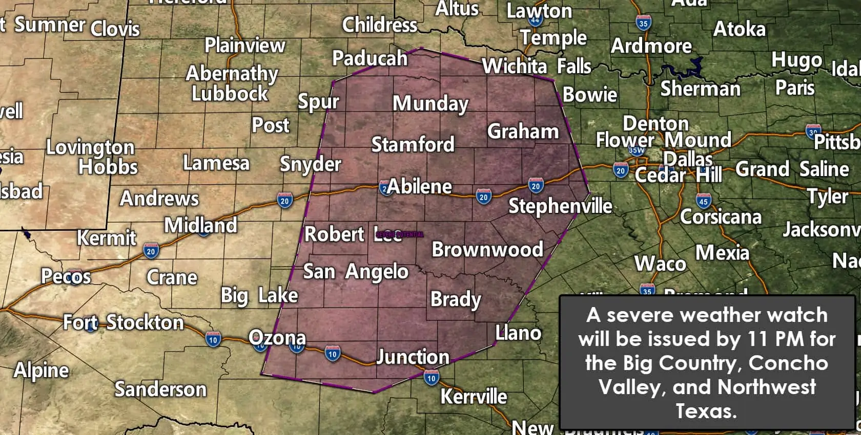
Our friends in the Storm Prediction Center have issued a short-term technical weather discussion. They plan to issue a severe weather watch (tornado or severe thunderstorm) for portions of Northwest Texas, the Big Country, the Concho Valley, and western North Texas. I anticipate that a severe weather watch will be issued by 11 PM.
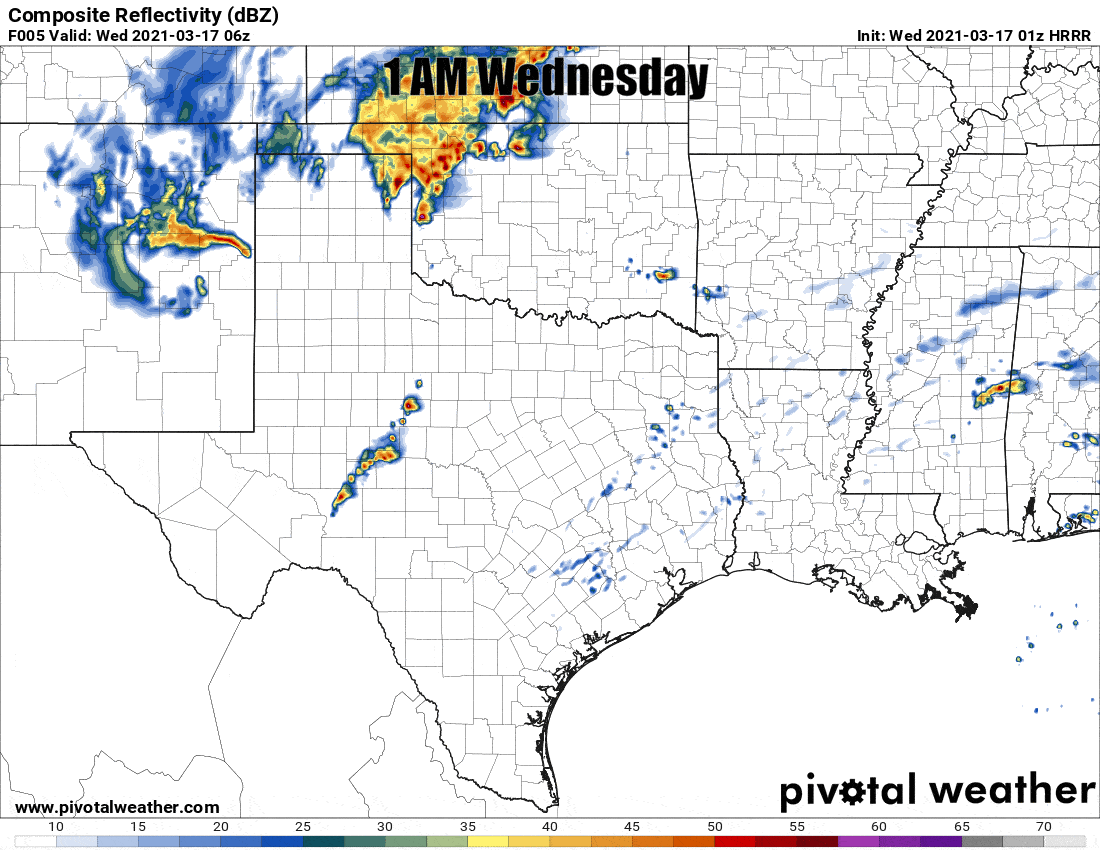
Simulated weather model radar from the 8 PM HRRR through Wednesday at lunch.
A dryline/cool front extends from near Amarillo southward to about 30 miles east of Interstate 27, east of Lubbock, near Midland and Fort Stockton. Thunderstorms are expected to begin developing between 11 PM and 1 AM east of the dryline. The dryline/cool front will continue pushing east overnight along with a broken squall line. The strongest thunderstorms may produce large hail and damaging straight-line winds. A few tornadoes are not out of the question, especially if any part of the squall line becomes well organized. Most storms may struggle to remain ahead of the cool front. Storms undercut by the cool front may still produce some hail but would not be as intense as storms along/ahead of the front.
Timing looks to be about 4-6 AM for the D/FW Metroplex. Sooner west of D/FW and a bit later east of D/FW. Some storms may be strong to severe with large hail and localized damaging wind gusts. Brief tornadoes cannot be ruled out, so you will want a way to receive severe weather warnings overnight.
The highest threat for severe storms overnight seems to be in the Concho Valley, Big Country, and North Texas. Most storms will be pretty loud and produce brief heavy rain. Not all storms will produce hail, damaging winds, or pose a risk of a tornado. We’ll be up all night to provide weather updates on the blog and our digital media platforms. You can keep an eye on the storms with our free interactive weather radar here or in our free mobile app.


0 Comments