
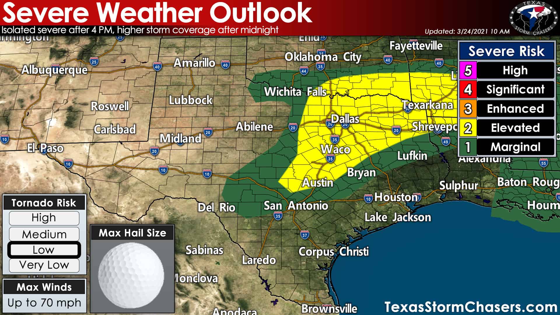
The threat of severe thunderstorms this afternoon and tonight is increasing. We currently have a severe weather threat highlighted across Northeast Texas, Texoma, North Texas, southward into Central Texas. A level two out of five risk includes those aforementioned regions. A level one out of five risk includes the Hill Country, Brazos Valley, and Northwest Texas. Regardless of what ‘risk level’ you might be located in, any ‘risk level’ means you have a chance for stronger storms. Don’t get hung up on where lines/risk levels are drawn on a map. Mother Nature certainly doesn’t care, that’s for sure. I would not be surprised if we see the risks expanded a bit farther south/southeast in later updates.
Timing and threats
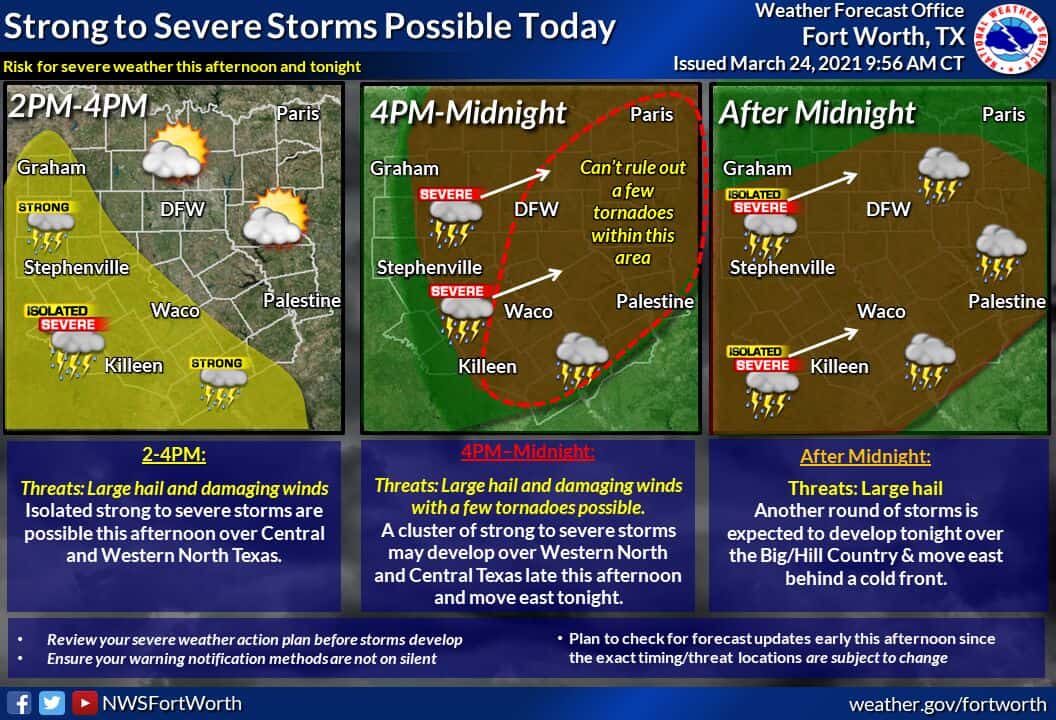
Two rounds of severe weather are possible today and tonight. The first round would feature more isolated activity and occur mainly after 4 PM. More intense thunderstorms may become supercelluar with a risk of large hail, localized damaging wind gusts, and a low tornado threat. A more favorable combination of moisture and wind shear should exist near and east of Interstate 35 in North/Northeast Texas. Storms moving into those regions may have a slightly (comparatively) better chance of producing a tornado. The threat for a few severe storms late this afternoon does include the D/FW Metroplex southward to Waco and Austin – eastward into the northern Brazos Valley.
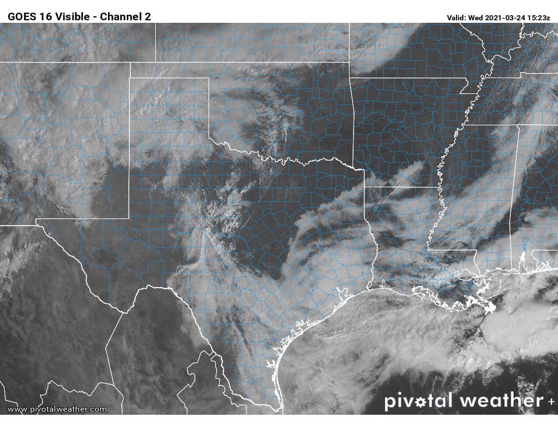
Round #1 (this afternoon) is conditional on enough sunshine to destabilize the atmosphere and ‘punch through the cap’. Based on the satellite imagery, it sure looks like we see sunshine. Clearing skies helps increase confidence in the theory that we may have more isolated severe storms this afternoon/evening before a more widespread round of storms tonight.
Round #2 tonight
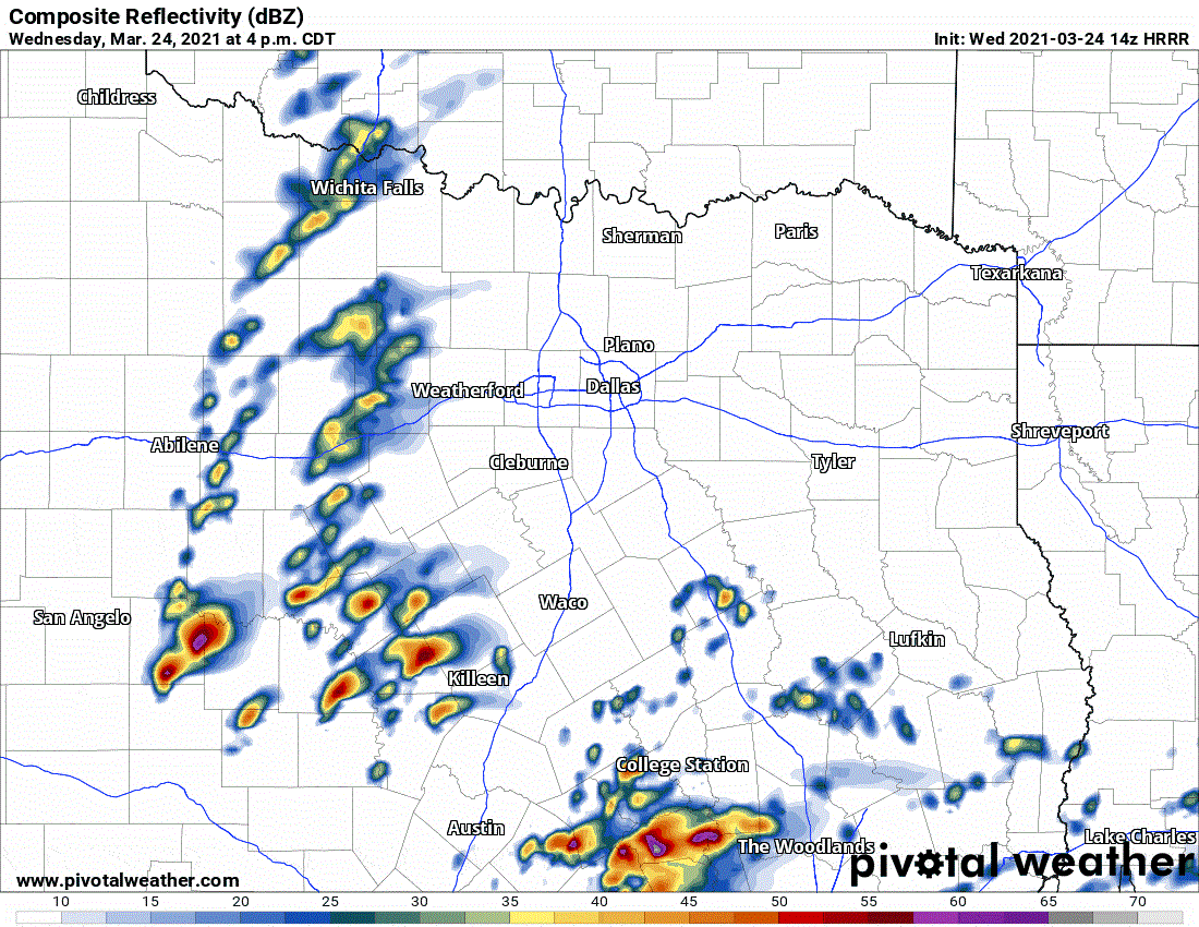
Simulated weather model radar from the 9 AM high-resolution rapid refresh (HRRR) model for this afternoon and tonight. This is only one model, so don’t assume it has everything ‘nailed down.’ Hopefully, it is overdoing thunderstorm coverage this afternoon.
Late tonight, most likely after midnight, a strong upper-level storm system will spark off more numerous thunderstorm activity in western North Texas southward into the Hill Country. Storms will move east along a cool front/dryline. The most intense storms could produce large hail and damaging straight-line wind gusts. Isolated tornadoes are not out of the question, but a more linear storm mode (squall line versus discrete supercells) would help keep the tornado threat lower.
Like a few days ago, we’ll have to see how far east storms can make it tonight before they weaken in the pre-dawn hours Thursday. I expect a loud night for North/Central Texas, but that does not mean a severe storm will directly impact everyone. We’re likely to see storms weaken as they move into East Texas toward sunrise Thursday. The stronger upper-level lift may allow a severe weather threat to continue through Thursday morning in Northeast Texas and the Ark-La-Tex. As a cool front/dryline moves east of Texas Thursday morning, the threat of severe weather will end.


0 Comments