
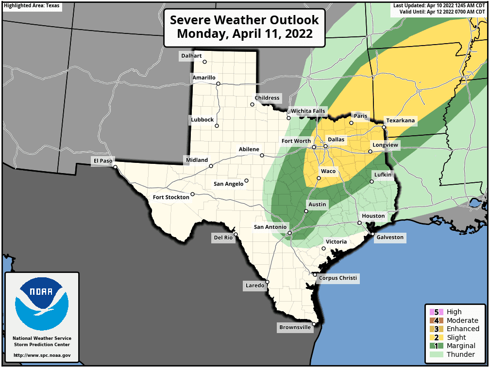
We seem to have locked into a cycle in Texas for severe weather threats beginning weekly on Mondays. No clue what’s up with that, but let’s just say “Here we go again!”. However, for tomorrow, while the Storm Prediction Center has placed a large portion of northern and northeastern Texas under a Slight Risk (Level 2) for severe weather, we are expecting a strong atmospheric cap to hold for most or even all of the day. It’s highly likely that even with this Slight Risk, we may see no storm development at all…or perhaps just one or two storms widely spaced which means most of us will see no impacts at all from severe weather on Monday. Still, the ingredients will be in place for any storm that develops to rapidly become supercellular with large hail and damaging wind as the main threats. The tornado threat will be low but non-zero on Monday. Our advice for Monday…stay alert to rapidly changing weather conditions in your specific area and have a way to receive weather notifications. This won’t be a widespread high impact day, but for those that are under whatever manages to develop tomorrow, could see some unpleasant impacts. Let’s just hope the atmospheric cap can hold.
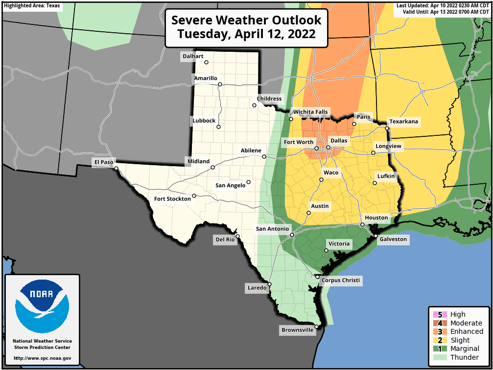
For Tuesday, the Storm Prediction Center has placed an Enhanced Risk (Level 3) for portions of north central Texas including the entire DFW metro area. A Slight Risk (Level 2) outlines the Marginal risk and stretches down into central Texas, Austin, over to parts of north Houston and the entirety of East and Northeast Texas. Once again on Tuesday, we will have a strong atmospheric cap in place for most of the day; however, better heating, moisture and lift from an atmospheric disturbance pushing into the southern plains will mean better ingredients in place to cause the cap to break. At this time, we are expecting at least a couple of strong to severe storms to breach the cap along the dryline west of the DFW metro and west of the I-35 corridor in central Texas by late in the afternoon or early evening on Tuesday. Again, this will not be a widespread event…most will not see any storm development on Tuesday afternoon or evening…but for those that do, these storms could do some pretty significant damage with large hail up to the size of tennis balls and damaging winds and perhaps a couple of tornadoes. Our best advice for Tuesday again would be stay weather aware during the afternoon and evening hours and have a way to receive weather notifications. Most folks won’t see storms on Tuesday either, but for those that do, they could see significant damage from hail or high winds…or even a tornado or two.
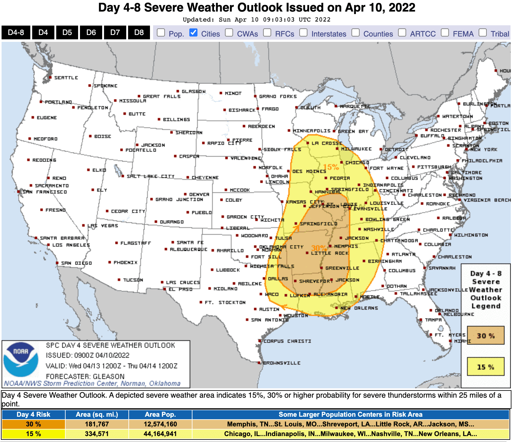
For Wednesday…another round of rain and storms is possible along and ahead of a cold front that will sweep through the state on the heels of Tuesday’s activity. Timing and coverage of storms is a bit unclear this far out, but the Storm Prediction Center has outlined the risk area in the graphic below for much of eastern Texas on Wednesday to address this potential for ongoing or new storm development. We won’t get too much into Wednesday’s potential just yet and will wait until the short range models have a better grasp on the evolution of storm that day. Overall, we will continue to monitor this next system and plan to provide both live video updates along with our written blog updates so be sure to check back with us!


0 Comments