
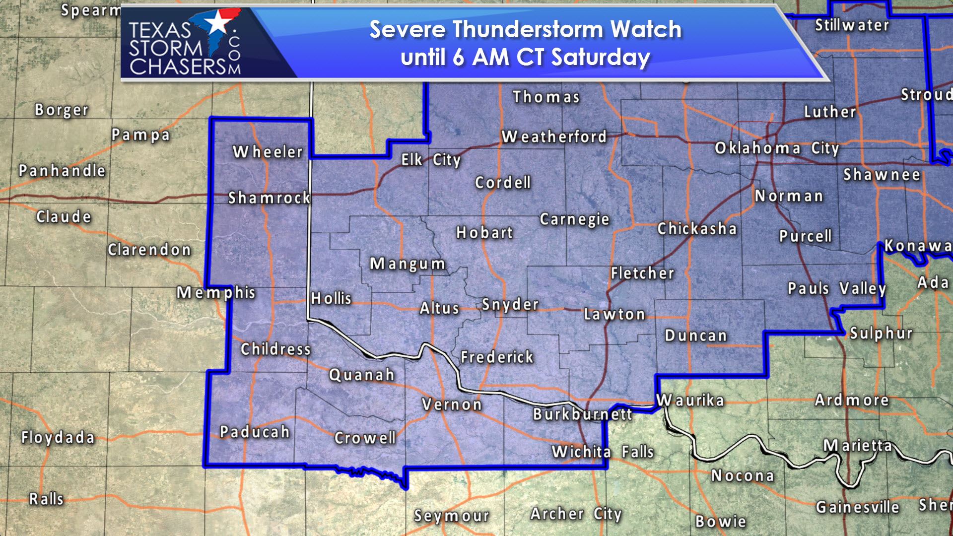
A severe thunderstorm watch has been issued for the far eastern Texas Panhandle and portions of Northwest Texas. This watch runs until 6 AM Saturday. Wheeler, Shamrock, Childress, Paducah, Crowell, Vernon, Wichita Falls, and Burkburnett are a few towns included.
Severe Thunderstorm Watch Number 173
NWS Storm Prediction Center Norman OK
1035 PM CDT Fri Apr 28 2017
The NWS Storm Prediction Center has issued a
* Severe Thunderstorm Watch for portions of
Central and southwest Oklahoma
Parts of northwest Texas and the southeast Texas Panhandle
* Effective this Friday night and Saturday morning from 1035 PM
until 600 AM CDT.
* Primary threats include…
Scattered large hail and isolated very large hail events to 2.5
inches in diameter likely
Scattered damaging wind gusts to 70 mph possible
A tornado or two possible
SUMMARY…Severe storm development is expected in the next couple of
hours across the southeast Texas Panhandle and adjacent southwest
Oklahoma. The initial storms could be supercells capable of
producing very large hail. A gradual transition to more
cluster/linear modes is expected in the early morning hours, with
some increase in the damaging wind threat into central Oklahoma.
While the near-surface layer is a bit stable, a tornado or two
cannot be ruled out.
The severe thunderstorm watch area is approximately along and 50
statute miles north and south of a line from 20 miles north
northwest of Childress TX to 15 miles east southeast of Chandler OK.
For a complete depiction of the watch see the associated watch
outline update (WOUS64 KWNS WOU3).

Simulated Model Radar through Saturday Morning from HRRR
Lift is increasing across the area as upper level energy arrives. A warm front draped over the area will also be a focal point for thunderstorm development in the coming hours. Despite the late hour, the atmosphere is very unstable and strong wind shear will support organized thunderstorms. The strongest storms may produce hail up to the size of tennis-balls and localized wind gusts over 65 MPH. A tornado is not out of the question, but the most intense storms may tend to be in western Oklahoma. We should see storms grow upscale into a cluster or squall line fairly quickly after they develop. There is some uncertainty on how far this squall line will extend south of the Red River, but the most intense portions will likely move northeast toward Central Oklahoma later tonight.


0 Comments