
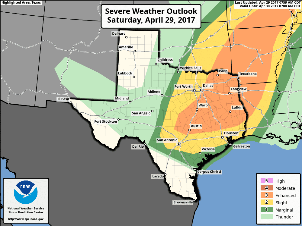
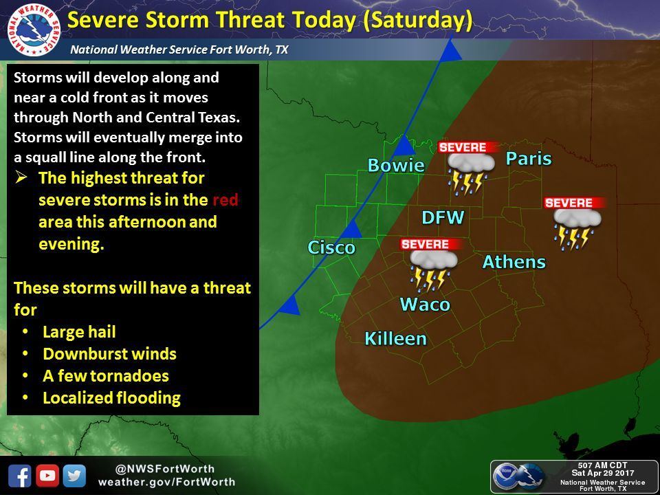
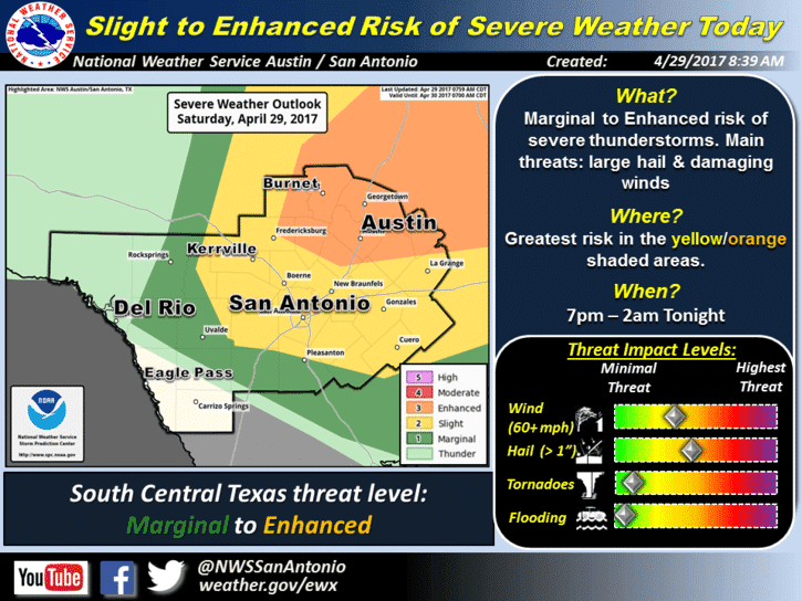
A cold front is currently stretched between Wichita Falls and Abilene as of 10am. It’s moving slowly and expected to stall, but exactly where it stalls is hard to determine at this moment. Current thinking puts it across north central TX along the I-35 corridor between 1 and 2pm. The position of the front this afternoon will have an impact on where storms will form across north Texas which makes today’s forecast quite challenging for our local forecasters. We still have a strong cap in place across the warm sector out ahead of the front. Breaking the cap will require either a great amount of surface heating, or lift by the approaching front and upper level low. The upper level low is expected to begin advancing east by mid-day as the upper level disturbance advances east to the Texas/New Mexico border. As this happens, we’re expecting to see rapid development of storms along and ahead of the front which will eventually merge into a squall line which advances east through the afternoon and evening hours. Large hail and damaging winds will be the greatest threats, but a couple of tornadoes cannot be ruled out…especially if any discrete storms can form out ahead of the main squall line. Timing for initiation along the front is expected between 2 and 4pm this afternoon across north Texas with development expected to hold off until 7pm across central Texas. Southeast Texas may see impacts between 10pm and 1am and far East Texas will likely not see impacts until closer to midnight. We will continue to monitor this threat and provide updates as we get into the early afternoon hours.


0 Comments