
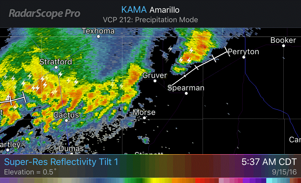

It has been an interesting morning across eastern New Mexico. A little after midnight a tornadic supercell developed well west of Clovis, NM. That storm had an impressive radar presentation and I wouldn’t be surprised if a tornado did occur out in the middle of no-where. There haven’t been any damage reports so that’s a good thing. Whats left of those storms have now moved east into the Texas Panhandle. Shortly before 6:10 AM there were two strong storms moving east/northeast across the Panhandle. The first is a couple miles south of Dimmitt. It could move over Interstate 27 by 8 AM between Tulia and Plainview. Another strong storm is over Highway 287 near Cactus, or north of Dumas. That storm is less organized compared to the one south of Dimmitt. It’ll be moving northeast and could make a ruckus in the northern Texas Panhandle. These storms are not severe and in all likelihood will remain below severe limits this morning. They could drop a quick inch or two of rain.

We’ll start off taking a look at today’s severe weather outlook. We are starting to enter our fall severe weather season in Texas. Typically it is less active than our spring season, but not always. The fall of 2015 proved that with November 16 and December 26. When it comes to severe weather it’s always wise to keep an eye on the sky, regardless of the time of year. The Storm Prediction Center has issued a category 1 severe weather risk – the lowest on a five level scale. This marginal severe weather risk includes most of the Texas Panhandle, locations west of Interstate 27 in West Texas, west of Highway 87 from Lubbock to Midland, and into the Permian Basin and Borderland. I will say I wouldn’t be surprised to see this risk expanded a bit east into Southwest Oklahoma and Northwest Texas in later outlooks.
Most storms today are going to remain under severe weather limits, but we do have a combination of wind shear and instablity that could support a more organized storm mode this afternoon and tonight. The best relative chance of stronger storms will be in the marginal risk zone. The strongest storms could produce hail up to the size of ping-pong balls and localized wind gusts over 60 MPH. The tornado threat is not zero today, but should be very low. A brief tornado may occur in the Borderland east into the Permian Basin if we see a sustained supercell develop this afternoon or evening. Widespread severe weather is not anticipated at this time.
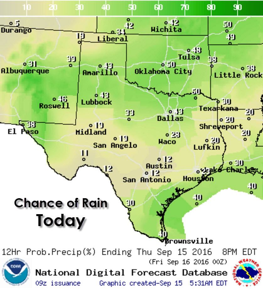
Isolated to scattered storms are possible this afternoon across the Borderland, Permian Basin, Texas Panhandle, Northwest Texas, Big Country, Texoma, North Texas, Northeast Texas, and Central Texas. The usual afternoon popup storms are expected again today along the coast from Southeast Texas southwest through the Middle Texas Coast into Deep South Texas and the Rio Grande Valley. Any stronger storm this afternoon, outside of the severe weather risk areas described in the previous paragraph, could produce small hail and gusty winds.
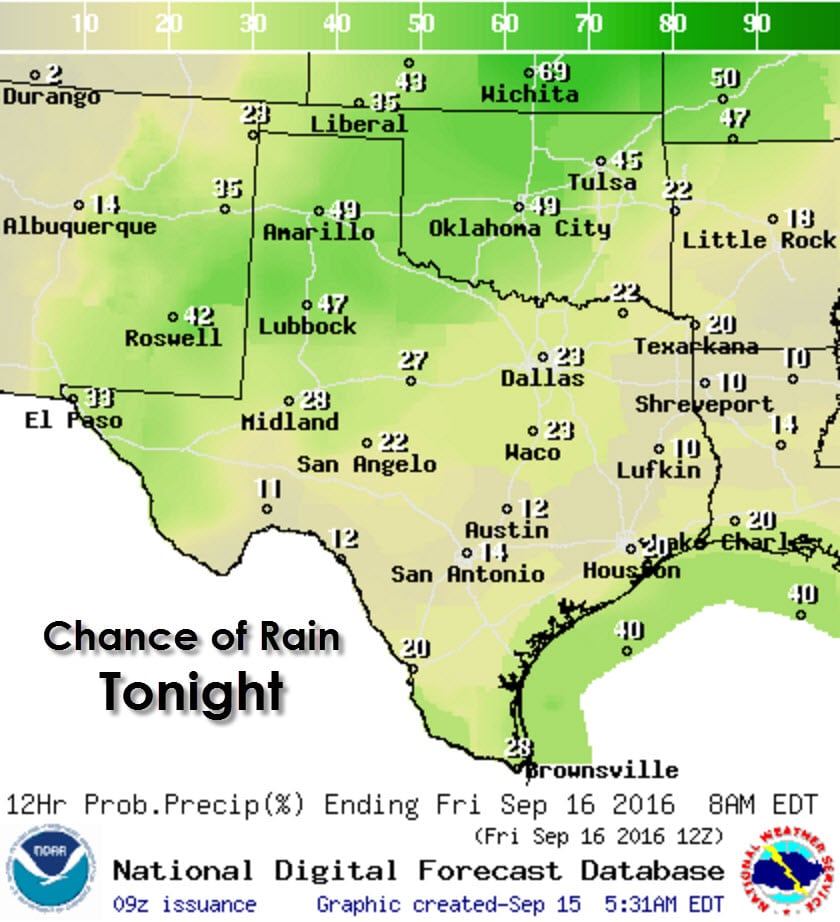
Storm chances will continue this evening and into the overnight hours across the Texas Panhandle, West Texas, Northwest Texas, into the Permian Basin and Borderland. A few storms could be severe and produce locally heavy rain. Widespread flash flooding is not anticipated.
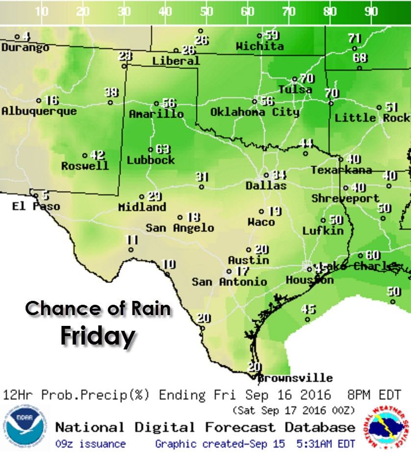
Rain chances will increase tomorrow across the southern half of the Texas Panhandle into much of West Texas, Northwest Texas, and the Big Country as a slow moving cool front helps spark off new storms. A few storms could be strong to marginally severe with gusty winds and hail. Afternoon storm chances will re emerge across East Texas and Southeast Texas with a slightly higher coverage level compared to today.
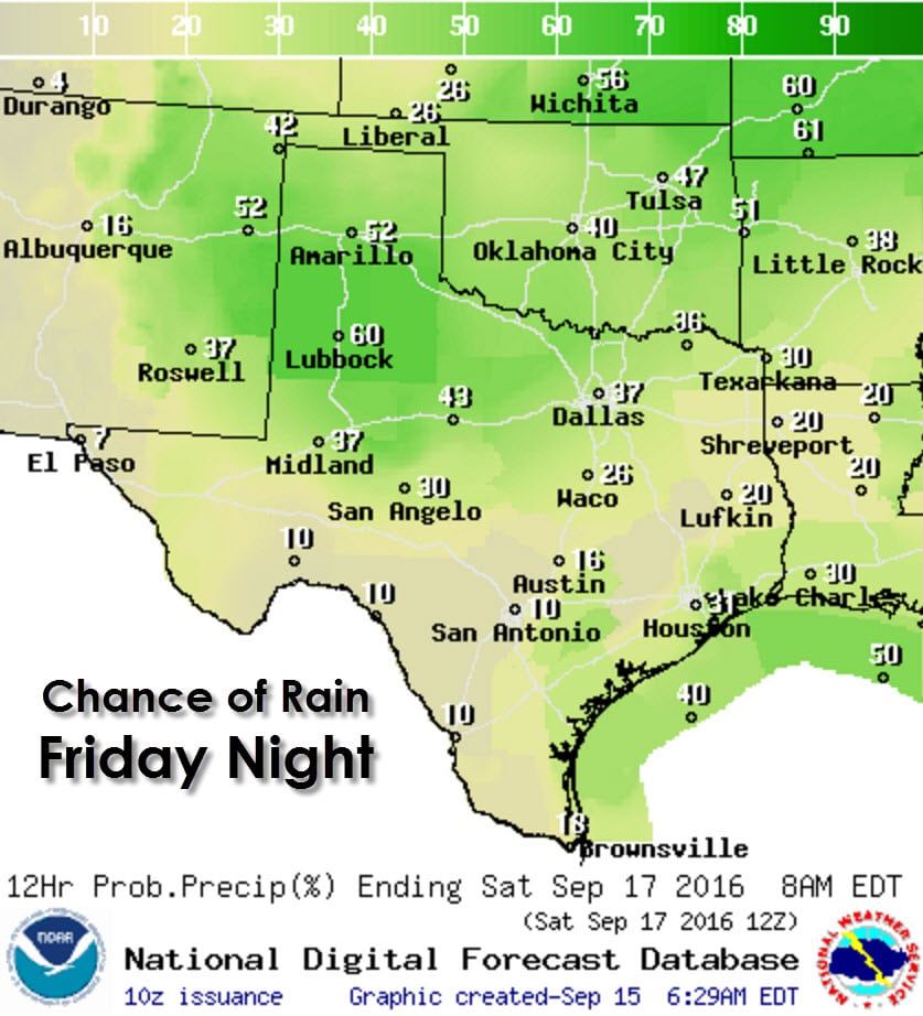
Those rain chances across the Panhandle, West Texas, and Northwest Texas will continue Friday Night and spread south into the Big Country and North Texas. It certainly won’t be a wash-out in all those areas, but don’t be surprised if there are storms in the area for the evening football games.

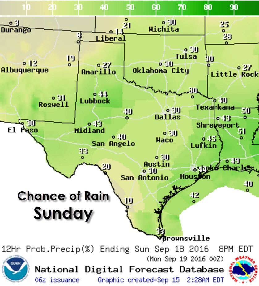
Finally, this weekend will bring isolated to scattered storm chances to pretty much all of Texas. It won’t rain everywhere nor all the time. A few stronger storms may develop in the Texas Panhandle on Saturday, something we’ll keep an eye on and refine as we get closer to the weekend. Don’t go cancelling your outdoor plans for the weekend but it would be wise to have a backup in case some rain or storms encroach on your area.


0 Comments