
An isolated severe thunderstorm, potentially dangerous, is possible as soon as noon in Northwest Texas, around Wichita Falls. These storms may have hail, some as large as baseballs, and could quickly move northeast into southern Oklahoma. Scattered severe thunderstorms, also posing a threat, will develop after 3 PM in Northeast Texas and the Ark-La-Tex southwest toward the D/FW Metroplex. Storms will tend to move in a northeasterly direction, though some may move more easterly. The most intense storms may produce damaging hail up to the size of baseballs, localized wind gusts over 65 MPH, and a tornado cannot be ruled out.
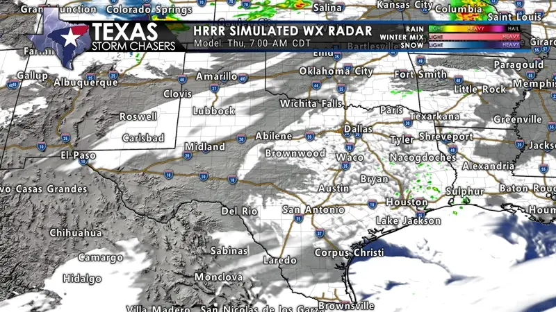
Those using the Texas Storm Chasers app must click the ?/box above to view the radar animation. Beginning mid-evening, additional thunderstorms may develop near a dryline in western North Texas into portions of Central Texas. These storms may also become severe, with a risk of hail and strong wind gusts. They would move northeast and across the Interstate 35 corridor. Storms may congeal into a complex that would move into Northeast and East Texas during the morning hours on Friday, with a decreasing risk of hail. Strong wind gusts may continue. Additional scattered thunderstorms may continue developing through the morning hours on Friday from the Concho Valley and Big Country east into the Hill Country, Central Texas, North Texas, and east into the Brazos Valley. Those storms would tend to move north/northeast. We can’t rule out pocket-change-size hail with stronger storms.
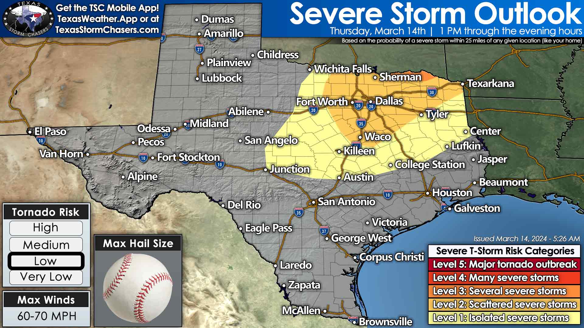
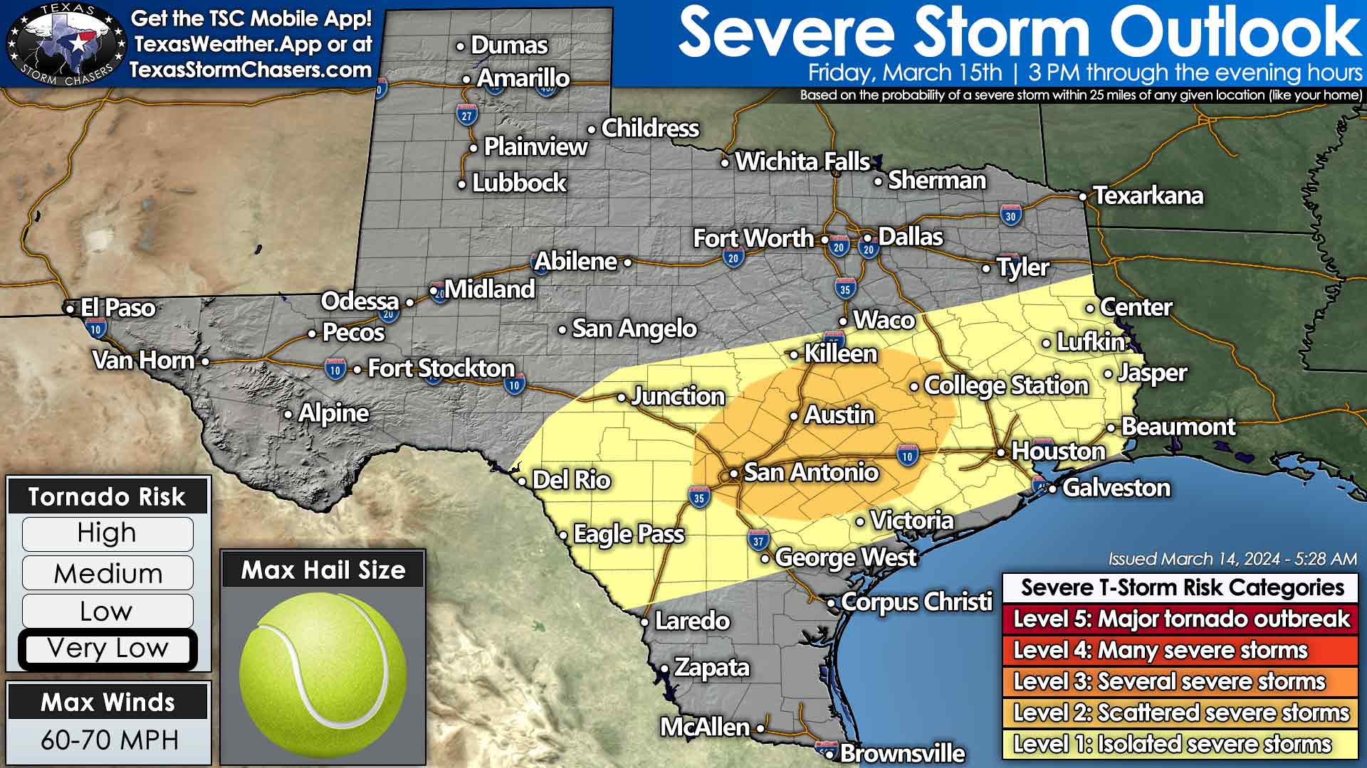
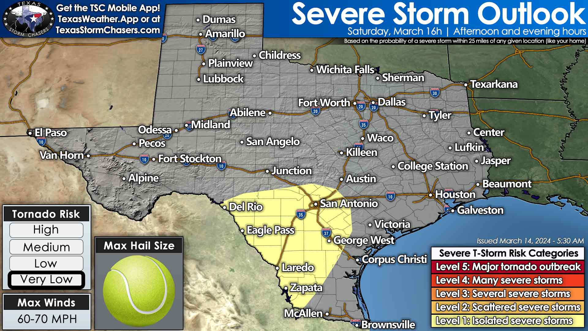
A cool front will move south tonight into Friday. We’ll see temperatures north of the front fall into the 40s and 50s. It is not a crashy arctic cold front situation, but it will mark a difference compared to the 70s and 80s in the south. Where the cool front ends up Friday afternoon will determine who is under the threat of severe storms. We believe the front will be in the northern Edwards Plateau, east through the Hill Country, Central and South-Central Texas, into the Brazos Valley and East Texas. Isolated to scattered severe thunderstorms are expected to develop by mid-afternoon and continue into the evening. The strongest storms may produce damaging hail, strong wind gusts, and a tornado. Heavy rainfall is also expected, which could be an issue for urban corridors. A similar scenario is expected Saturday afternoon, except it’ll move further south into the Edwards Plateau, Rio Grande Plains, and South Texas.
North of the cool front, where surface temperatures are cooler, we’ll see the opportunity for showers and storms several times over the next five days. The reason is an upper-level low sitting across the southwestern United States. A blocking pattern aloft is preventing that system from moving farther east, so it’s just stuck. The system will keep Texas in an area of ‘lift’ aloft, allowing for several opportunities for rain through early next week. One to three inches of rain may fall by Monday across the Edwards Plateau, Hill Country, Central Texas, South-Central Texas, the Coastal Plains, Brazos Valley, Southeast Texas, and East Texas. We’re looking at one-quarter to one-half inch of rain for the Permian Basin, Big Country, North Texas, Texoma, Northeast Texas, Deep South Texas and the Rio Grande Valley.

0 Comments