
Baldy-in-Chief has a special evening video update to discuss the latest model data and outlook for severe weather in #Texas tomorrow, March 14, 2024. Severe thunderstorms are expected tomorrow, beginning around 3 PM (give or take an hour) and continuing through the evening.
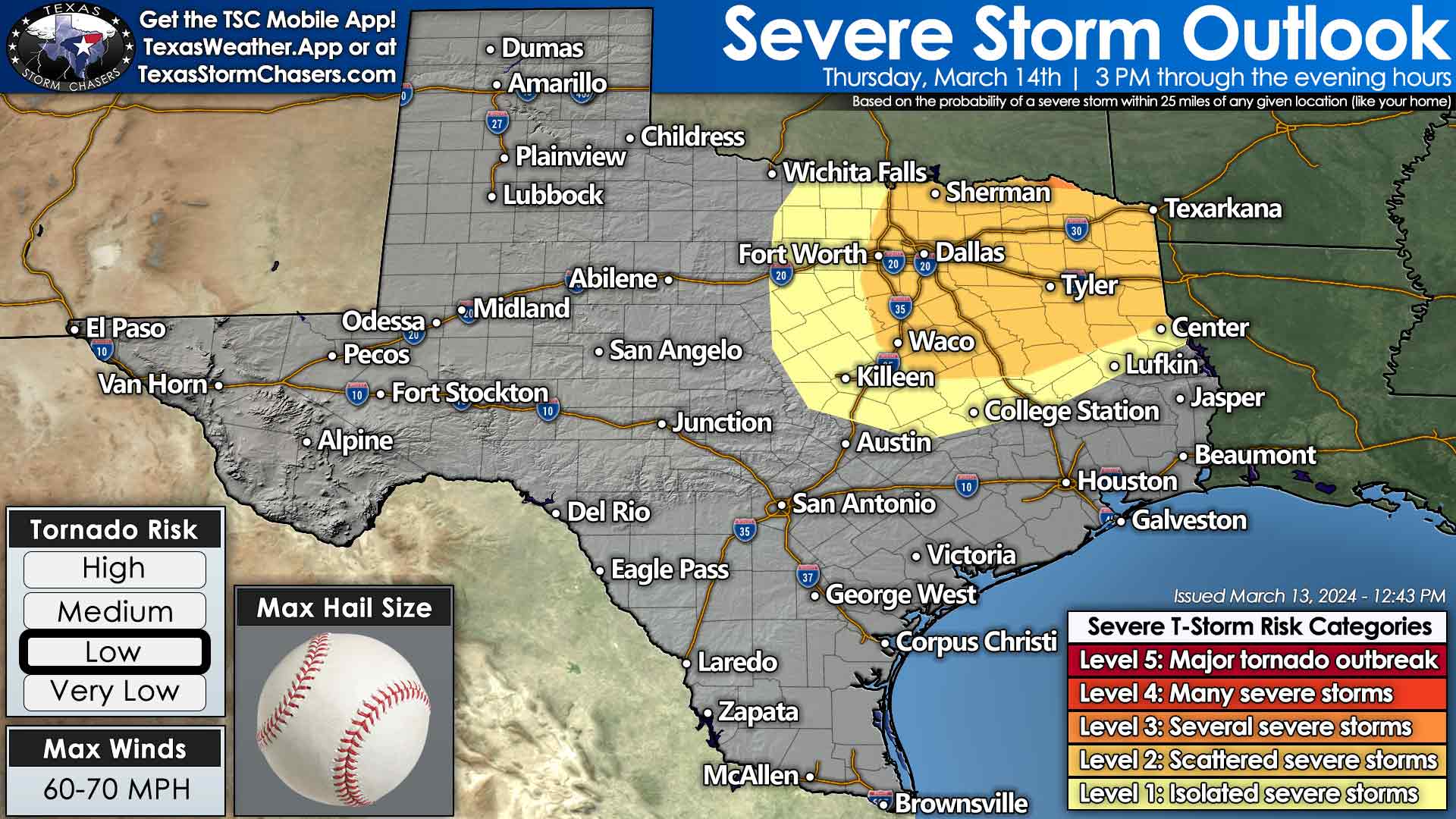
The most likely regions to be impacted by scattered severe thunderstorms include North Texas, eastern Texoma, Northeast Texas, and the Ark-La-Tex. Supercelluar storm modes are likely, with damaging hail up to the size of baseballs a substantial concern. Localized damaging wind gusts over 65 MPH, and a few tornadoes are also threats. We’ll need to closely monitor trends as we get into tomorrow in case a smaller corridor of more significant severe thunderstorm potential becomes evident.
Texas Storm Chasers App users must click the ?/blank box above to view an animation of tomorrow’s storm timeline.
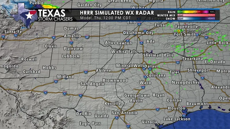
We anticipate a busy evening in Northeast Texas. Thunderstorms may form far enough west to impact the D/FW Metroplex north to Gainesville and Sherman. However, they may also form just east of the population as mentioned above centers. Storms will generally move northeast, with more intense supercells perhaps moving more easterly. It’s one of those things we’ll watch for tomorrow. By Friday morning, thunderstorms may develop, become more numerous, and move east across the Concho Valley, Central Texas, Brazos Valley, and East Texas. Some storms may produce hail and heavy rainfall.
We’ll have storm chasers out with live streaming video planned. Our free mobile app users will receive a notification when any live storm chasing video and severe weather coverage is available. You can also watch on our website and on our social media channels.

0 Comments