
Click the image for a larger version.
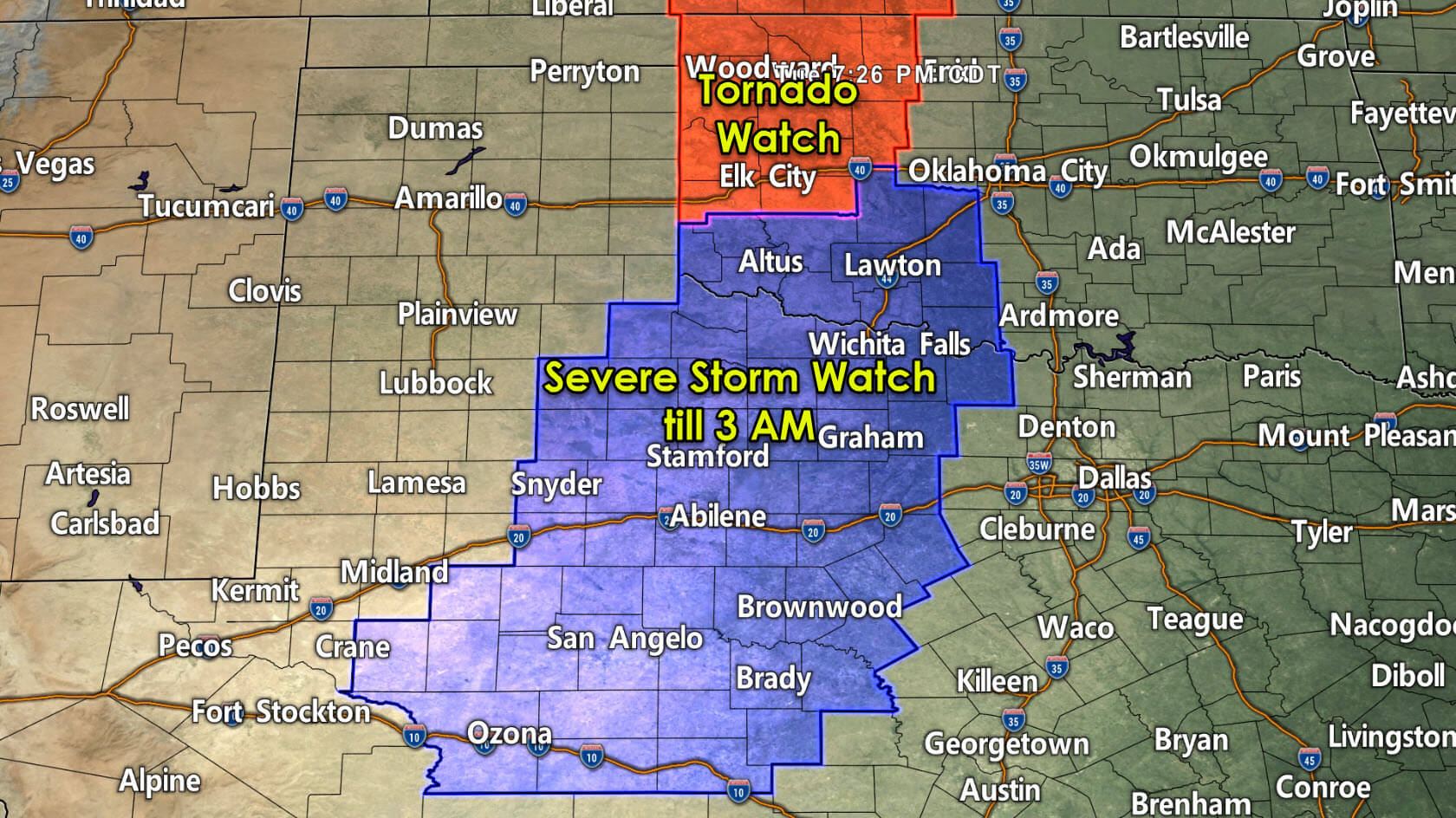
The Storm Prediction Center has issued our first severe weather watch of the night in Texas. A severe thunderstorm watch has been issued through 3 AM. The watch includes Northwest Texas, West-Central Texas, the Big Country, the Concho Valley, and western North Texas. Snyder, San Angelo, Abilene, Quanah, Wichita Falls, Bowie, Mineral Wells, Stephenville, and Brownwood are included. Additional severe weather watches will likely be issued later tonight and early tomorrow morning for the Interstate 35 corridor from Oklahoma City south into the Hill Country.

Click the image for a larger version. Simulated weather model radar from 9 PM tonight through 10 AM Wednesday.
Our first storms of the night have developed in the far eastern Texas Panhandle. Those are moving into Oklahoma and will not be our problem. Farther southwest, we’ve got storms developing southeast of Post and north of Snyder. We’ll see the dryline ‘unzip’ within the next few hours – with a nearly solid line of thunderstorms extending from the Concho Valley north into southern Kansas. Individual storms will move northeast while the squall line itself will progress east at around 30 MPH.
Storms should arrive on the Interstate 35 corridor from the Red River south to San Antonio between 2 AM and 5 AM Wednesday. We’re expecting the line of storms to make it to Northeast Texas, East Texas, and Southeast Texas between 6 AM and 9 AM Wednesday. Some storms are likely still going to be producing damaging winds, pocket-change size hail, and perhaps brief tornadoes. Not all storms will be severe, but we’ll probably have to keep an eye on the storms until they push east of Texas early tomorrow afternoon.
The strongest storms are likely to produce damaging straight-line winds, pocket-change size hail, and a low chance of a tornado. Strong northwest winds will arrive behind the storms with a cold front. We’re expecting strong northwesterly winds on Wednesday and Thursday. Outdoor decorations (including Haloween inflatables) need to be tied down – otherwise, they may go flying.


0 Comments