
https://youtu.be/jhWza6k_3Bg
After a downright chilly Wednesday morning, we’re starting today several degrees warmer. Our climb up the temperature rollercoaster has begun. We’ll enjoy relatively quiet weather through Saturday before our next upper-level storm system begins its approach.
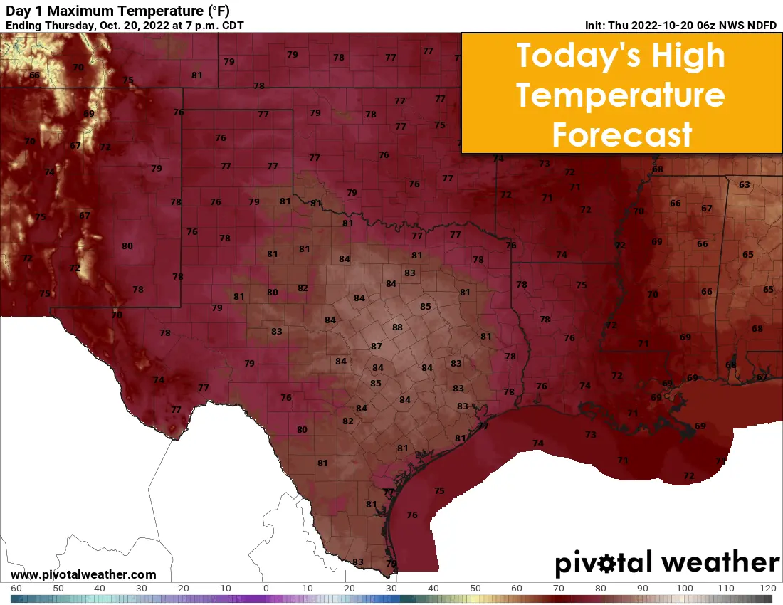
High temperatures this afternoon will top out in the 70s and 80s across Texas. Overnight temperatures through the weekend will be warmer than the previous two mornings. By Friday, Saturday, and Sunday, high temperatures will make it up into the 80s and lower 90s. As our next upper-level storm system approaches, southerly winds will become noticeably stronger on Sunday. Some wind gusts may exceed 40 miles per hour, so it would be wise to secure outdoor decorations.
Weather pattern changes Sunday onward
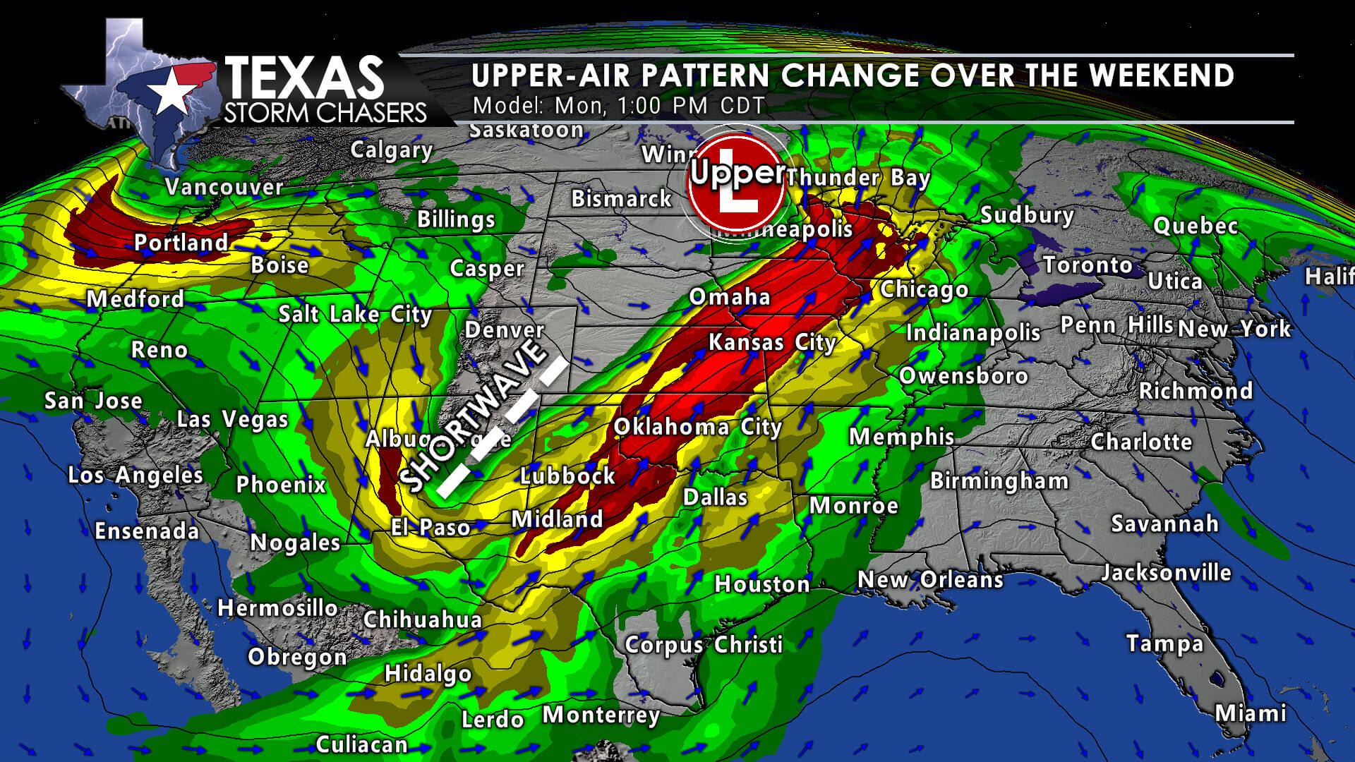
An upper-level pattern change will occur across the United States over the weekend and early next week. A dynamic, active jet stream will replace our northwesterly flow aloft over the last few days. A robust upper-level storm system will bring active weather to Texas, and several states, Sunday Night through Tuesday.
The most widespread, noticeable impact will be gusty winds. Strong southerly winds will begin Sunday and howl Sunday night as a robust surface low pressure moves across the Northern Plains. Light showers are possible Sunday Night across Northwest Texas, the Big Country, into Texoma, and North Texas. Some surface wind gusts may exceed 45 miles per hour Sunday night. Near-critical wildfire danger is expected across the western half of Texas on Sunday and Monday.
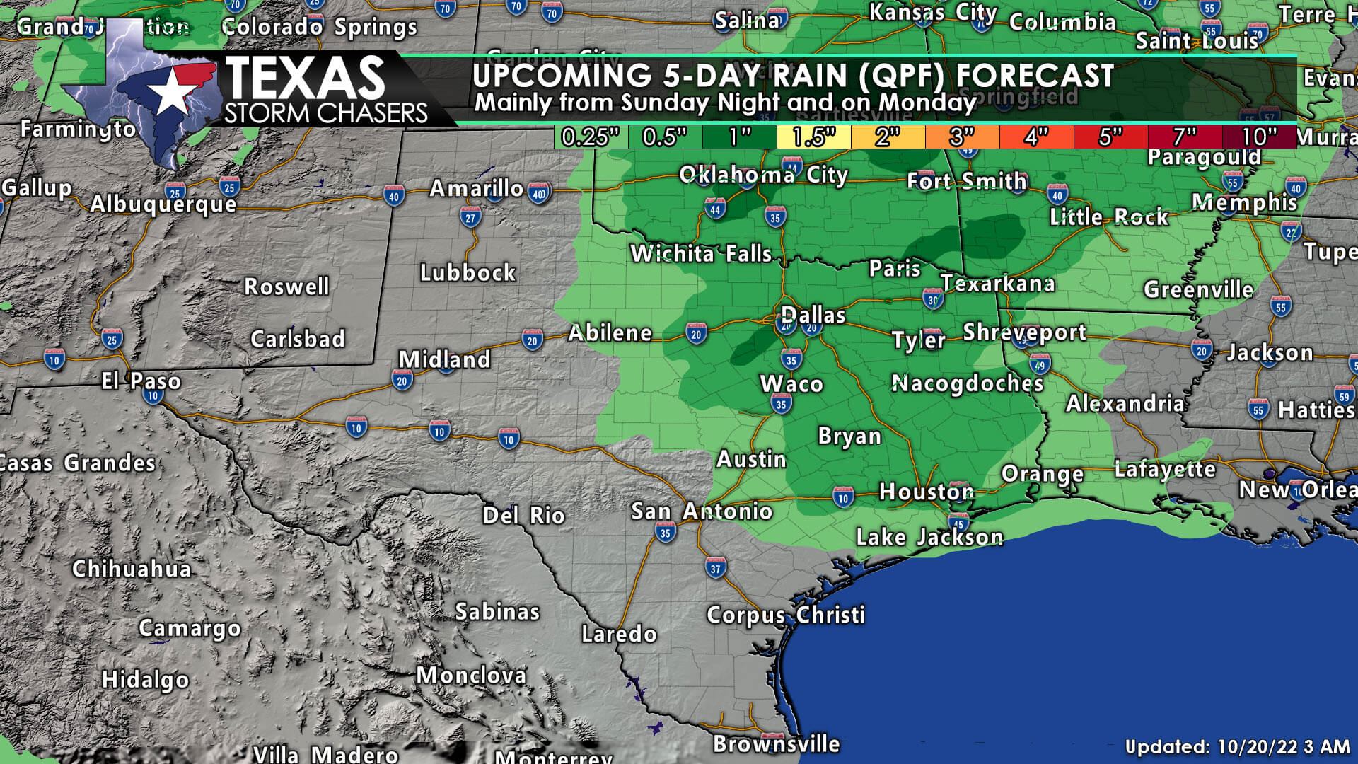
The chance for thunderstorms may increase on Monday as a dryline/cool front moves into Texoma, North Texas, Central Texas, and pushes east into the Ark-La-Tex and the Piney Woods of East Texas Monday Night. While a few strong thunderstorms are possible, the overall severe thunderstorm threat remains unclear. Regardless, a drought-busting rain is not likely. The most plausible scenario is a thin line of thunderstorms along the cool front, with some lighter showers continuing behind a squall line.
We need a better idea of where various features and ingredients will be set up on Monday. We may see a displacement of the best wind shear and a more moisture-rich/unstable airmass. That displacement would reduce the overall severe thunderstorm threat. We’ll get that fine-tuned as we get into the range of higher-resolution weather models. We should see a few days of quiet, perhaps cooler weather, return after the early week storm system.


0 Comments