
Mother Nature likes to troll us in the weather department. Sure enough, thunderstorms were able to make it well south of the Red River last evening. In combination with our summer-like heat, the result was damaging winds and large hail. An outflow boundary, produced by last evening’s storms, continued to fire off storms from Sherman down to Canton through the early morning hours. Welcome to summer thunderstorms! Unfortunately, we’re going to see summer temperatures continue through mid-week.
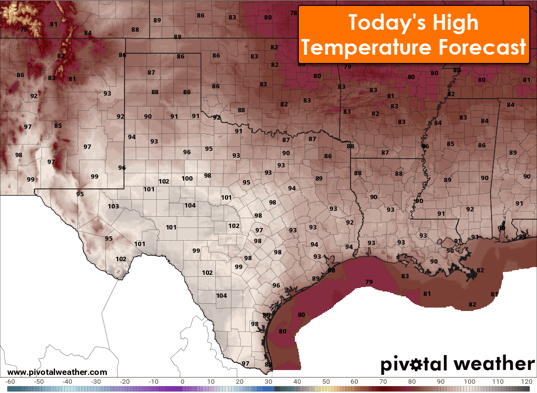
Today’s hottest weather will be across the Permian Basin, Concho Valley, Edwards Plateau, Big Bend into Deep South Texas. Triple-digit high temperatures are expected. We’ll be a wee bit cooler, and I use the word cooler as relative, further north and east. It’s still warmer than what we should see in mid-May.
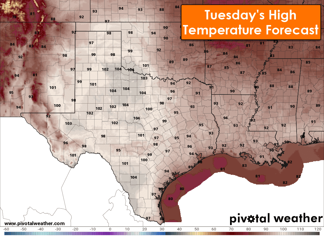
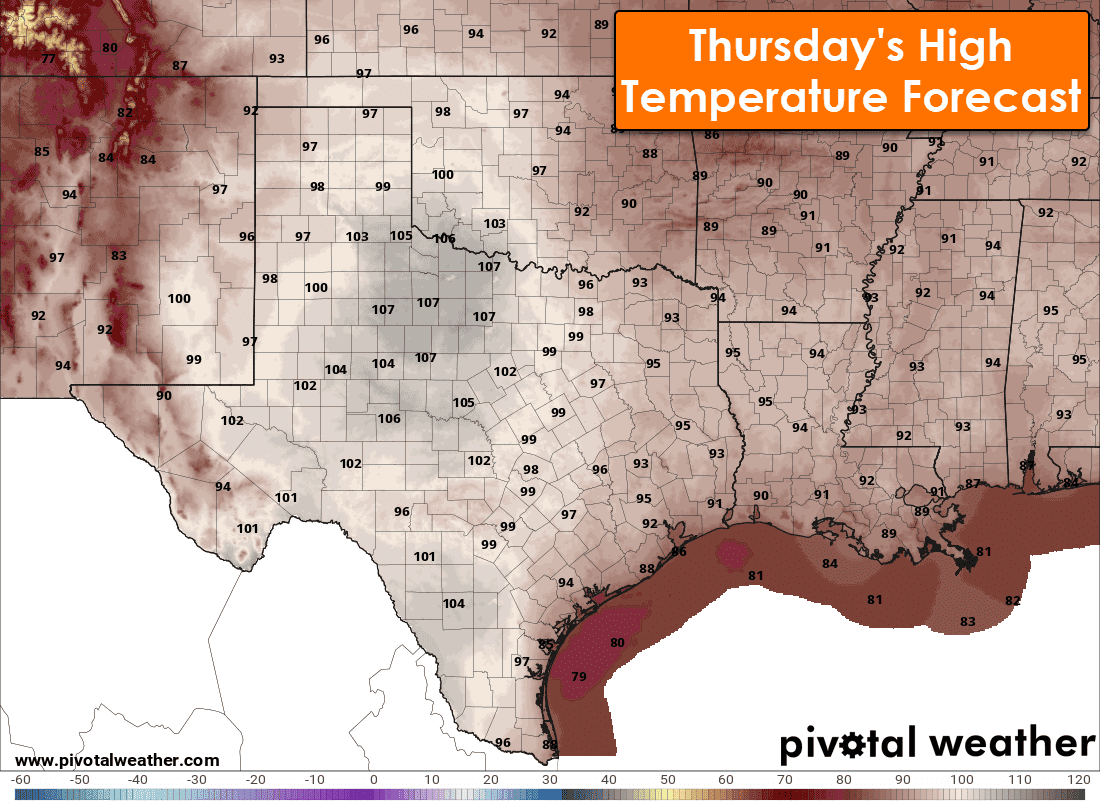
Tuesday will bring a return of triple-digit heat to the regions mentioned above, plus the BIg Country, West Texas, Northwest Texas, Hill Country, and western North Texas. Some folks may be closer to 106-107 degrees. San Antonio, Waco, and parts of D/FW may make a run at 100 degrees. Wednesday and Thursday look just as hot, if not even hotter. Some West-Central and Northwest Texas locations may make a run at 108-110 degrees on Thursday.
Today’s Severe Weather Potential
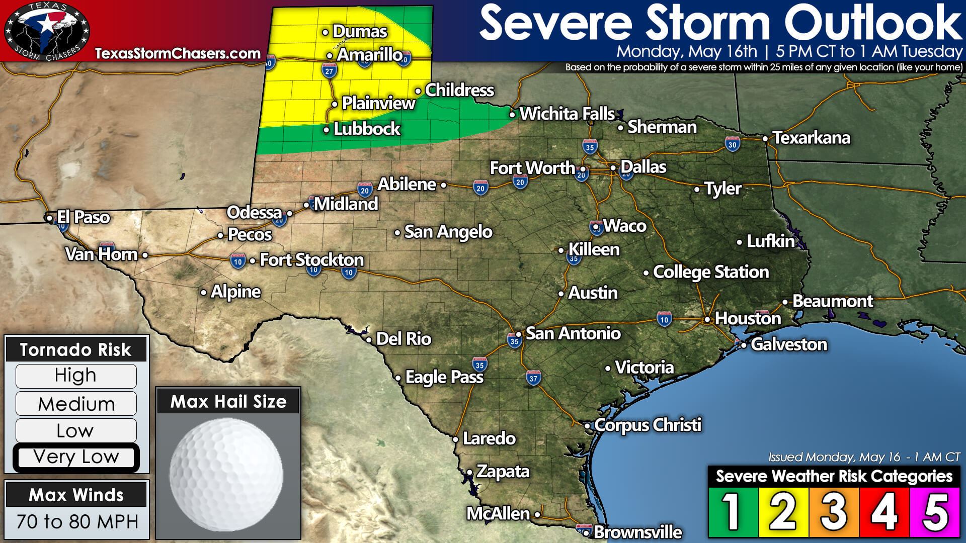
This evening, a level two (out of five) risk for severe storms across the Texas Panhandle and portions of West Texas. A level one (out of five) risk for severe storms includes Northwest Texas. The primary timing for severe storms will be after 5 PM through about 1 AM Tuesday.
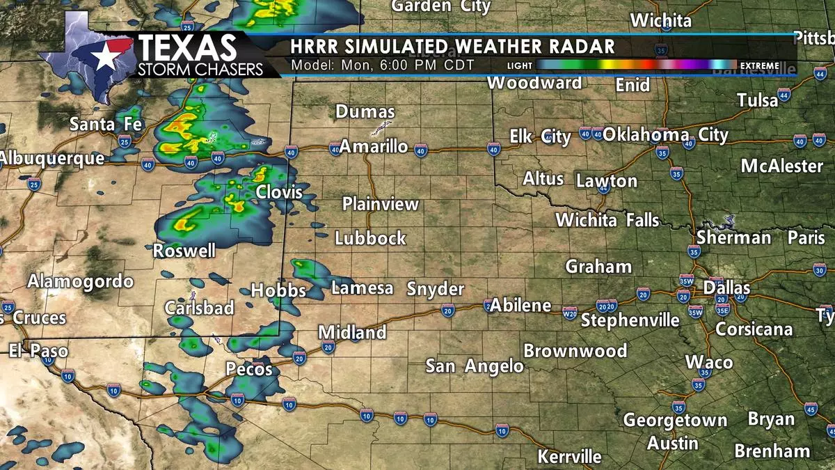
A line of thunderstorms, perhaps broken, will develop in eastern New Mexico late this afternoon. Those thunderstorms will move east into the Texas Panhandle around dinner-time. Hot temperatures and high dewpoint depressions will result in very high cloud bases. Damaging straight-line winds, perhaps hurricane-force (75+ MPH), are expected with the strongest storms. With the storms, widespread blowing dust, some hail, and lightning-induced wildland fires are also expected.
Storms will continue well into the evening and move into the eastern half of the Texas Panhandle and portions of Northwest Texas after 9 PM. Localized damaging wind gusts, hail, and lightning-induced wildland fires will be threats. Storms should slowly weaken after 10-11 PM but may continue through a good portion of the night in a more isolated state.
A few storms are possible on Tuesday in the northern Texas Panhandle. We’ll have to see how today’s storms influence tomorrow’s setup. A pattern change later this week will bring a return of precipitation chances beginning on Thursday. A strong cold front (by May standards) looks to arrive on Friday and Saturday – with the opportunity for thunderstorms. That may kick off what looks to be a more active weather pattern next week.


0 Comments