
We’re starting the day with rain showers across parts of the northern two-thirds of Texas. Nothing too dramatic early this morning, but at least it’s enough to wet the ground. As we go through the morning and into the afternoon, we’ll see showers and a few thunderstorms move eastward from the Interstate 35 corridor into Arkansas and Louisiana. Severe weather is not expected this morning, and it won’t be raining for more than a few hours at any given location.
Here is the timing on rain, as shown from the High-Resolution Rapid Refresh (HRRR) model. Each video is for the same time periods but zoomed in with city labels.
Rainfall Totals
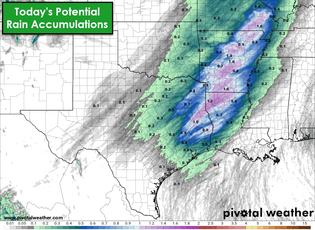
We definitely need rain to combat our building drought, but today’s rain won’t be a drought-breaker. It’s certainly better than no rain, but most folks will see between one-tenth and one-half inch of rainfall – if they’re near or east of Interstate 35 and north of Interstate 10. A few folks in the Piney Woods of East Texas may see closer to one-inch of rain. Regardless, no flash flooding or river flooding is expected from today’s rain.
Today’s severe weather potential
The Storm Prediction Center has maintained a marginal severe weather risk for the afternoon and early evening hours. This level one out of five risk includes eastern North Texas, Northeast Texas, East Texas, Southeast Texas, and the Brazos Valley. Lackluster instability values will limit today’s severe weather threat. While this morning’s showers aren’t expected to be severe, we may see a broken line of storms fire up this afternoon as a cold front moves southeast.
If the broken line of storms can develop, some of those storms may produce small hail and localized wind gusts of 40 to 60 miles per hour. It is not a big deal on the large-scale of things, but if we have one storm produce damaging winds over your neighborhood, it would be a big deal for you.
Rain should be moving out of the region by tonight, although some light rain may mix with some snow in the northern Texas Panhandle. Accumulations would be limited. Our attention will quickly shift to a second storm system arriving Saturday Night and Sunday morning.
Winter Weather Potential Saturday Night into Sunday
A strong upper-level storm system will quickly move across the Southern Plains Saturday Night and into Sunday morning. The upper-level storm system’s track will significantly impact where snow falls and how much accumulates. We’ll get a better idea of the specifics over the next twenty-four hours as the system begins to be sampled by weather stations on the West Coast.
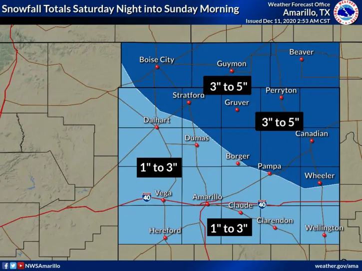
It seems plausible that two to five inches of snow could accumulate in the Oklahoma Panhandle and the northeastern Texas Panhandle. One to there inches of snow is possible across the remainder of the Panhandle and perhaps northern sections of the South Plains (north of Lubbock). Strong winds could result in blowing snow and reduced visibility on Sunday, even after the snow quits falling.
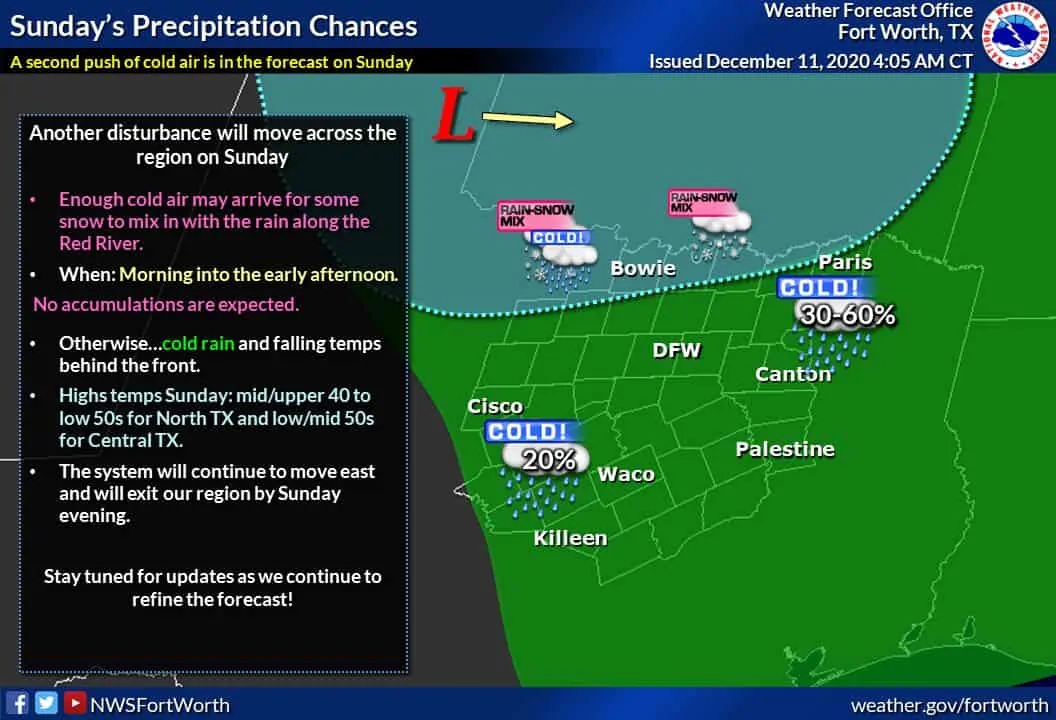
A rain/snow mix may briefly occur Sunday morning along the Red River in Texoma (Places like Wichita Falls, Bowie, Gainesville, and Sherman). Like all things weather-related in Texas, and especially when it comes to winter, the forecast will likely need to be revised more than once before tomorrow night.

0 Comments