
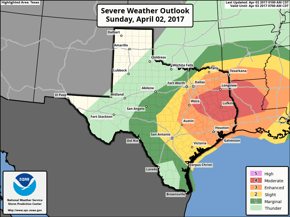
We’ll have our next severe weather outlook update in about an hour, but I don’t expect too many changes. We have a level 4 risk across East Texas with a larger level 3 risk encompassing the southeastern half of North Texas, Central TExas, Southeast Texas, into Northeast Texas. Both these risk zones have the potential of multiple rounds of severe storms this morning and this afternoon. All modes of severe weather will be possible, so keep an eye on your preferred weather warning device. The highest risk of significant tornadoes will be with any discrete thunderstorms, but tornadoes could occur with complex storm structures within a squall line later today as well. Otherwise, widespread damaging winds are a big concern with a squall line expected in portions of North, Northeast, and East Texas by late morning and this afternoon. Isolated storms are possible from now through the late afternoon in East Texas and Southeast Texas. We’re already seeing some of those in Central Texas into Southeast Texas. Heavy rain and flash flooding are also significant concerns.
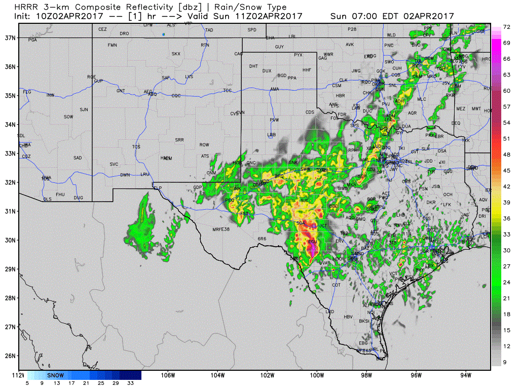
I’ll leave you with a few images, including a simulated radar projection through the afternoon. Keep in mind this simulation is just that – and won’t get everything right. Have a way to receive severe weather warnings. If you’re on our website (versus mobile app) we have several useful links pinned to the top of the site in the blue bar. Use them to get more specific information about your local forecast and to track storms. It will be a busy day, but we’ll get through it.


0 Comments