
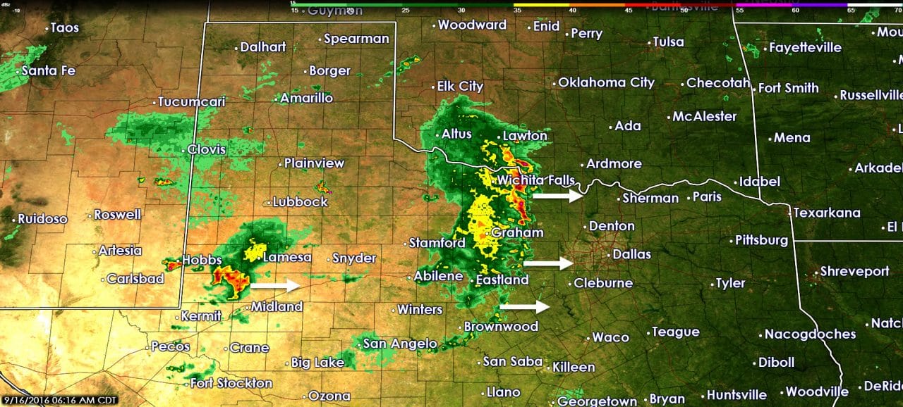
It has been a stormy night across parts of the state as a line of storms has marched east into western North Texas. We might have had a brief tornado occur near Smyer, TX around 10:40 PM last evening. Smyer is located on Highway 114 about 20 miles west of Lubbock. I have not seen any damage reports, but radar showed a tightly wound up storm. That storm brought gusty winds to Lubbock and became a part of a squall line that marched east across Northwest Texas, West-Central Texas, the Big Country, and now western North Texas. The good news is the storms have been weakening over the past few hours. Based on the current extrapolation it seems likely we’ll see a few showers and possibly a storm move into western sections of D/FW in the next hour. Not everyone in D/FW will get wet, but don’t be surprised if get a brief shower and 30 MPH west winds.
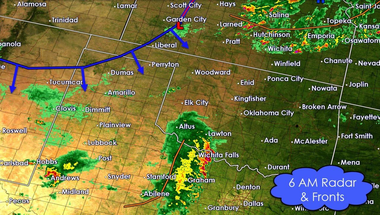
Weather models have not handled this line of storms well overnight. That reduces confidence in using one particular solution for the forecast today and tonight. Having said that today’s forecast is low confidence means you shouldn’t be surprised if we see a few changes as we go through the day. Surface analysis indicates a cool front is slowly moving south across the northwestern Texas Panhandle. It extends north into western Kansas where an area of low pressure resides near Dodge City. This front will only crawl south today into the Texas Panhandle, West Texas, and into OKlahoma. This front will be one area to watch for new thunderstorm development later this afternoon.
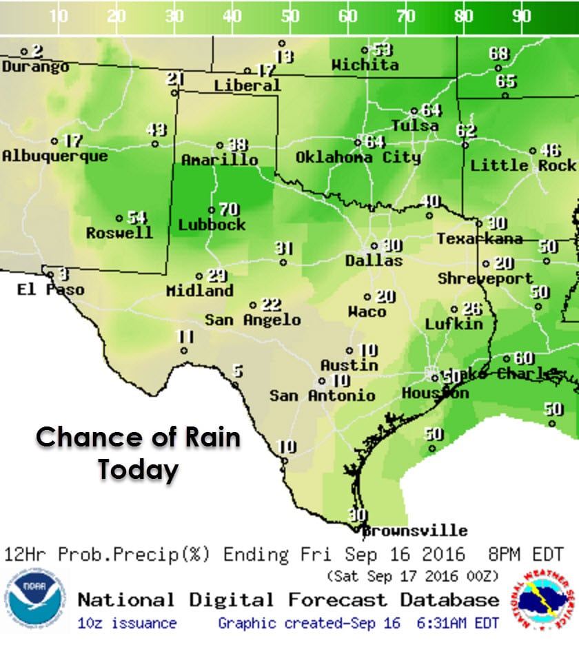
Outside of the new storms later today and this evening near the cool front we’ll also have another afternoon of scattered popup storms in North Texas, Northeast Texas, East Texas, Southeast Texas, the Middle Texas Coast, and the Rio Grande Valley. Most of these popup storms will rain themselves out after an hour or so. A few could briefly pulse up and produce small hail, wind gusts to 50 MPH, and locally heavy rains. Most should be out of the picture in time for Friday Night Football, but have someone keep an eye on the weather just in case.
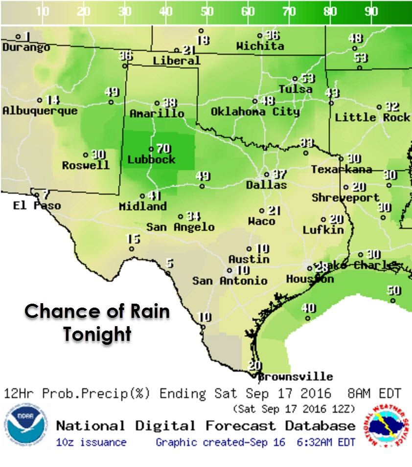
Like last night another line or complex of thunderstorms may develop in the southern Texas Panhandle and West Texas this evening. That development is not a guarantee, but if it occurs the line will move east towards Northwest Texas, the Big Country, Concho Valley, and eventually western North Texas. Some of these storms could be strong to severe with quarter size hail and localized wind gusts over 60 MPH. A few spots could also receive a quick inch or two of rain. This potential will be monitored throughout the day and the forecast updated accordingly based on new data.
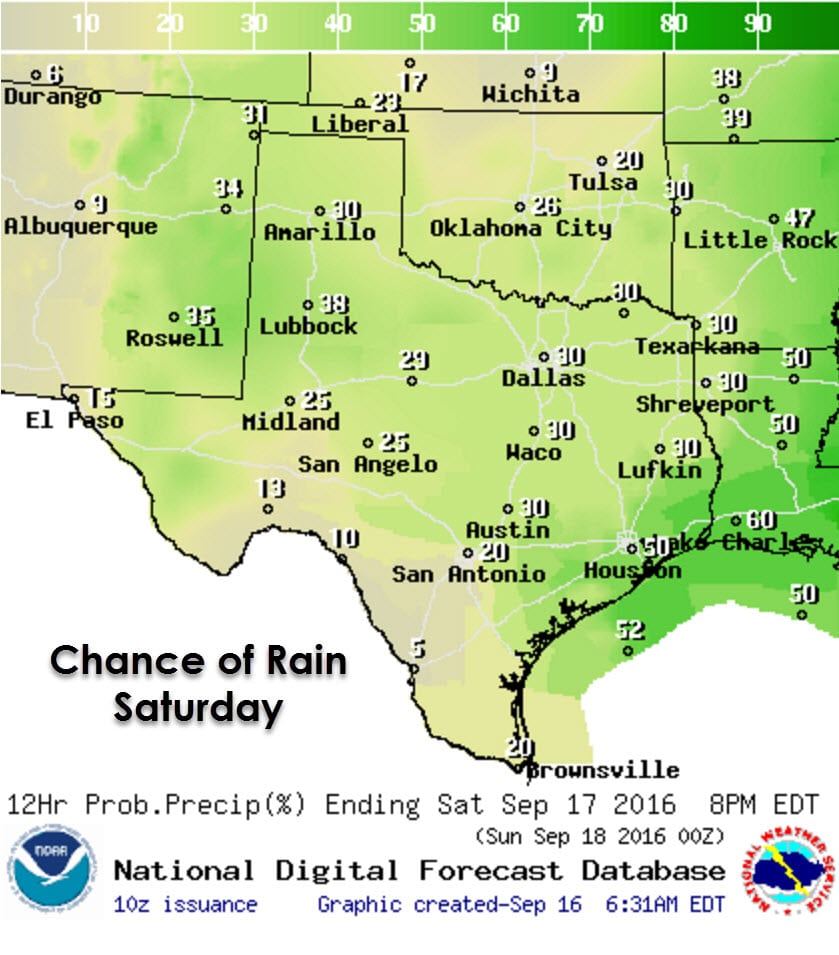
Isolated to scattered storms will be possible on Saturday across much of the state. The highest chance (as of now) will be along the coast in Southeast Texas where a weak area of low pressure will help develop numerous storms. The lowest chance of a storm will be in Southwest Texas. All locations not mentioned above will have a 1 in 5 to a 1 in 3 chance of getting a quick storm tomorrow. That means most folks will stay dry, but some will get a quick storm. Any thunderstorm that develops may produce dangerous cloud to ground lightning. If thunder roars you should move indoors or to your vehicle. Tomorrow’s potential will also depend on how storms today and tonight play out – since any residual cloud cover or boundaries could help increase or decrease chances tomorrow over a region.


0 Comments