
After all the winter mischief (can we even call it something so nice?) last week we’re switching gears and talking about spring storms. Multiple upper-level storm systems will result in unsettled and wet weather for the eastern two-thirds of Texas over the next week. Arctic air remains well to our north. Unlike last week, our upcoming week of weather will be far more spring-like. Now before some of you go running off screaming something about softball size hail and flying cows – sit down and drink more coffee. We’re not to that point of spring just yet.
Tonight’s Severe Weather Outlook
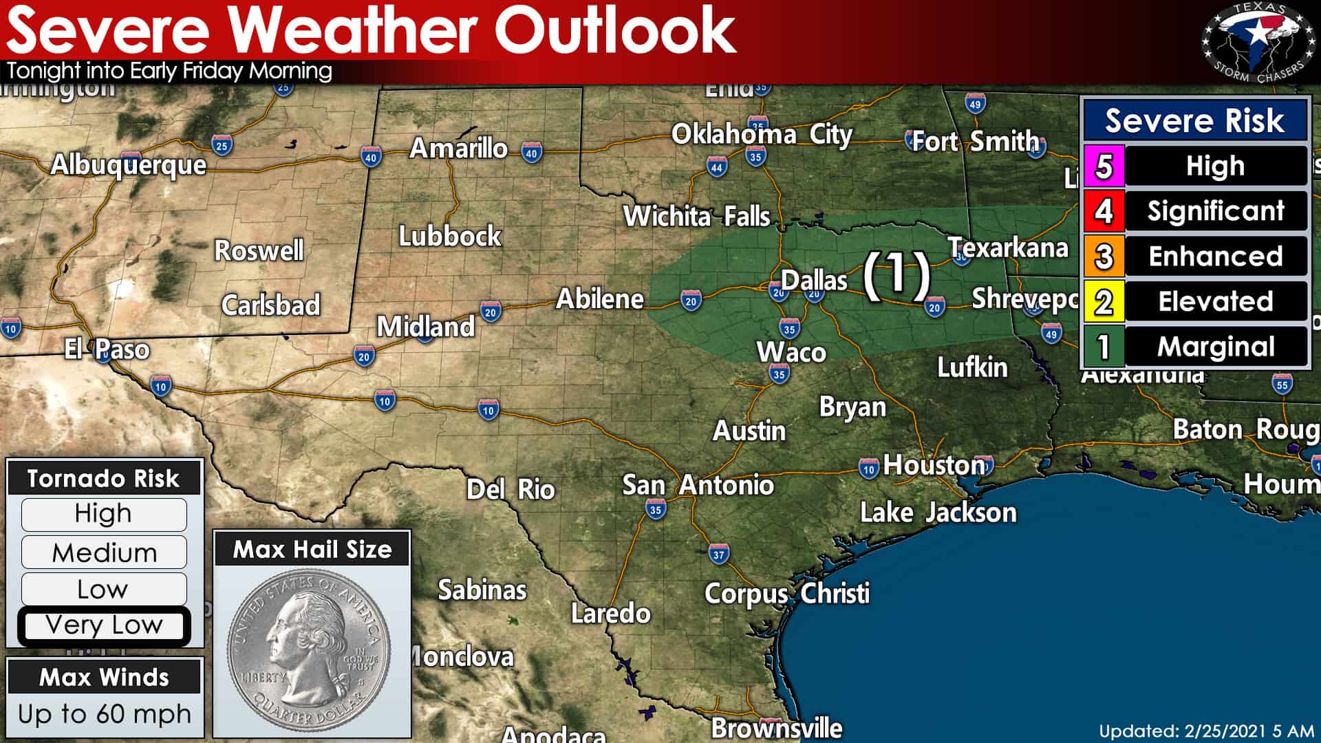
The mighty fine folks up at the Storm Prediction Center have highlighted a level one risk of severe weather for tonight. A level one (marginal) risk for a few stronger storms includes North Texas, Texoma, and Northeast Texas. One is the lowest of five risk levels with our severe weather outlooks. Most precipitation tonight will remain below severe-limits. However, some stronger storms may briefly produce hail up to the size of quarters. Tornadoes and damaging wind gusts (58+ MPH) are unlikely tonight. You can always find the latest Texas severe weather outlooks, along with an explanation on the risk scale, by clicking here.
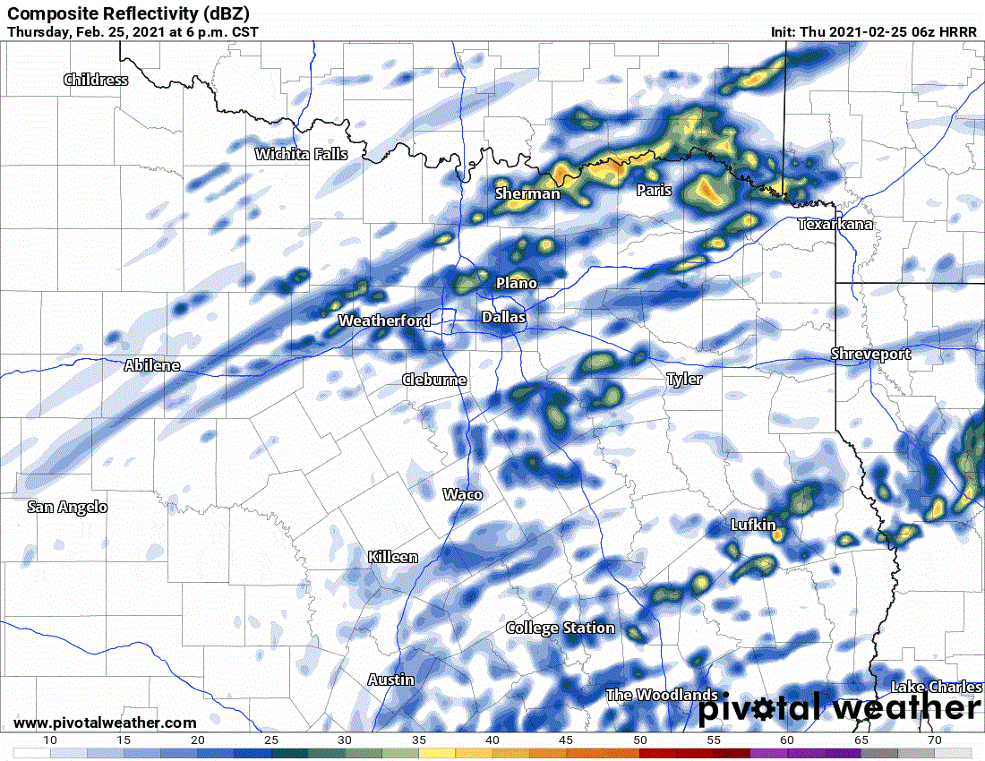
While the chance of severe thunderstorms tonight is marginal, the chance of rain is not. We’re forecasting scattered to numerous showers and thunderstorms tonight and Friday morning across the eastern half of Texas. Those across North Texas and Northeast Texas will have the highest chance of getting woken up by thunder tonight. As stated earlier, some storms may become rowdy enough to produce hail. Showers are likely further west and south with lesser rainfall amounts. We should see storms move east into Lousiana by mid-morning Friday. Patchy showers could continue through lunch-time.
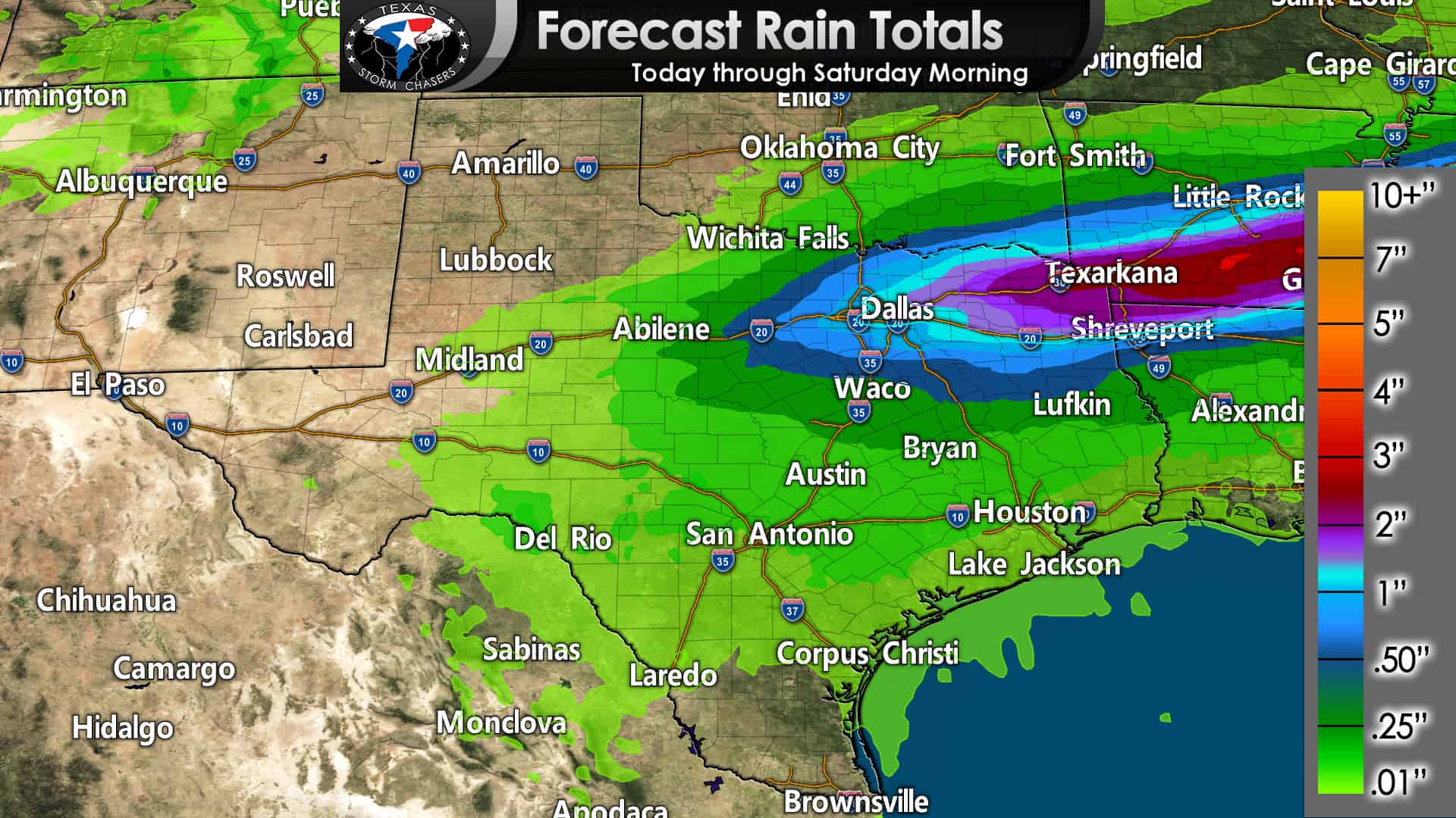
The eastern two-thirds of Texas has a decent chance of at least a trace of rain. One-half to two inches of rain is likely in North Texas and Northeast Texas over the coming thirty-six hours. Texarkana eastward into southern Arkansas may receive over two inches of rain. Texarkana seems to be the place to go this month if you’re looking for big precipitation totals.
This Weekend
Showers and thunderstorms are possible on Saturday and Sunday across the eastern half of Texas. The risk of severe thunderstorms appears low on Saturday. However, severe weather chances become more unclear on Sunday across the southeastern half of Texas. Very humid weather and rain chances are forecast this weekend for those same regions – it’ll feel very much like spring with some heavier rains possible.
Congratulations on making it through another post from Baldy-in-Chief! We’ll be around tonight just in case storms do get a bit rowdy. As always, you can follow along with our free interactive weather radar here on our website and within our awesome mobile app (which you can check out here).


0 Comments