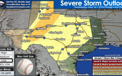
The first line of thunderstorms has now begun moving into southwest Arkansas and East Texas. The strongest portion of that line has moved east of Texas. A few sections of that line produced wind gusts up to 45 MPH, but it behaved itself and remained below severe weather limits. A second line has begun developing just ahead of a cool front from Paris to Greenville to Hillsboro to Gatesville and Lampasas. This second line is moving east/southeast and will solidify over the next two hours. This is the line that will eventually move east/southeast through Central Texas, the Brazos Valley, and into Southeast Texas by 5 AM. Some storms in this line may become strong with localized damaging winds up to 50-60 MPH. We’ll have to watch for any isolated, sustained storms that can form out ahead of that line. While unlikely at this point a brief tornado cannot be ruled out with any discrete supercell. The tornado threat, low as it was earlier, is now very low. A quick inch of rain may fall from the line as it moves east this morning. You can track the storms overnight with our free interactive weather radar.
Texas Weather: More Storms Heading Your Way Today And Friday!
Rowdy thunderstorms accompanied by heavy rainfall are set to persist until...


0 Comments