
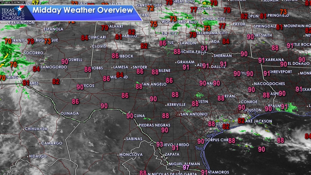
The first of July has arrived and the weather certainly reflects it. Temperatures have warmed into the 90s across the southern half of Texas with 80s in the ‘cooler’ spots. Heat index values are already near 100 degrees along and east of Interstate 35 where humidity values are highest. Temperatures and heat index values will continue climbing as we head into the mid-afternoon. Most sites will top out in the 90s except Southwest Texas, specifically Laredo, who will be in the 101-103 degree range today.
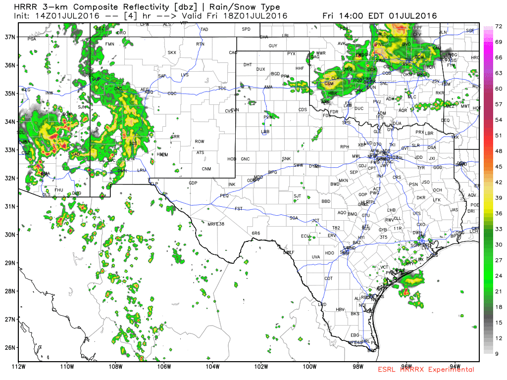
A few showers have developed along the seabreeze from Victoria to Galveston. This isolated activity will continue through the afternoon as the seabreeze makes slow progress inland. The strongest activity may produce frequent cloud to ground lightning and brief heavy rain. Showers will diminish by sunset as surface heating lets up. The experimental high resolution rapid refresh model shows this isolated activity well this afternoon. A second area of isolated storm development may be in the northern Texas Panhandle late this afternoon and evening. Storms will develop in Colorado and Kansas this afternoon. It is not out out the question that some storms impose on the northern Texas Panhandle.
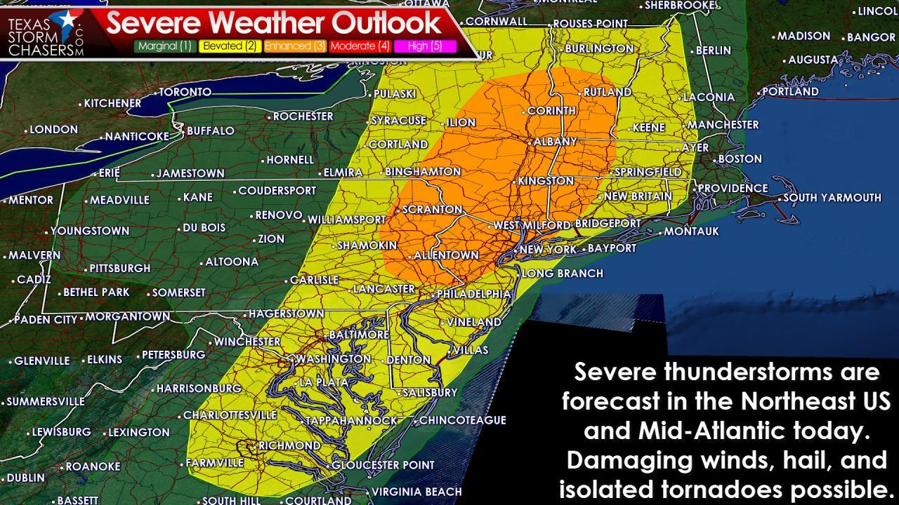
Our severe weather season in Texas may be done but the Northeast United States is dealing with it every couple of days. The Storm Prediction Center has issued an enhanced risk of severe weather for portions of the Mid-Atlantic today. Thunderstorms with damaging winds, hail, and isolated tornadoes are all possible. The threat for damaging winds will be highest in the enhanced risk area this afternoon. Storms will move towards the coast by early evening. We’ll probably be seeing some wind damage photos later today since they have no shortage of foliage.

0 Comments