
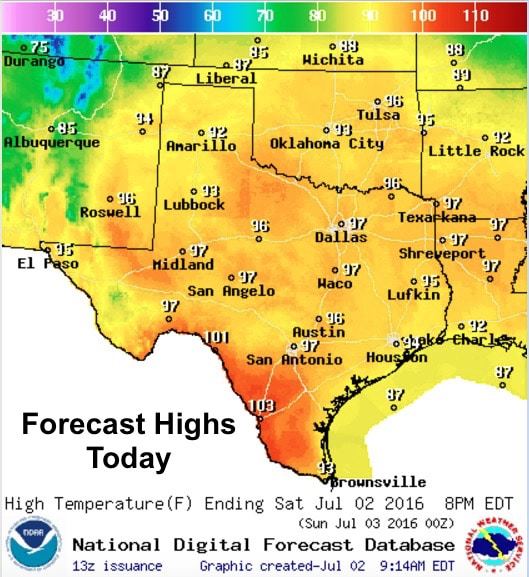
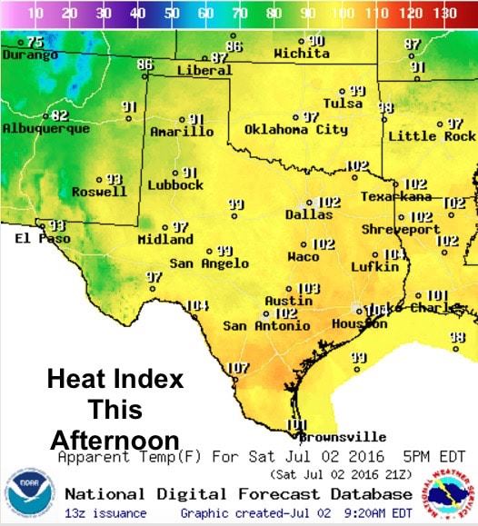
Hot and humid conditions expected today as high pressure dominates the forecast this weekend and into next week as well. The forecast highlight today will be the high Heat Index readings expected across southeast, south central and south Texas later this afternoon. Heat Index readings are expected to reach 105 to 110 degrees by this afternoon. This will make for some very uncomfortable conditions for anyone who has outdoor activities planned later today. Best advice…stay indoors and under the fan and A/C during peak heating. If you have to be out, be sure to drink plenty of water. Make sure outdoor pets and livestock have access to plenty of water and shade. It would also be a good idea to check on elderly friends and neighbors.
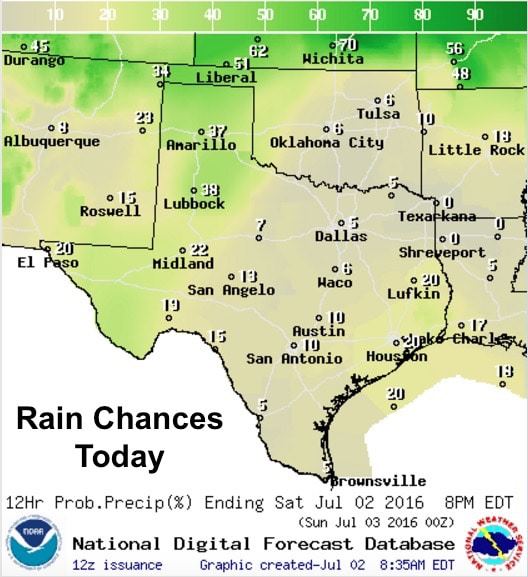
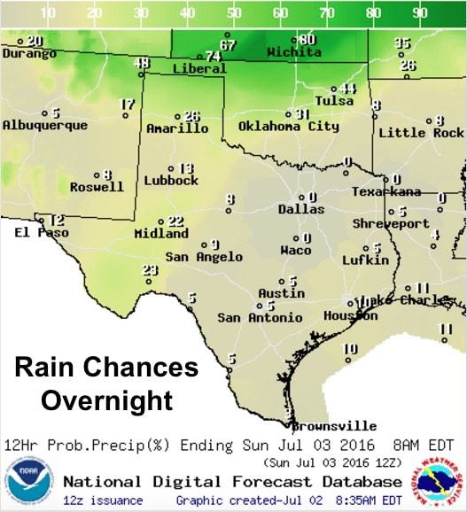
Rain chances today will reside mainly across the panhandle and western Texas with only slight chances for pop-up showers and storms across southeast Texas. The far northern portion of the Texas panhandle has been placed under a Marginal Risk of seeing severe storms; however at this time, it appears the greatest risk for seeing any severe storms will be just off to the north across the Oklahoma panhandle and into southern Kansas as a weak cold front drops south into this region. Elsewhere across the panhandle and down into far west Texas, a few strong pop-up storms are possible with the threat of brief heavy downpours, gusty winds and lightning.
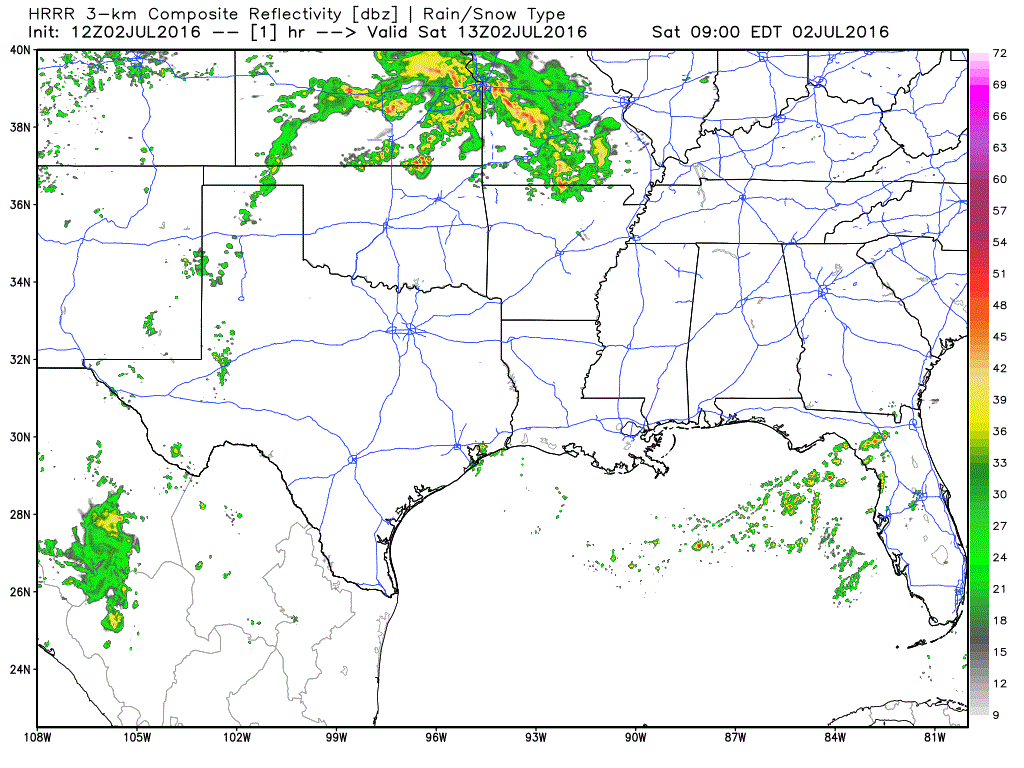
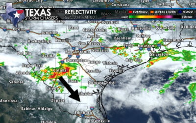
Simulated Radar through 10pm This Evening

0 Comments