
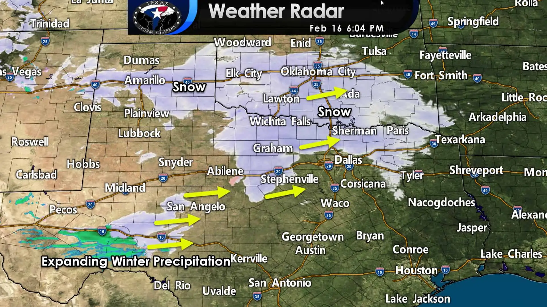
Light to moderate snow is falling along Interstate 40 in the Texas Panhandle east into West and Central Oklahoma. Further southeast, snow is pushing east/northeast across Northwest Texas and North Texas. Dry air in the lowest levels of the atmosphere is keeping most of D/FW snow-free thus far.
I expect snow to fall across most of the D/FW Metroplex by 7 PM as the atmosphere moistens. This initial wave of precipitation may produce one to three inches of snow in the Panhandle, Northwest Texas, and Texoma (Red River counties of North Texas) by midnight.
Farther southwest, our more substantial wave of precipitation is in its formative stages near Junction to the west of San Angelo. It is this developing batch of precipitation that will quickly grow as it moves east this evening.
A significant winter storm will bring substantial accumulations of ice (freezing rain and sleet) along with snow to the eastern third of Texas tonight. Snow will be most likely along and north of Interstate 20. A winter mix is expected from Interstate 20 southward into Central Texas, the Brazos Valley, East Texas, and Southeast Texas.
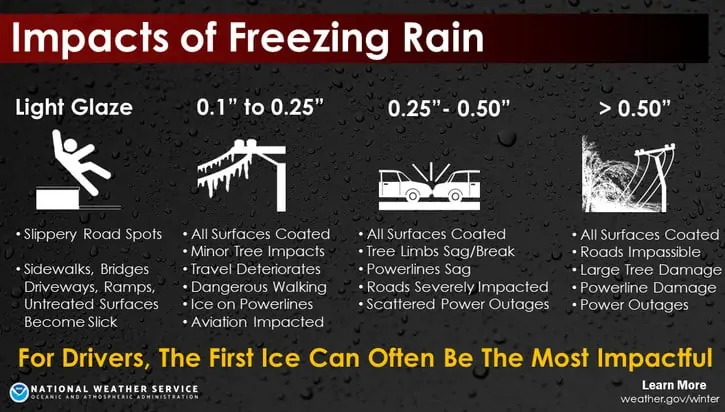
There is some uncertainty on whether we’ll be dealing with freezing rain or sleet. If freezing rain is the primary precipitation type – we’re going to have a major ice storm on our hands. Widespread, severe impacts to trees and power infrastructure are likely. Travel will be nearly impossible as ice forms on top of the snow from earlier in the week.
Ice accumulations are likely tonight as far south as San Antonio and Houston. For those who receive more sleet than freezing rain, sleet accumulations may approach one to two inches. Those significant sleet accumulations would also make travel nearly impossible but spare folks of widespread power outages.
Sleet would be more likely closer to Interstate 20 (north has higher chances versus south). Snow accumulations of two to six inches are expected in North Texas and Northeast Texas by Wednesday morning.
The highest snowfall accumulation can be expected along the Red River, with amounts decreasing with the southward extent to Interstate 20. Precipitation intensity and coverage will decrease by lunch-time Wednesday as precipitation moves off to the east of Texas. Light winter precipitation may continue much of tomorrow with minor ice and snow accumulations.
Another round of winter precipitation is possible Thursday morning across the Hill Country, Edwards Plateau, and South-Central Texas. We’ll deal with that after we get past tonight.


0 Comments