
May has arrived, and we continue the peak of our spring severe weather season. After multiple instances of hail yesterday in Central and East Texas, we’ll be ‘spreading out’ the storm chances today. Let’s dive into the details by starting with the latest severe weather outlook.
Severe Weather Outlook
Severe weather outlooks issued by the Storm Prediction Center utilize a five-level risk scale. Each risk level is based on the probability of severe storms within twenty-five miles of any given point, such as your location. A level one risk is the lowest and means isolated/short-lived severe storms are possible. A level five risk is the highest, is quite rare, and indicates a significant tornado outbreak or derecho is likely. Being in or near any risk zone means you may have stronger storms in your vicinity. View the latest Texas severe weather outlooks here.
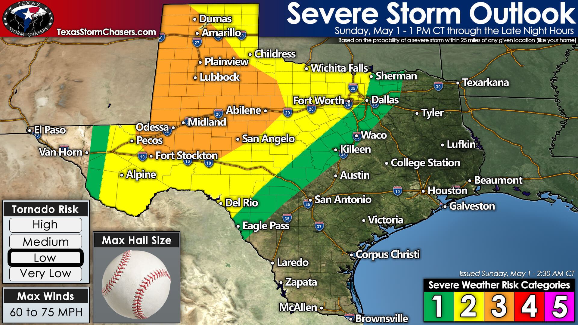
A level 3 (out of 5) risk for severe storms includes the western Texas Panhandle, West Texas, the Permian Basin, Big Country, and the Concho Valley. The standard level 2 (out of 5) risk for severe storms includes the eastern Texas Panhandle, Northwest Texas, Texoma, the western half of North Texas, southwest into the Edwards Plateau. Finally, a level 1 (out of 5) risk for severe storms surrounds the higher risk levels. Any risk level means a chance for a severe storm later today or tonight.
Threats
Large, potentially destructive hail is likely the primary and most common hazard amongst the strongest storms today. The most intense supercell thunderstorms may produce larger than baseball size hail. Localized damaging straight-line winds over 70 miles per hour, a few tornadoes, and isolated flooding are also hazards today. Lightning-induced wildland fires may also occur in drought-stricken fuels.
Timing & Discussion
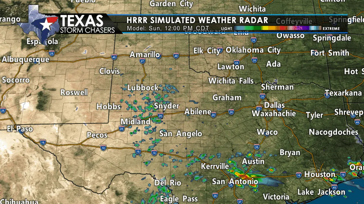
Today’s thunderstorm chances will be focused on a couple of areas. Early this afternoon, the first initiation point for thunderstorms will be just east of the dryline. We’ll likely see storms firing around 2 PM central from eastern New Mexico south into the Trans-Pecos Valley and the Davis Mountains.
We could also see isolated strong to severe storms develop early this afternoon, further east in the Hill Country and North Texas. Those isolated storms would be associated with outflow boundaries produced by yesterday’s storms. Most storms will move northeast, but more intense supercells will move easterly.
Scattered to several severe thunderstorms will east/northeast across the Texas Panhandle, West Texas, Permian Basin, and Edwards Plateau this afternoon and early this evening. Multiple supercell thunderstorms capable of producing destructive hail are likely. Localized damaging wind gusts, lightning-induced wildland fires, and even a few tornadoes are also possible.
The tornado threat is expected to be focused on storms interacting with outflow boundaries or storm-scale interactions. More isolated thunderstorms are also possible through the afternoon and early evening associated with outflow boundaries in North Texas, Central Texas, and the Hill Country.
Around or a few hours after sunset, we’ll likely see storms in western Texas begin congealing into clusters – though a few supercells will continue well into the evening. Tonight, those storms will continue moving east/northeast into Oklahoma, Northwest Texas, Texoma, the Big Country, Concho Valley, and western North Texas.
Large hail, damaging straight-line winds, and perhaps a tornado will remain possible past midnight. Storms will begin to weaken late tonight gradually, but it is May. We can support organized thunderstorms most of the night, especially as strong southerly winds keep pumping moisture to the north. The message for today is we expect several to numerous thunderstorms across Western Texas this afternoon and evening. Rain will be welcome, but the strongest storms will likely be dropping nasty-size hail.
Storm Chasing & Live Video Plans
We’ll have most of our folks out storm chasing today. You can expect at least two live storm chasing streams to be available for your viewing pleasure later today on our YouTube channel and our website. I will be staffing the TSC Weather Office to provide severe weather coverage.
Monday – Thursday
Monday’s severe weather chances are more uncertain and conditional. If tonight’s storms work over the atmosphere, we may not end up with much storm activity Monday afternoon/evening south of the Red River. A significant severe weather event, including another substantial tornado risk, may evolve from Central Oklahoma north to near Wichita, Kansas.
After today’s chase, we’ll be positioning ourselves up in Oklahoma City to document tomorrow’s storm chances. The chance for severe storms may return to Texoma and North Texas on Wednesday – and spread into Northeast Texas on Thursday. We’ll deal with the upcoming storm chances once we get past today.


0 Comments