
Unsettled weather is expected this week, with a tendency toward cooler temperatures and sporadic rain chances. We definitely could use the rain, and such a weather pattern doesn’t typically feature widespread, nasty tornado outbreaks. That being said, we will have the chance for a few hailers this afternoon and evening near a frontal boundary.
Severe Weather Outlook
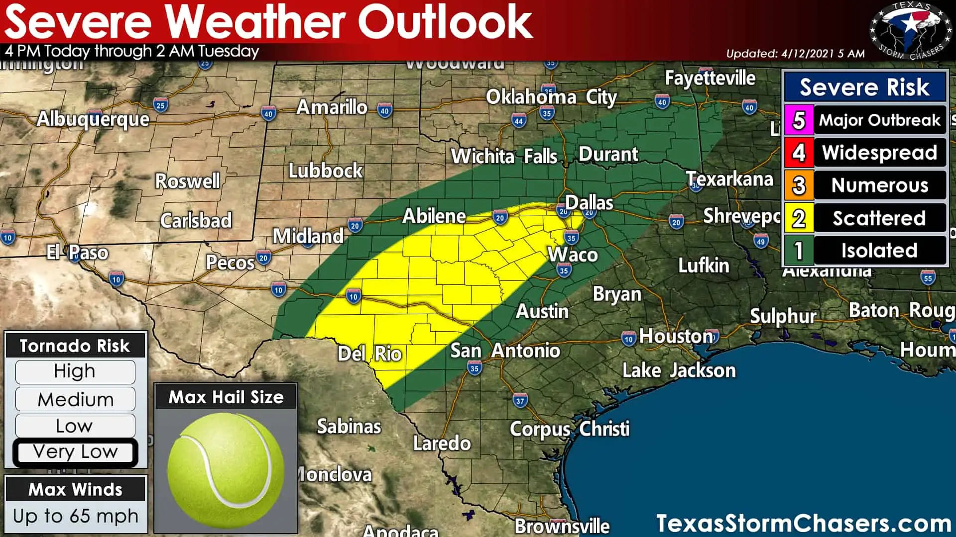
Today’s severe weather outlook from the Storm Prediction Center
Our friends in the Storm Prediction Center have highlighted the chance for isolated to scattered severe storms today. The relative highest chance for a few hailers will be in the Edwards Plateau, eastern Concho Valley, extending northeastward through the Hill Country and North Texas.
Severe weather risk levels highlight the coverage or probability of severe weather within a local area. The higher the risk level, the more likely severe weather is within that zone. Click here to learn more about the severe weather outlook risk scale.
The primary threat with today’s most intense storms will be large hail. Very large hail up to tennis balls’ size may occur along with localized wind gusts up to 65 MPH. The threat of tornadoes is very low due to lackluster low-level wind shear and high cloud bases.
Not all storms will be severe, nor will all storms produce tennis-ball size hail. Thunderstorm numbers will be limited, so most folks are not going to get stormed on today. However, any storms that develop will be in an environment supportive of hail and localized high winds.
Safety note for first responders: Dangerous cloud to ground lightning will be produced by any thunderstorm today. Lightning striking in areas outside of precipitation cores could result in grass fires in drought-stressed surface fuels. Firefighters working a wildland fire near a thunderstorm should be mindful of erratic outflow winds.
Thunderstorm Timing
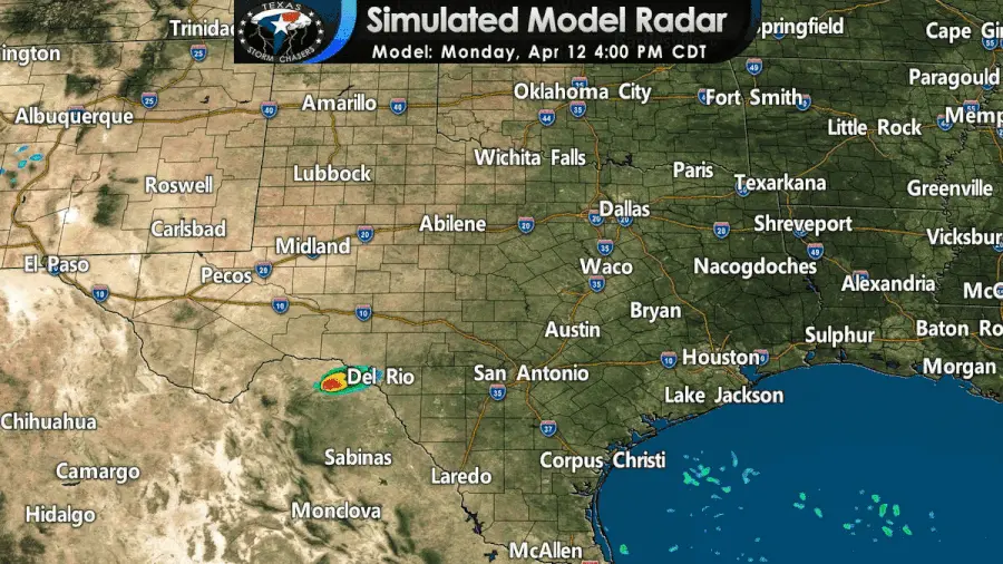
Simulated weather radar from a high-resolution weather model for this afternoon and evening. This is only for a general guideline. Since today’s activity is expected to be more isolated, models will have difficulty pinpointing exact locations.
Initial thunderstorm development will likely occur after 4 PM in the Concho Valley and southwestern North Texas. Splitting storms are probable, with ‘left splits’ moving northeast and ‘right splits’ moving southeast. That process will continue through the early evening as isolated to scattered storms develop into the Hill Country, eastern Big Country, and North Texas.
Several thunderstorms could be underway by dinner-time, with the most intense producing very large hail and gusty winds. Not all storms will be producing damaging hail.
Thunderstorm intensities should start coming down not long after sunset in terms of very large hail. Still, we may see storms continue past midnight and into the early morning hours Tuesday. Some of those storms could continue producing quarter to goofball (golfball, too) size hail.


0 Comments