
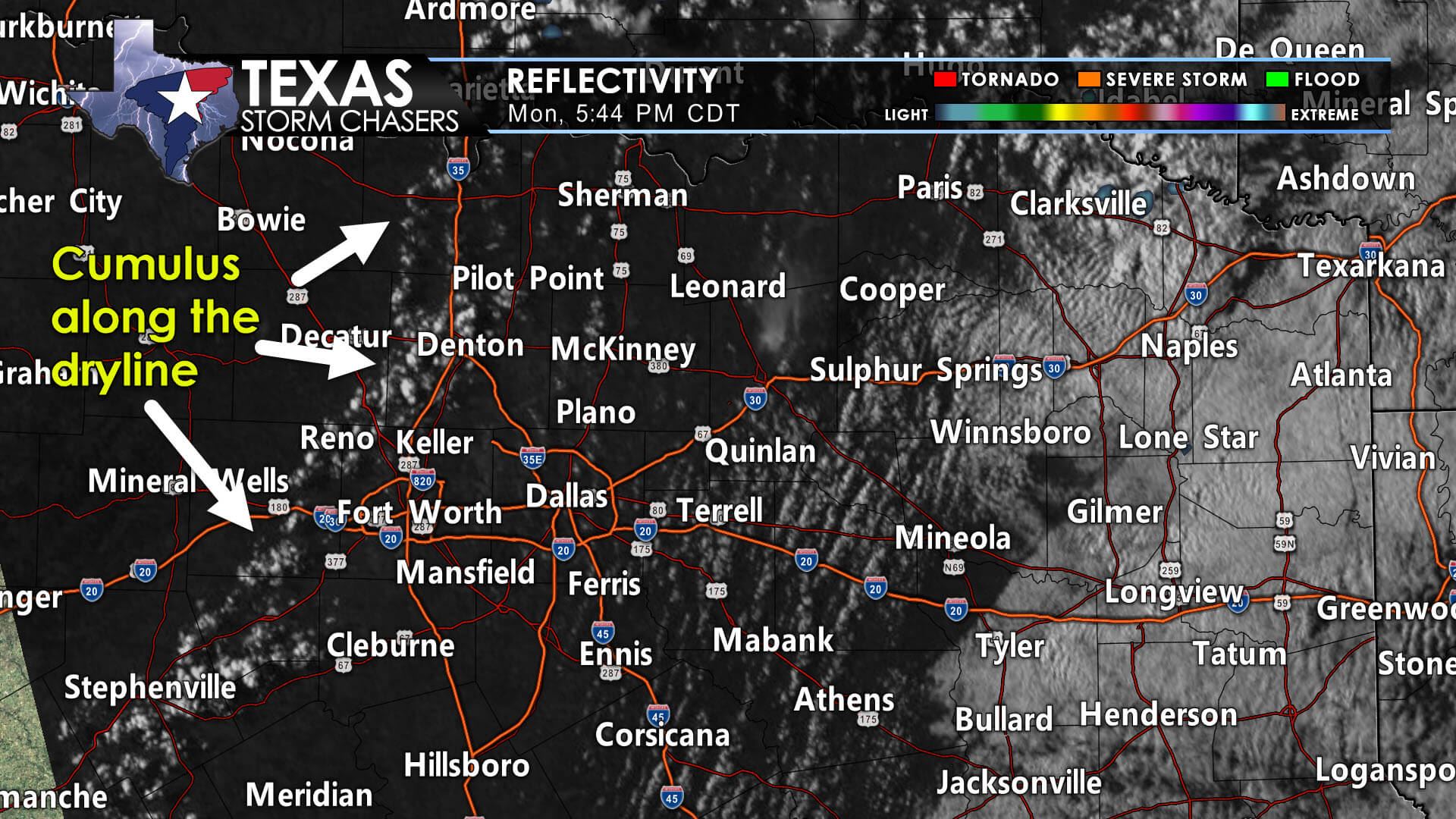
A conditional threat for one or two severe thunderstorms continues in North Texas and Northeast Texas. This afternoon, a strong lid on the atmosphere, known as a cap, has prevented intense thunderstorm development. There is the potential we may see one or two storms punch through the cap and materialize. If a storm can develop, we anticipate it will rapidly intensify and become severe. Very large hail would likely occur along with localized damaging wind gusts. A brief tornado can’t be ruled out, but that threat assumes we have any storms develop in the first place. Storm movement would be to the northeast, with any sustained storms moving more easterly. A majority, if not all, of North Texas and Northeast Texas, won’t see a lick of rain over the next several hours. Yet, if a storm were to develop, it would get rowdy.
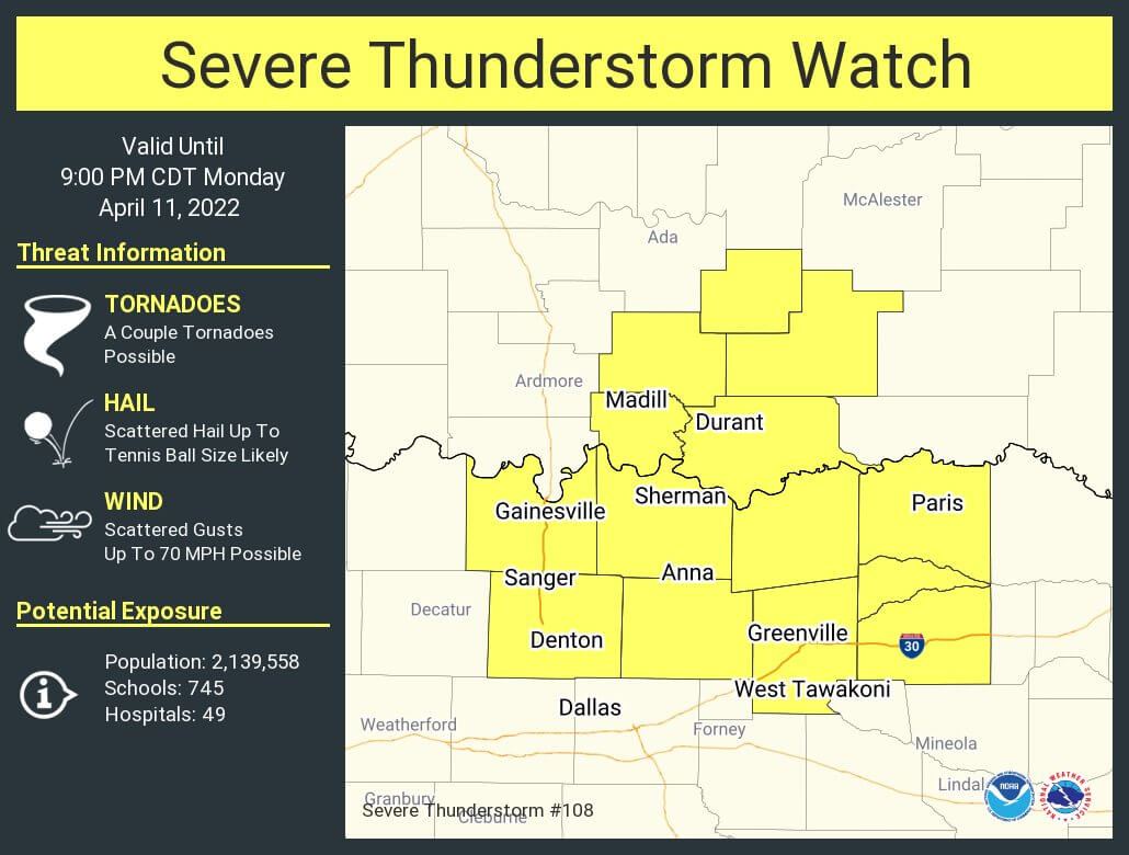
The Storm Prediction Center has issued a small, short-duration severe thunderstorm watch for eastern Texoma through 9 PM. This watch includes Gainesville to Denton, east to Sulphur Springs, and Paris. As described above, this is pre-cautionary if we’re able to see a storm develop. If we can get past 7:30 PM without storm development, we’ll be in decent shape for the night.
I’ll go ‘live’ on our social media platforms and our website for severe weather coverage if storms get going. Otherwise, we’ve got several chasers out in Arkansas, where severe weather is ongoing. I’ll have a detailed discussion out by 9 PM regarding Tuesday’s severe weather and fire weather threats.


0 Comments