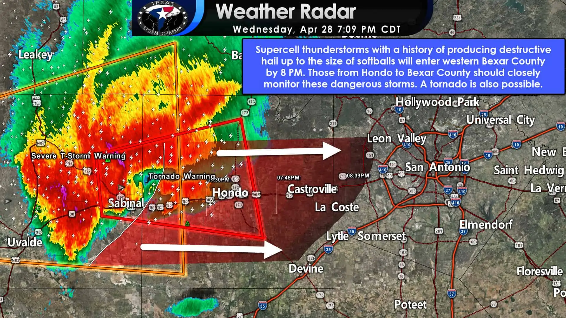
Tornado Warning now for developing tornado just north of Sabinal. Moving east down Highway 90 toward D’Hanis and Hondo. Could put a TOR down at any time. Also – SOFTBALL size hail has been reported! These storms are moving toward Bexar county. They should make it to the west side of Bexar county by 8 PM. These dangerous storms are moving toward the San Antonio metro. Make sure you’re keeping an eye to the sky and have a way to receive weather warnings. We’re also tracking a new severe storm southeast of Mineral Wells – moving toward western D/FW.
Mesoscale Discussion 0459
NWS Storm Prediction Center Norman OK
0701 PM CDT Wed Apr 28 2021
Areas affected…South-central Texas
Concerning…Tornado Watch 120…
Valid 290001Z – 290130Z
The severe weather threat for Tornado Watch 120 continues.
SUMMARY…A threat for very large hail, wind damage and possibly a
tornado will move eastward into the San Antonio Metro around 8 pm
central.
DISCUSSION…The latest radar shows a cluster of severe storms
located about 60 statute miles to the west of San Antonio. Ahead of
these storms, the RAP is analying a pocket of strong instability
with MLCAPE near 4500 J/kg and 0-6 km shear near 50 kt. This
environment will be very favorable for supercells with large hail.
Hailstones of greater than 3 inches in diameter will be possible
with the stronger updrafts. Wind gusts exceeding 65 knots may also
occur, with the possibility of wind driven hail.


0 Comments