
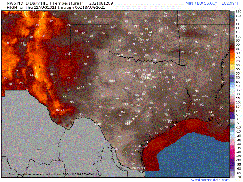
Forecast high temperatures across Texas over the next five days from the National Weather Service.
We’ve reached the top of our temperature roller coaster this week. After today, temperatures across Texas will either fall or remain near steady-state through early next week. The reason for falling temperatures is because of another summer cool front arriving this weekend. Temperatures won’t necessarily be ‘cool’ since it is August, but rain chances will be going up state-wide. Increased cloud cover plus the rain will help knock temperatures down at least a few degrees. Daily fluctuations in temperatures are likely based on who gets lucky with a nearby rain shower and who ends up spending more time in the sun.
Rain chances are going up!
Rain chances today will be highest across the Borderland (Far West Texas) east into the Trans-Pecos, Permian Basin, and West Texas (west of Interstate 27). The same thing goes for the Upper Texas Coast and, to a lesser extent, inland into the Brazos Valley and South Texas. As usual with any summer-time thunderstorms, some may get rather rowdy in the lightning and microburst department.
Stronger storms may drop small hail and localized damaging wind gusts over 55 MPH. We can’t rule out brief flooding across Far West Texas over the coming days as the monsoon goes into overdrive. We’re expecting the same story on Friday, except rain chances will expand in Texas’s western and southeastern portions.
A cool front will begin moving south into Texas tomorrow evening and continue into the weekend. Rain chances across Far West Texas will remain high into the weekend thanks to the monsoon. A few inches of rain is likely for El Paso – where we may even see periods of flooding. Rain chances across the eastern seventy-five percent of Texas this weekend will be thanks to the cool front and several nebulous upper-level sources of lift. It doesn’t take much to get afternoon popup storms going when you have tropical moisture and just a hint of ‘lift’ in the atmosphere.
Any stronger storms during the afternoon hours will produce dangerous cloud-to-ground lightning, small hail, 50 to 70 MPH localized wind gusts, and a quick one to three inches of rain. Widespread severe thunderstorms are not expected – this is a summer-time ‘popup storm’ setup versus an organized ‘im going to bow echo half the state to make David stay up all night’ situation.


0 Comments