
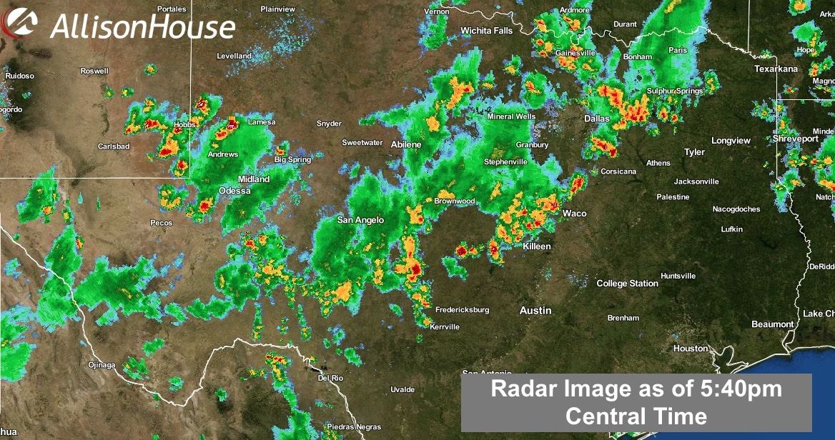
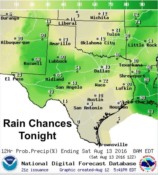
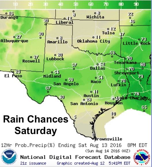
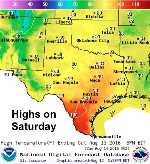
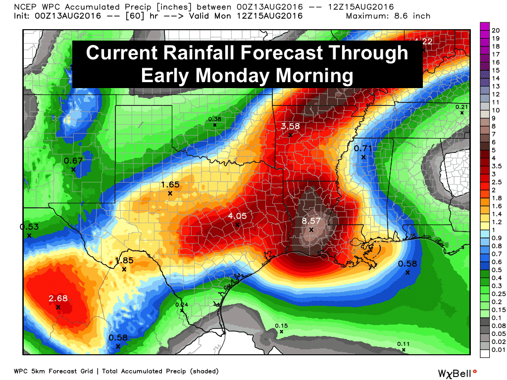
This was the hottest day of the season for many areas across the state this afternoon with a few record highs recorded…107 at DFW Airport and 106 in McAllen. The cold front we’ve been talking about for several days now is slowly drifting south through the rolling plains and northern Texas. Numerous showers and storms have developed out ahead of it this afternoon, some of them reaching severe limits with 60 to 70mph downburst winds. These storms will continue to pulse up and down through the evening hours, with the main threat being damaging winds, before decreasing in intensity after we begin to lose daytime heating. The front will continue to move south overnight, aided by the outflow boundary generated by this afternoon’s storms, and eventually settle in across central to south central Texas by tomorrow. Right now it appears that the heaviest rainfall expected tomorrow will be south of the I-20 corridor. The overall weather pattern will remain unsettled into next week as the stalled front hangs around and we see the area of low pressure, currently terrorizing Louisiana, drift west and into central Texas this weekend. While we are not anticipating the amount of rainfall from this system that parts of southern Louisiana has seen, we will see quite a bit of rain for this time of the year spread out over the next several days. Here’s a look at what we can expect overnight and tomorrow in terms of rainfall and forecast highs…plus a look at the updated rainfall outlook through early Monday.

0 Comments