

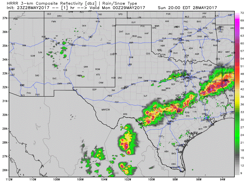
As stated earlier I was working an 11 hour shift today. By luck I was able to get off a bit early. With that explanation on the quiet nature of our activity, here is this evening’s update. A broken line of storms extends from Lufkin to Bryan to Austin to northwest of Pearsall to northwest of Laredo. Some of these storms are severe and capable of producing localized damaging wind gusts to 70 MPH and hail larger than the size of a quarter. Additional storms have been forming behind this ‘first round’ across Central Texas. With additional storms forming we have a concern for localized flooding. Thanks to the high moisture amounts in place these storms are quite efficient rainfall producers. These storms are moving east/southeast at 20 to 40 MPH. The faster-moving storms are in the Brazos Valley into East Texas. Slower-moving storms are in South-Central and Southwest Texas. All of this boomy mischief is thanks to a cold front slowly moving south/southeast across East Texas, Central Texas, into Southwest Texas. The highest chance for severe storms will be south of this front, but additional storms are possible behind the front as well. Both scenarios would produce localized heavy rainfall along with some hail and gusty winds. We’ve had several reports of wind damage in East Texas and probably a brief tornado or two. We’ll review those events after storms end, and the National Weather Service in Shreveport will likely survey damage areas to determine if any brief tornadoes occurred.
Simulated model radar through Monday morning.
Storms will continue to push southeast into Southeast Texas and South Texas this evening. Some of these storms, especially closer to the Mexican Border into South Texas, will have the higher chance of being severe with a risk of damaging wind gusts and large hail. This threat will likely continue into the morning hours Monday across South Texas. It looks like most storms, or at least the strongest ones, should be moving off the Southeast Texas coast by 2-3 AM. Scattered showers/storms may continue behind this initial batch of storms, but the risk of large hail/wind will be lower.


0 Comments