
Key Messages
(1) A historic winter storm is poised to Texas, with impacts beginning as early as Saturday morning, worsening on Sunday, and continuing through Monday.
(2) Frigid temperatures, rivaling the December 1989 ArcticOutbreak, are forecast on Sunday and into Monday, with prolonged, much below-average temperatures expected to continue through next week.
(3) Major impacts resulting in severe stress to Texas’s infrastructure (particularly power, water, and highways) are likely. Some regions of Texas will see travel crippled for days.
(4) Additional frozen precipitation will be possible toward the middle of next week, though confidence is low in the details at this time.
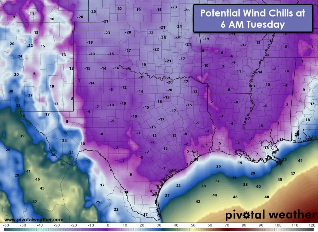
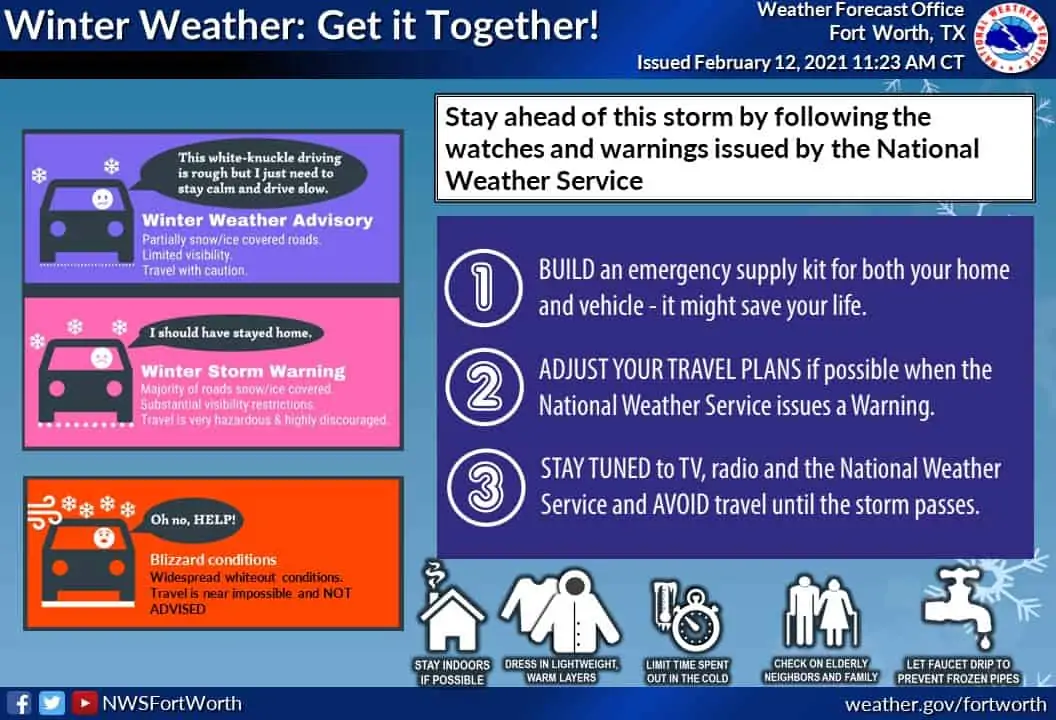
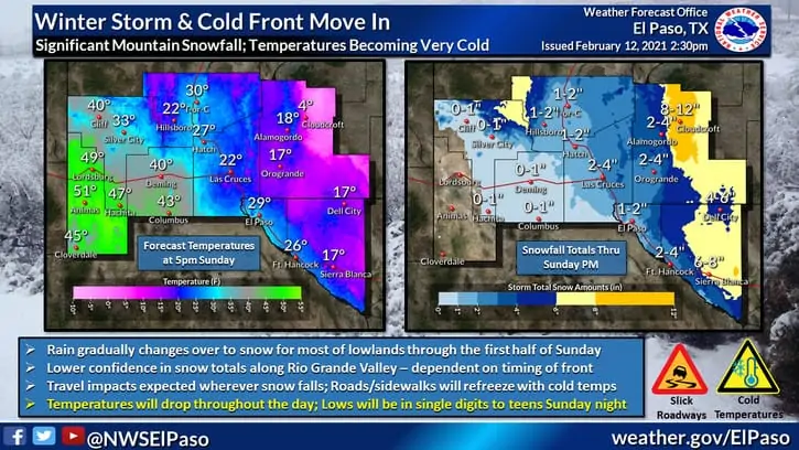
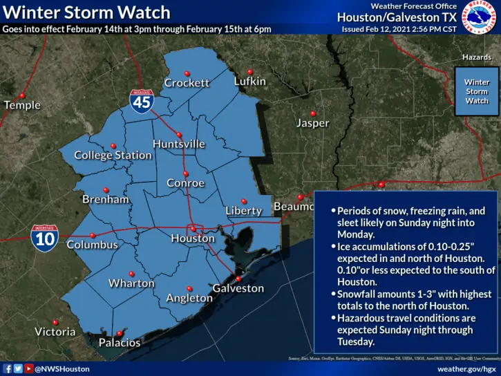
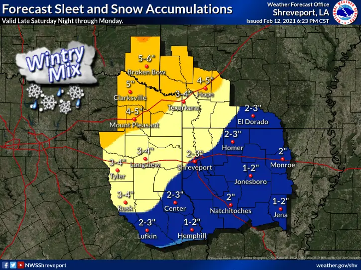
This post will consist of many graphics from local National Weather Service offices across Texas. To better explain timing and impacts on a localized scale, I’ve divided the graphics by NWS office and shown them in alphabetical order. I apologize for the number of graphics; there is a lot of information to get out when you cover 254 counties. Unlike my novel of a post this morning, this update will be purely graphical. I will have a detailed written update out late this evening, but I want to examine some of the arriving evening weather model data first. This would be a good time to bookmark our free interactive weather radar (here). It’ll be lit up like a Christmas tree later this weekend. Those using our free mobile app can click the ‘radar’ button in the bottom menu.
All graphics in this post can be enlarged by clicking or tapping on them.
NWS Amarillo
NWS Austin/San Antonio
NWS Corpus Christi
NWS El Paso
NWS Fort Worth
NWS Houston
NWS Lubbock
NWS Midland
NWS Norman (Wichita Falls/Northwest Texas)</h4)
NWS San Angelo
NWS Shreveport


0 Comments