
An active weather pattern will continue for the final days of January and the first week of February. That active weather pattern means we’ll be playing on the temperature roller-coaster. Today and Thursday will be the dive down that temperature roller-coaster before a steep climb up by Monday. A couple of chances for rain will exist over the coming five days too.
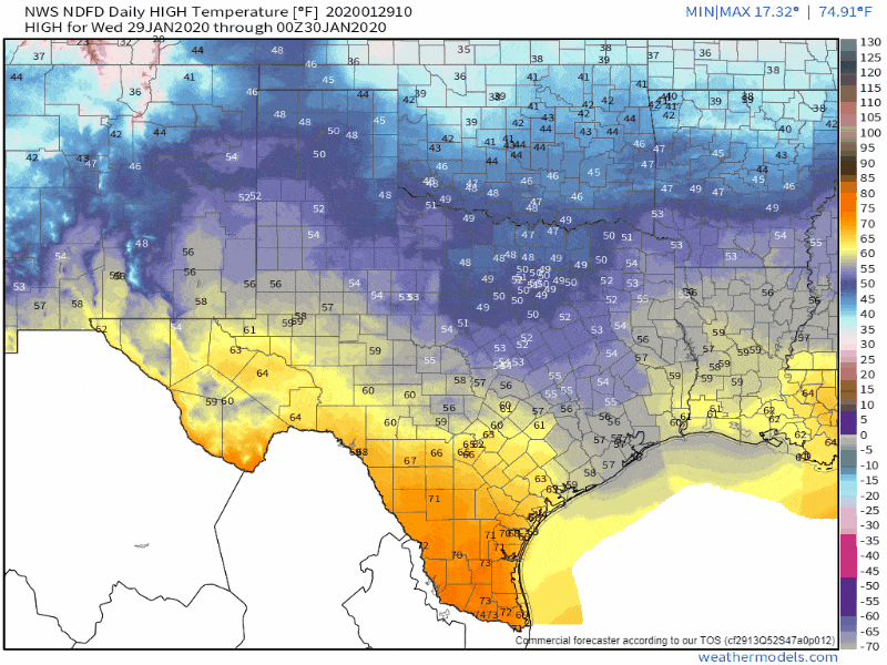
Forecast high temperatures over the next six days. Data from the National Weather Service.
Cold air advection (those northwesterly/northerly winds) will continue Today and on Thursday. Clouds will also be challenging to break up today. It’ll be rather cool to downright chilly the next two days across the northern three-quarters of Texas.
Those in the Rio Grande Valley, Deep South Texas, and along the immediate coastline will stay on the warm side. Everyone else in Texas is going to be on the chilly side today, and especially on Thursday. We’re not talking abnormal cold for late January, but it’ll be a bit of a change considering how warm we’ve been this winter.
Worry not warm-weather fans. Above-average temperatures will return to all of Texas this weekend and on Monday. We may see some approach previous record high temperatures on Monday with lots of the 70s and 80s across Texas. A cool front will arrive Monday night and on Tuesday, helping to knock temperatures back down toward average.
The next chance of precipitation will begin late tonight in the Borderland and in West Texas. Rain coverage may not be widespread, and it isn’t expected to be heavy. Indeed, it will be much lighter than the precipitation experienced in the previous days. Rain chances will spread east during the day Thursday. Scattered showers will be most likely Thursday night across the eastern half of Texas. The western half of Texas will be mostly dry by that point.
While not discussed in detail this morning, some of the rain late tonight and early tomorrow may mix with light snow in West Texas. Precipitation intensity looks to be light enough to preclude more than a dusting in a few spots.
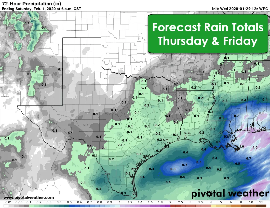
Forecast rain totals over the coming few days from the Weather Prediction Center.
Rain totals will likewise be on the light side with tomorrow’s system. Those across the southeastern half of Texas may see between one-tenth to one-half inch of rain. Overall, showers will be just enough to produce some run-off into streams. Flooding is not expected, and neither are severe thunderstorms.
After the Thursday/Friday system, we’ll see mostly dry weather across Texas until the next system begins arriving early next week. Nothing screams ‘high-impact’ in the weather model data early next week in the snow/ice/storm/flooding department.


0 Comments