
Video Discussion
Meteorologist Jason Cooley has put together a video briefing regarding tonight and tomorrow’s conditional severe weather potential. You can view his video along with my written notes below…
Tonight in East Texas
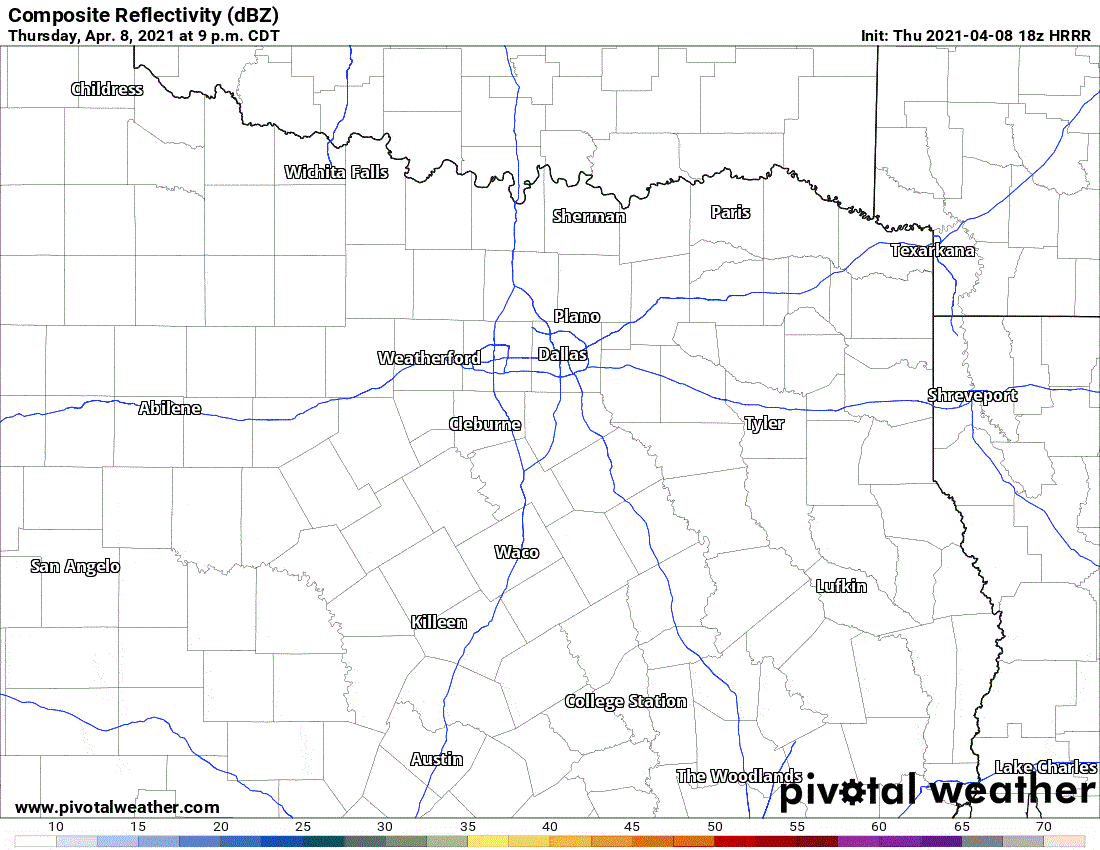
Simulated weather model radar for the late evening today in East Texas.
Before we dive into tomorrow’s severe weather chances, we need to address tonight. Short-term high-resolution weather models hint at the opportunity for an isolated storm around Tyler by 9-11 PM. If we do get a storm to fire, it could become strong or severe with large hail. We don’t expect many storms but don’t be surprised if we have a few quarters to ping-pong ball hail reports this evening in East Texas. Any storms that get going should quit being rambunctious or move into Louisiana by 1-2 AM.
Friday Afternoon and Evening
Tomorrow’s severe weather forecast remains very conditional. The cap, or a lid that prevents thunderstorms, will be the big player. Like I mentioned this morning, we are not expecting many thunderstorms tomorrow. However, any storms that do develop will have a high likelihood of being severe with significant hazards. This same scenario plays out many times during April and May. Most days, the cap will win, and skies will remain clear and blue (hence, blue sky bust). With an upper-level storm system passing overhead tomorrow, there is a concern we’ll see enough lift to punch through the cap in parts of North Texas.
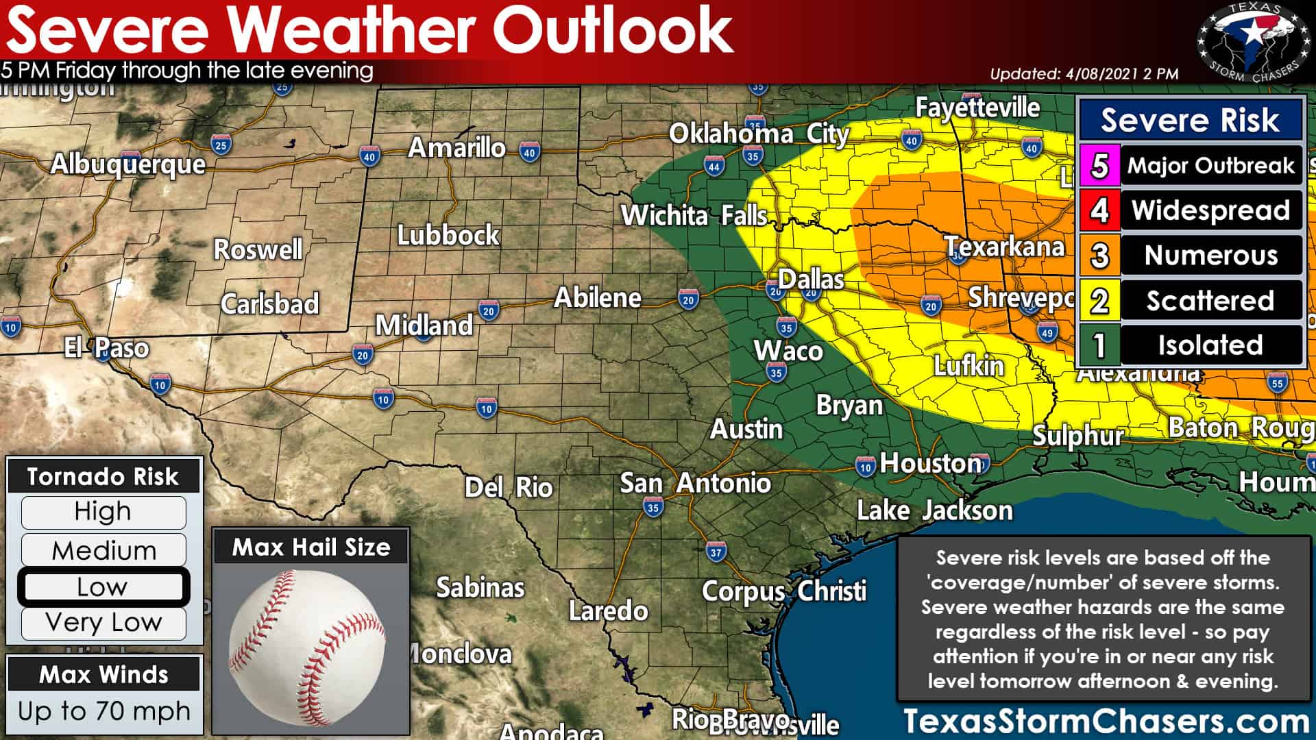
The Storm Prediction Center has concentrated the higher severe weather risk levels across Northeast Texas, the Ark-La-Tex, southward into East Texas’s Piney Woods. Frankly, the varying severe weather risk levels don’t matter much to me for tomorrow. If you’re in any risk level – one to three – that’s your cue to pay attention to the weather tomorrow afternoon and evening. That means those in North Texas, including the D/FW Metroplex, better pay attention after 4-5 PM Friday. Severe weather outlooks are based on the probabilities, or the coverage, of severe storms.
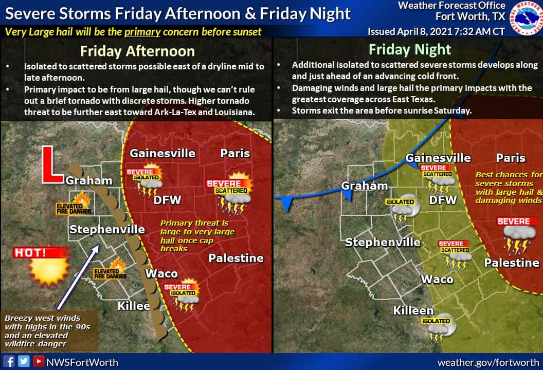
We won’t see many storms tomorrow afternoon, maybe one or two in North Texas. Yet, those storms that may develop will be pretty intense. Baseball (or larger) size hail and localized damaging wind gusts are probable if we get a storm to bust through the cap. A tornado cannot be ruled out. We think if a storm can break through the cap, it’ll be around the 5-7 PM timeframe in Southern Oklahoma, Texoma, into North Texas (including the D/FW Metroplex). Most folks will not be impacted by a storm tomorrow afternoon.
Tomorrow Night
Farther north in Oklahoma, where the cap is weaker, we expect several severe storms to develop by early Friday evening along a cool front. Those storms will grow upscale into a cluster or squall line that will move southeast with the cool front. We anticipate storms will move into Northeast Texas from Southeast Oklahoma around 8 or 9 PM. The strongest storms may be producing hail up to the size of baseballs, wind gusts to approximately 70 MPH, and perhaps a tornado.
There is uncertainty on how far south/southwest storms will fire along the front tomorrow evening as it moves southeast. If storms remain confined to Northeast Texas, they should be moving east of Texas (Louisiana) by 1 AM Saturday. If storms are in progress farther west? We’ll still have activity ongoing through pre-dawn Saturday, although weaker with westward extent.


0 Comments