
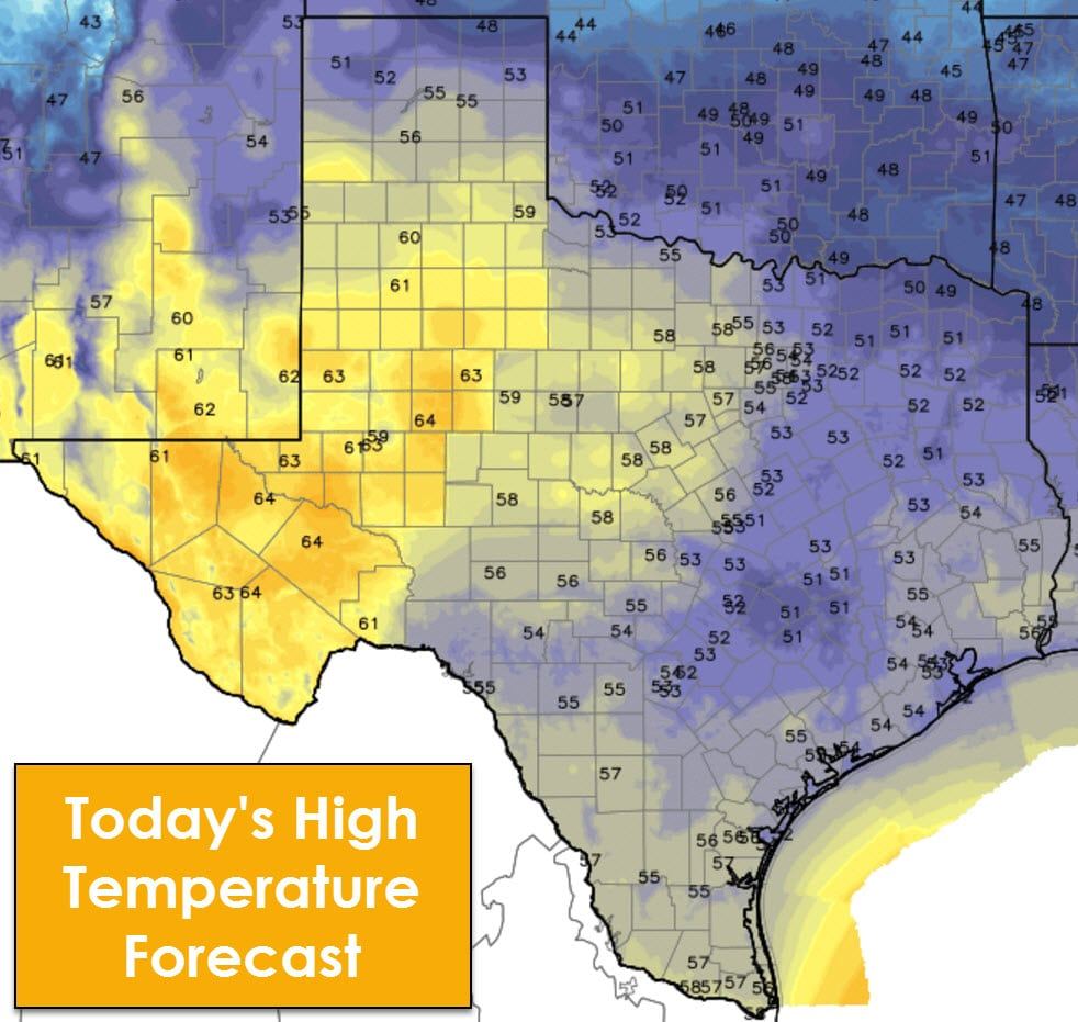
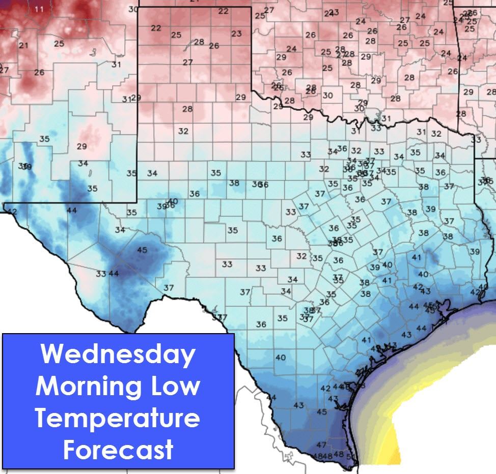
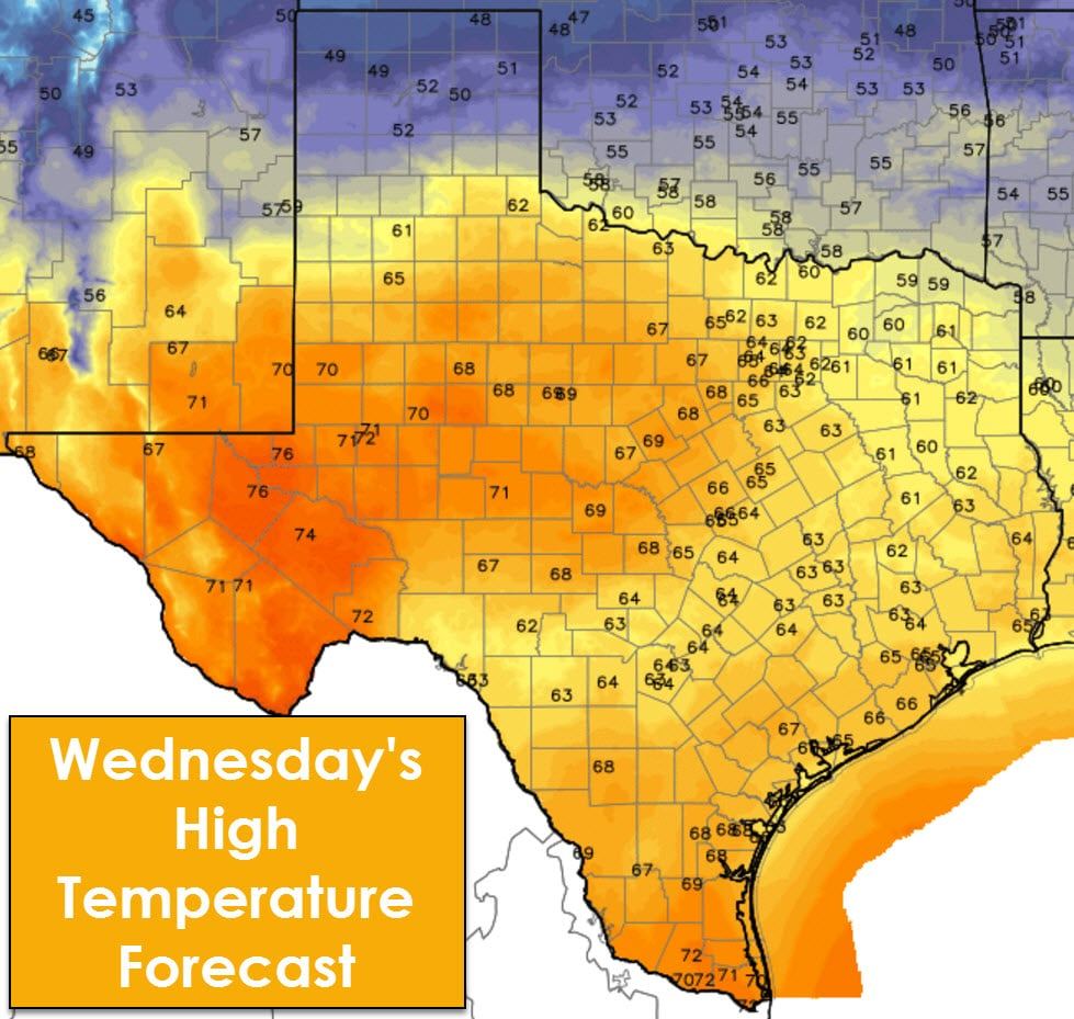
After a series of very cold days we’re finally heading back up on the temperature roller coaster. Afternoon high temperatures today will range from the upper 40s in the northern Texas Panhandle and northeast Texas up into the 60s in West Texas, the Permian Basin, and the Borderland. We continue the climb on Wednesday with 60s making a return to all of Texas, excluding the Panhandle. Parts of the Big Country, Concho Valley, Permian Basin, and Rio Grande Valley will make it into the 70s! Compare that with temperatures in the teens a couple days ago. Overnight low temperatures will also be moderating, although they’ll still provide a chill when walking out the door. A relatively dry air mass means temperatures can heat and cool efficiently – bringing us large temperature swings during the diurnal cycle.
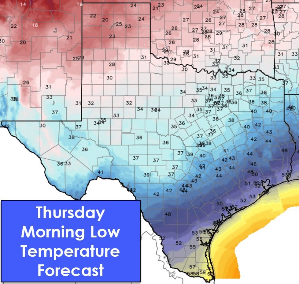
The chance of light rain returns to Deep South Texas, the Borderland, and parts of West Texas on Thursday into Thursday Night. Limited moisture levels mean most of the rain showers that do occur will generally be light. Comparatively higher rain totals may occur just west of the Borderland in New Mexico. Light showers may extend east into the Big Country, Concho Valley, and North Texas on Friday into Friday night. Again, limited moisture values mean a vast majority of folks will stay dry. Those that do get a brief shower will only receive very light totals. Increasing warm air advection on Saturday will bring a small chance of showers along and east of Highway 281 from the Big Country and Hill Country east to the Arkansas/Louisiana/Texas state lines.
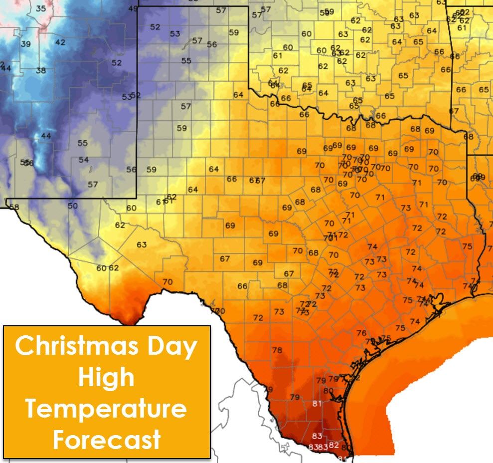
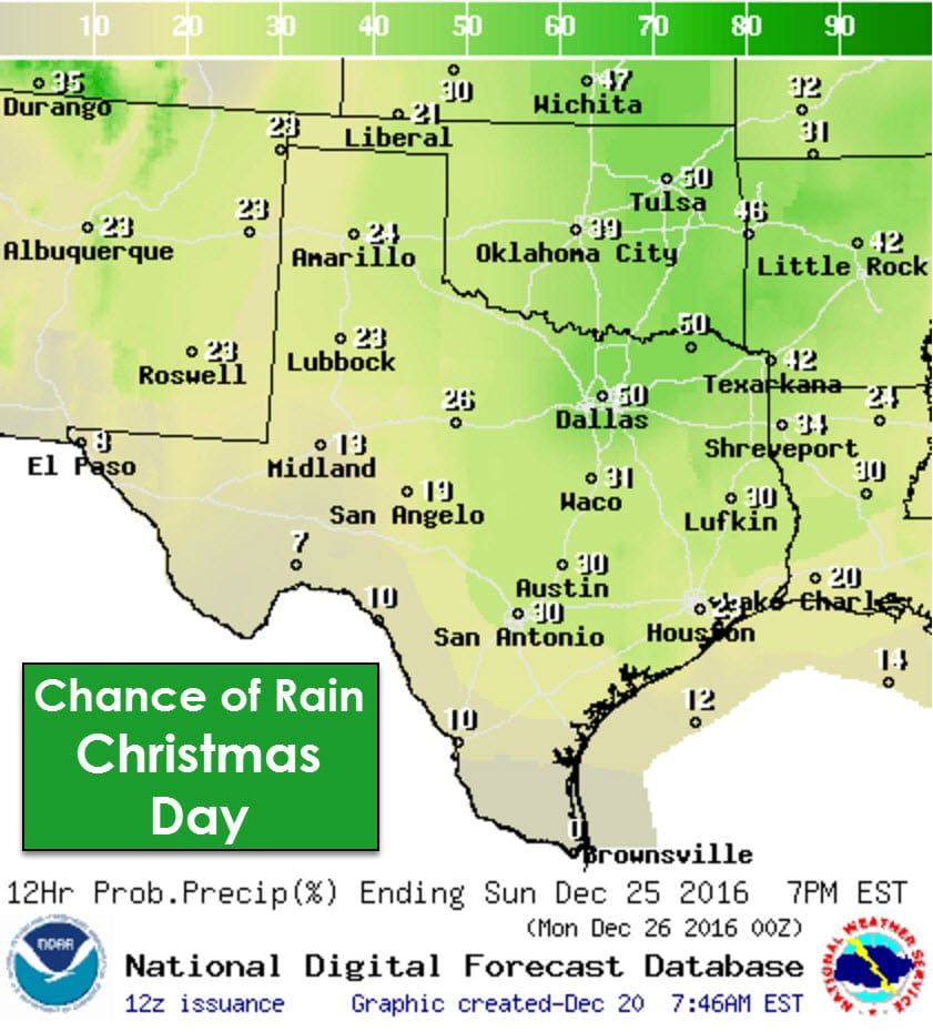
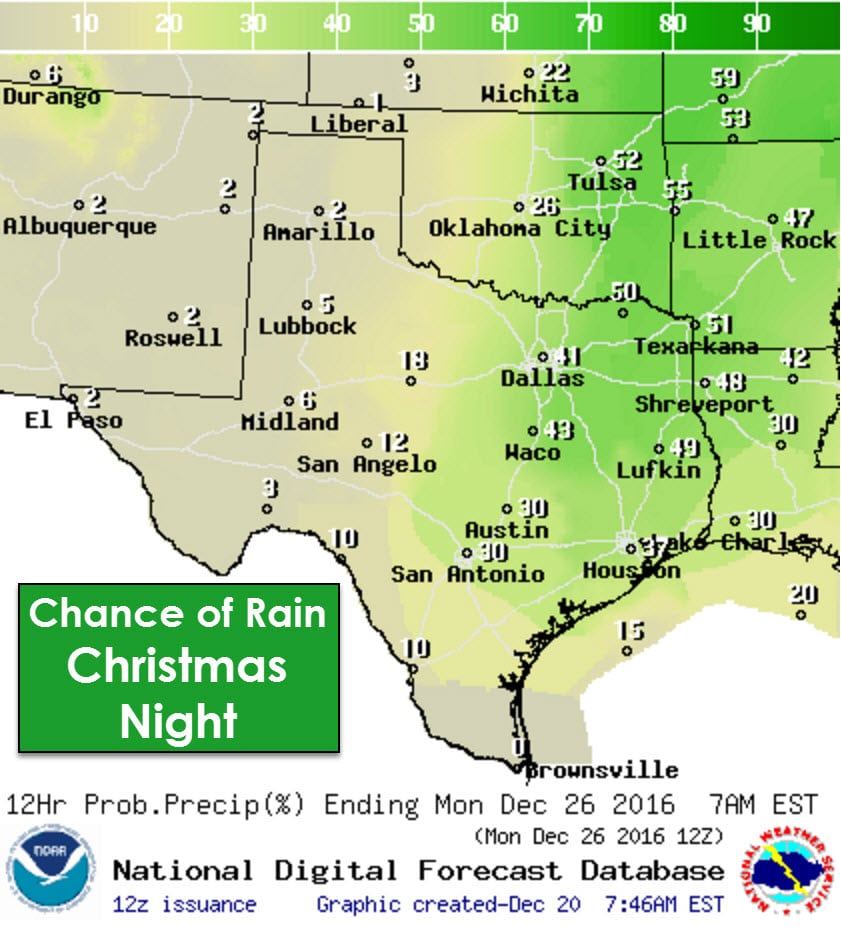
A strong upper level storm system plus increased moisture levels mean a chance of showers and thunderstorms on Christmas Day. We’re still several days out so forecast changes are likely. At this point the severe weather risk looks low. Wind shear values are fairly impressive, but the atmosphere looks like it won’t be all that unstable. If more instablity is able to materialize the risk for a couple strong storms may exsist. We’re not looking at anything remotely reminiscent of December 26, 2015 in risk level or intensity. Christmas Day will feature temperatures ranging from the 50s up into the 70s, so the second warm Christmas Day in a row. Rain chances will be highest along and east of Interstate 35 for Christmas Night.


0 Comments