
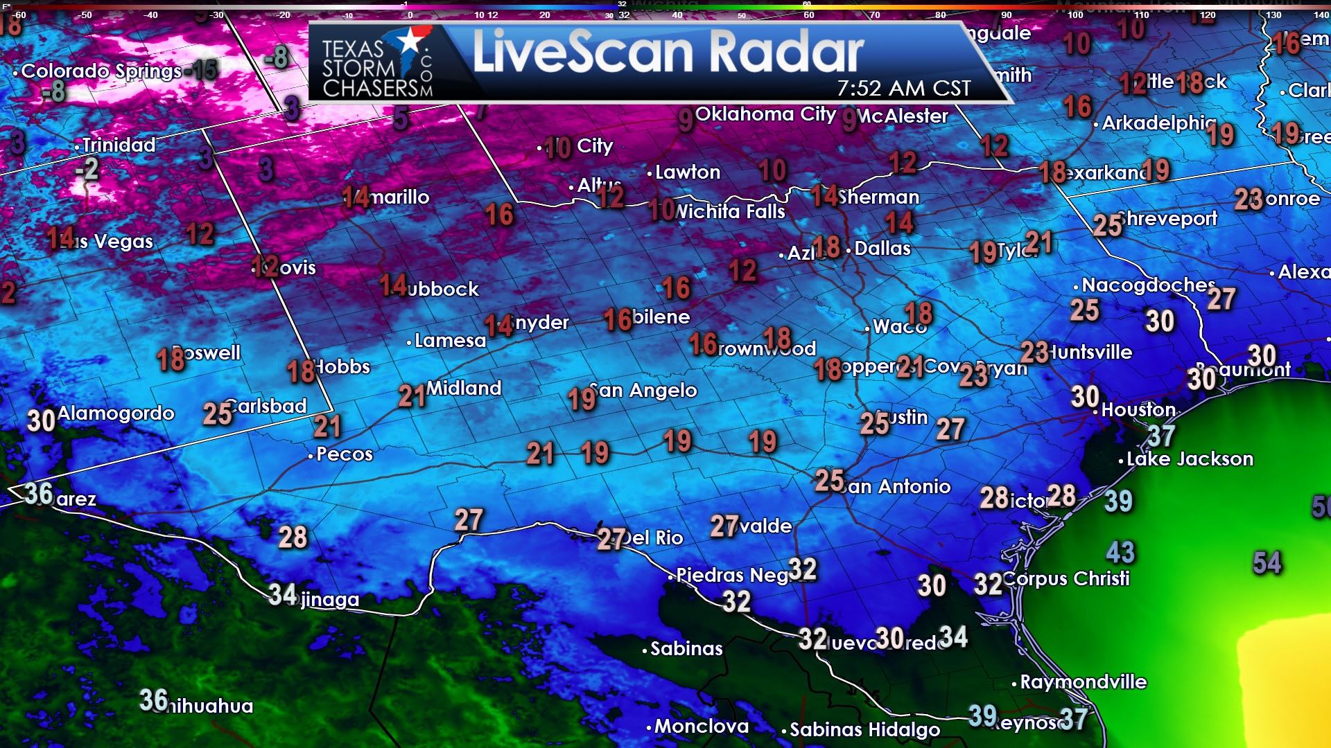
Temperatures dropped below freezing as far south as Laredo to Corpus Christi this morning. Teens were experienced in the Permian Basin, Concho Valley, Hill Country, into Central Texas, and Northeast Texas. The Panhandle was 20 degrees warmer overnight, but that doesn’t mean much because its still in the single digits to lower teens. Wind chills range from the single digits to the twenties across the state this morning. Look on the bright side, we’ll start a warming trend on Tuesday. Precipitation looks unlikely until this upcoming weekend.
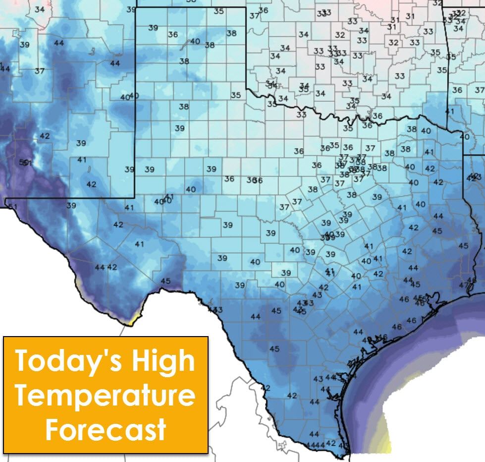
High temperatures will be cold this afternoon with most of the state struggling to make it out of the upper 30s to middle 40s. Winds will be noticeably lighter, so wind chills won’t be too much lower than the actual air temperature. Regardless, we’ll be around 10 to 25 degrees below average for our afternoon highs.
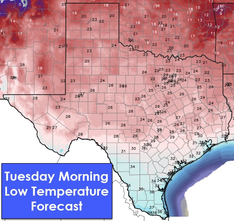
Tonight will be cold as well with the freezing line making it into South-Central Texas and the Middle Texas Coast. Unlike the past few nights we shouldn’t see too many locations getting below the 20s. A couple towns in the northern Texas Panhandle will make it into the upper teens. Compared to this morning, we should see temperatures 5 to 10 degrees warmer tonight across the northern half of Texas.
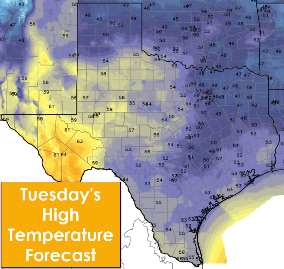
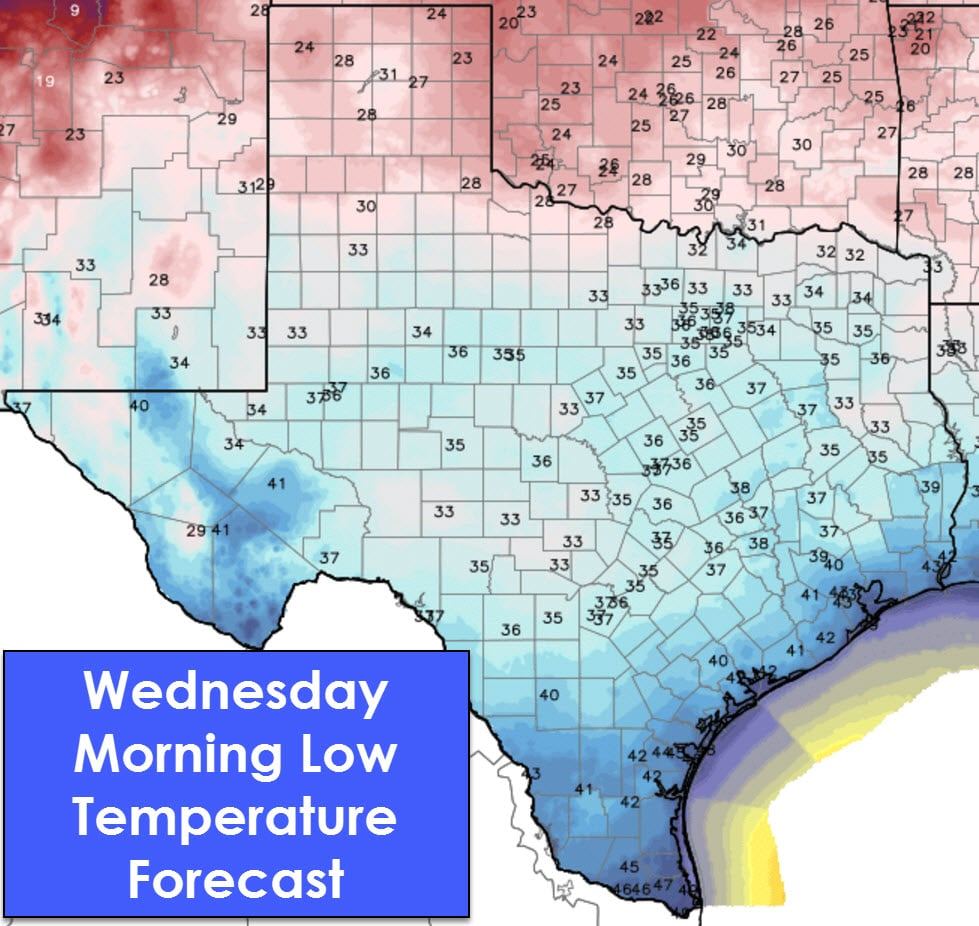
Temperatures on Tuesday will be an additional 10 to 15 degrees warmer across much of Texas with highs ranging from the middle 30s in the Texas Panhandle and Northeast Texas up into the lower 60s in the higher elevations of Southwest Texas. These temperatures will be cool, but noticeably warmer compared to the past few days of arctic air. The same can be said about Wednesday morning.
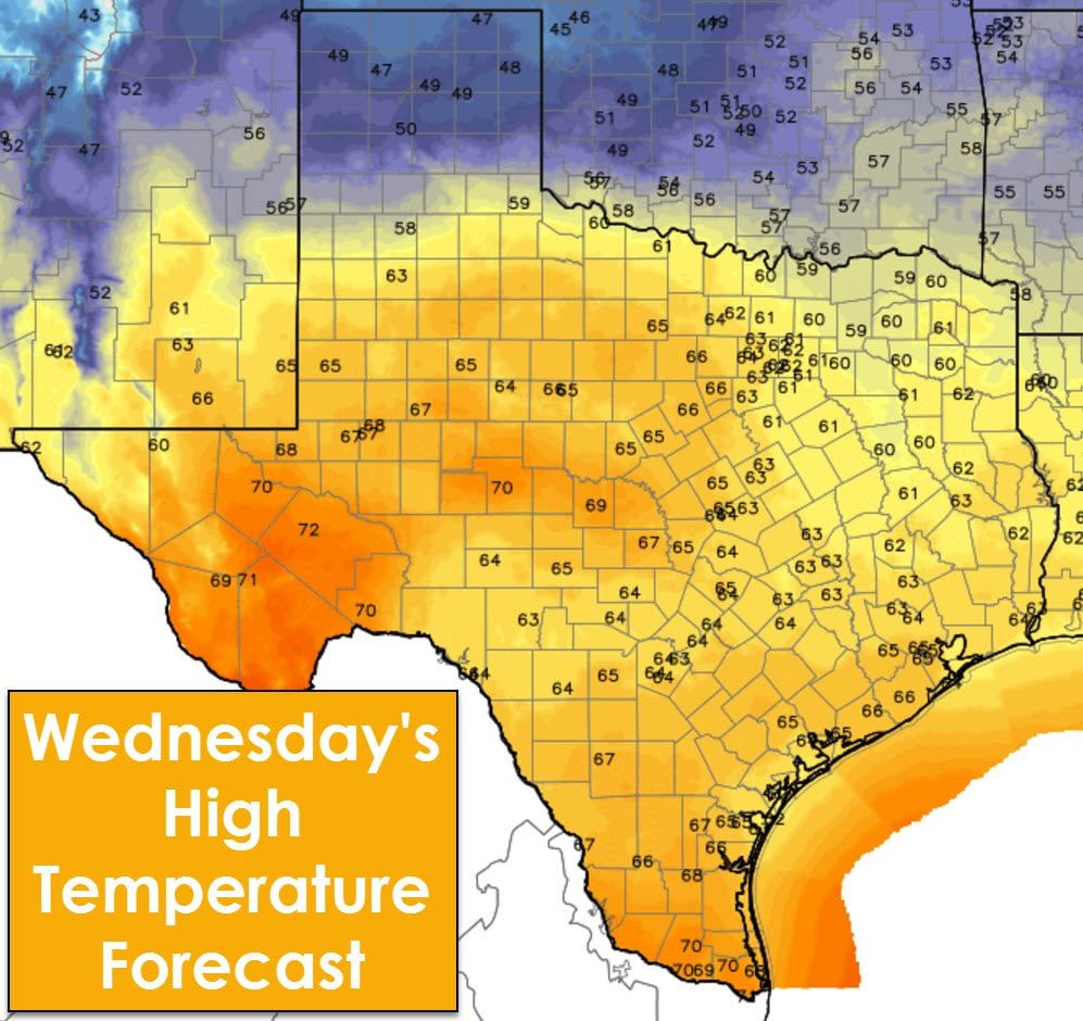
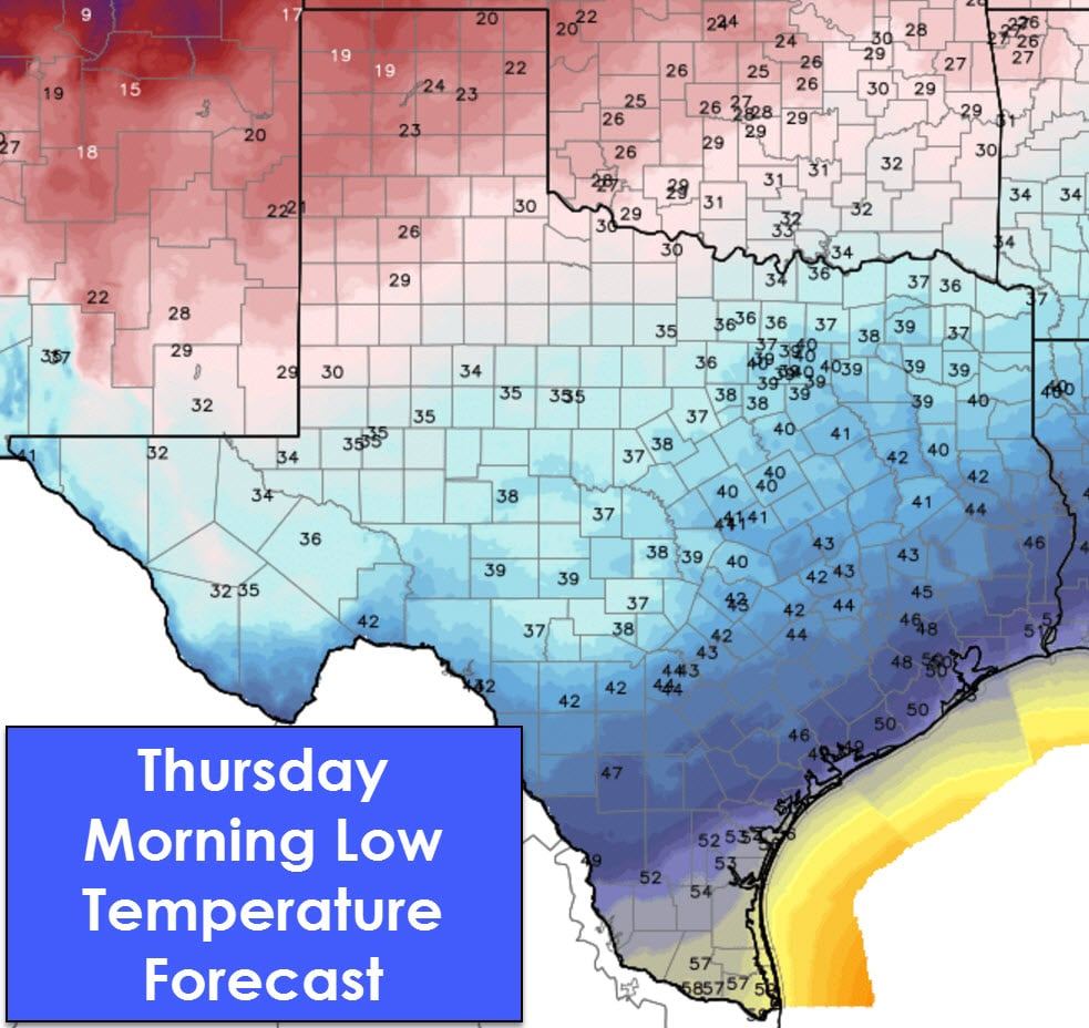
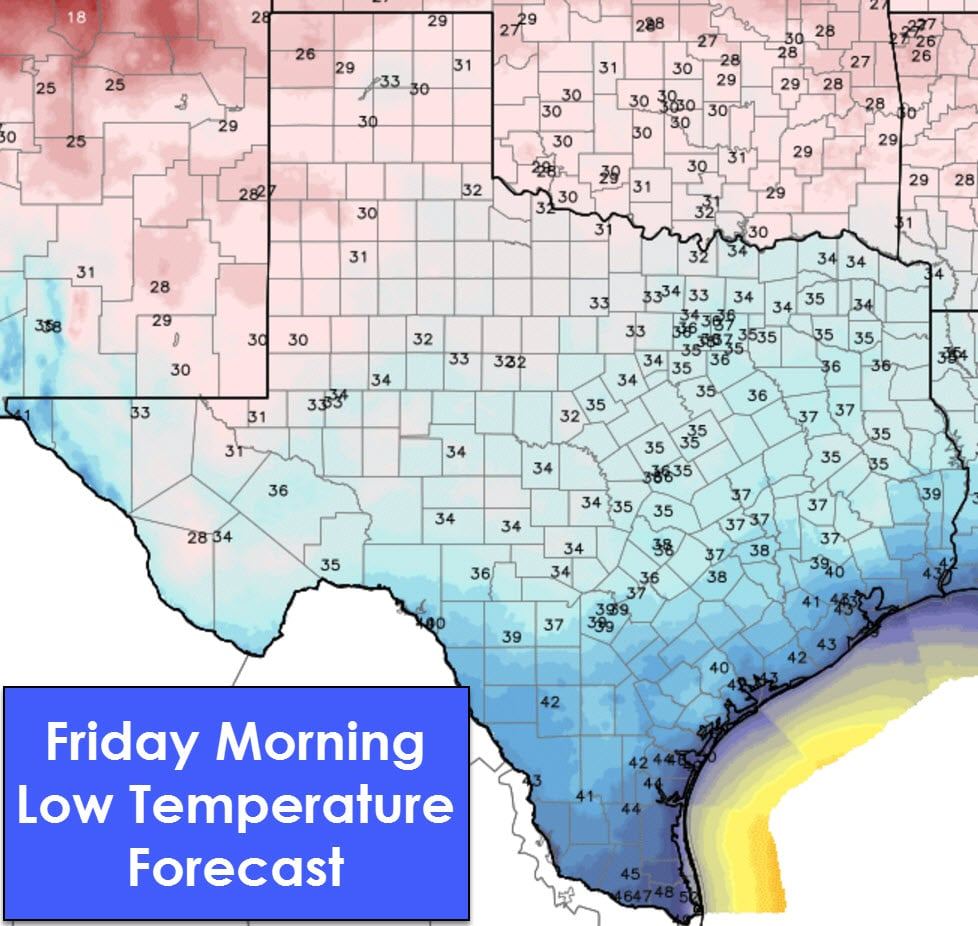
Wednesday looks to be the warmest over the next couple of days as temperatures make it up into the 60s to lower 70s across most locations. The exception to that will be the Texas Panhandle where cooler air holds in with high temperatures in the 40s. By Friday morning low temperatures will range from the upper 20s in the Panhandle up to around 50 degrees in the Rio Grande Valley, much more typical for December in Texas.
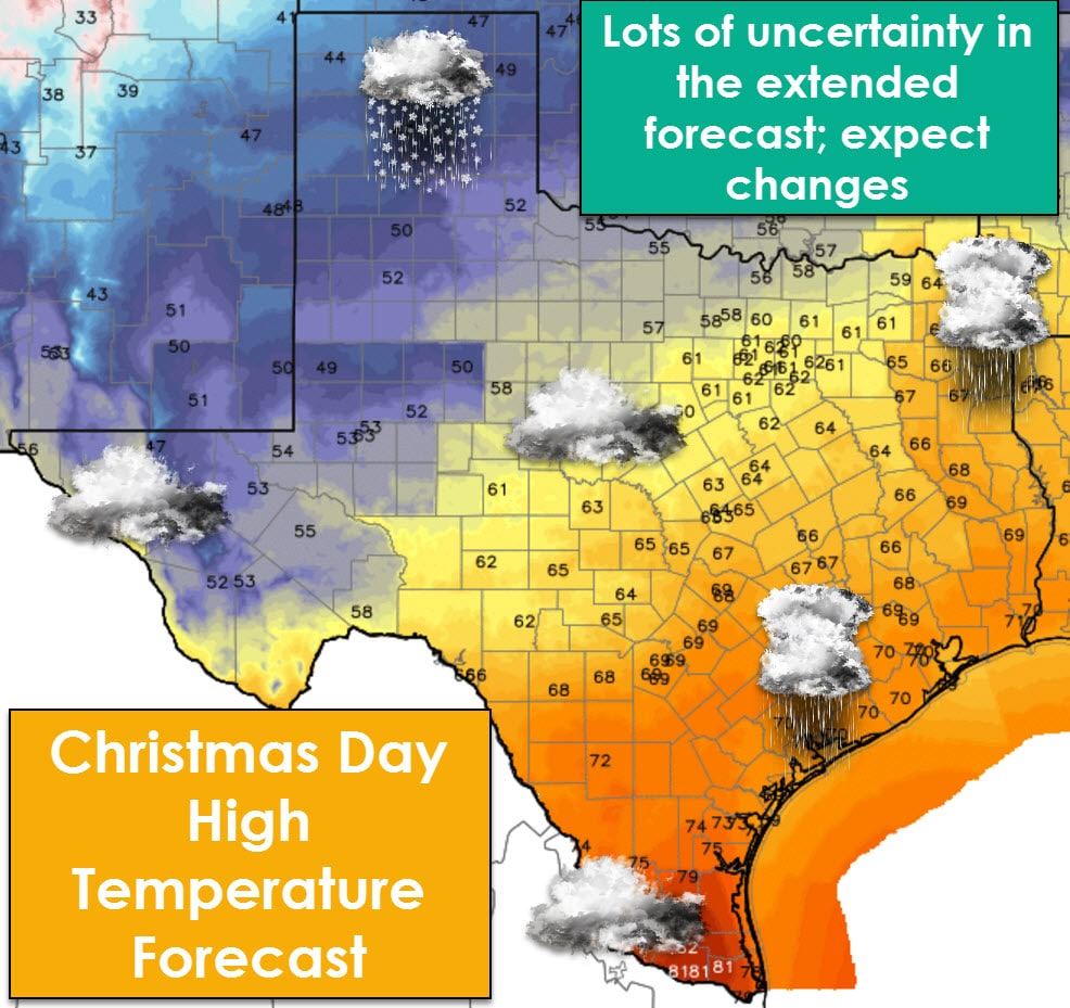
Lets jump ahead to Christmas! We’ve been getting questions over the past couple of days about a potential winter storm in the Christmas time-frame. At this point any sort of winter mischief is not expected. A rain/snow mix may occur on Christmas (Sunday) into Monday in the Texas Panhandle. Clouds with potential for showers will exsist across the remainder of Texas. Fairly decent rain/storm chances could set up along/east of Highway 281 into Northeast Texas, East Texas, and Southeast Texas. Both the temperature and precipitation forecast will greatly depend on the track of a storm system progged to be in our area. Expect changes to the forecast, but at this time expect a relatively active weather pattern to be in place for Christmas.

0 Comments