
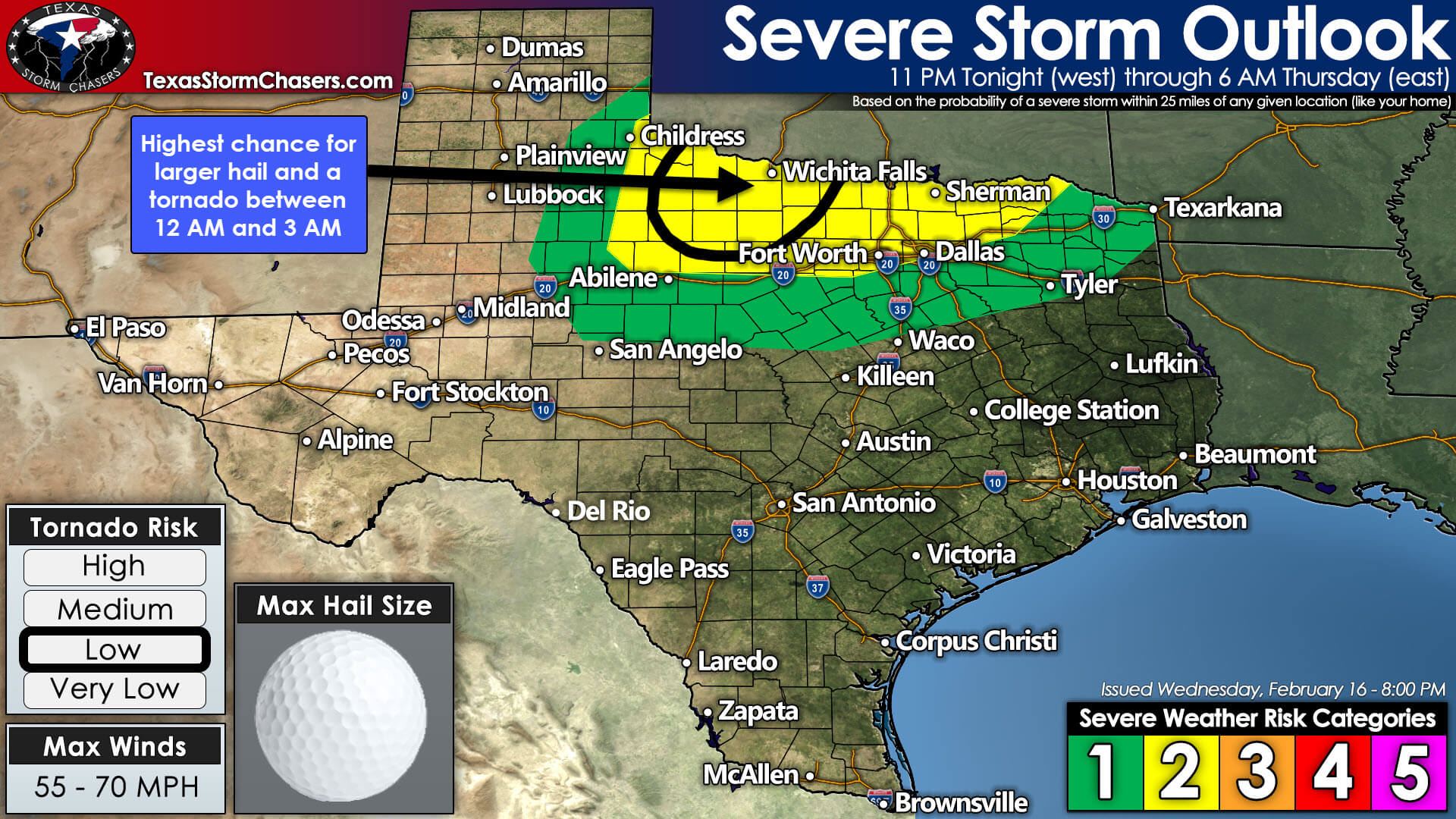
Showers and thunderstorms will increase in coverage across West-Central Texas and Northwest Texas later this evening. There will be the risk of a few severe thunderstorms late tonight and early Thursday morning. Our thinking is the highest threat for severe storms, relatively speaking, will be across Northwest Texas between about midnight and 3 AM Thursday. The most intense storms could produce hail up to the size of quarters and golfballs, localized wind gusts up to 70 MPH, and a tornado cannot be ruled out.
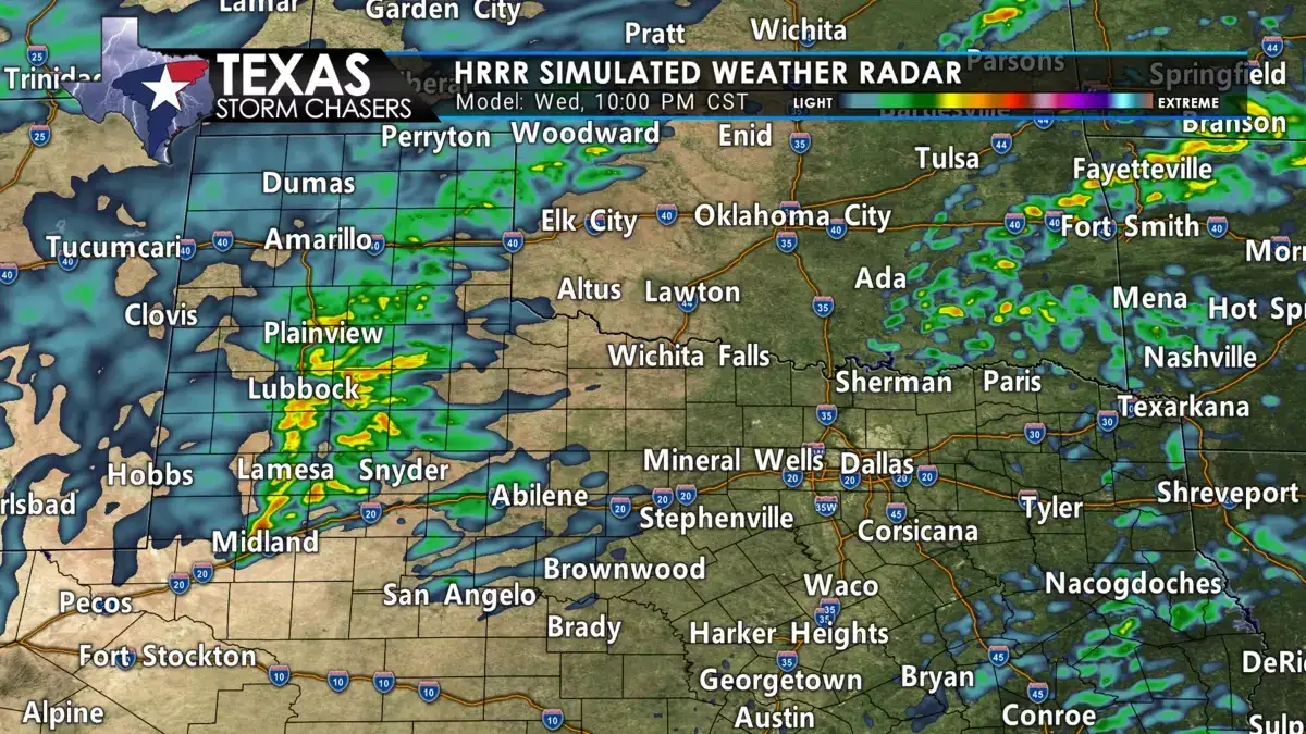
It will be windy across the eastern two-thirds of Texas tonight – and that wind will have nothing to do with thunderstorms. As storms move further east into Texoma and North Texas after 3 AM, we anticipate a decrease in the overall organization. The reduction in storm intensity will be due to a more stable airmass further to the east.
We can’t rule out strong storms around the D/FW Metroplex up to Sherman, but the risk does appear lower than further west around Seymour to Wichita Falls. The showers and storms in North Texas and Texoma may produce wind gusts up to 60 MPH simply because of the strong winds aloft. Small hail and brief downpours are also possible.
Much colder temperatures and strong northwest winds will accompany a cold front tomorrow. The cold front will progress through much of the state on Thursday. High temperatures will occur just before the front’s arrival for most locations. Those across South Texas and Southeast Texas may not have the front arrive until tomorrow night. The cooldown will be short-lived. Temperatures will warm back up over the weekend.


0 Comments