
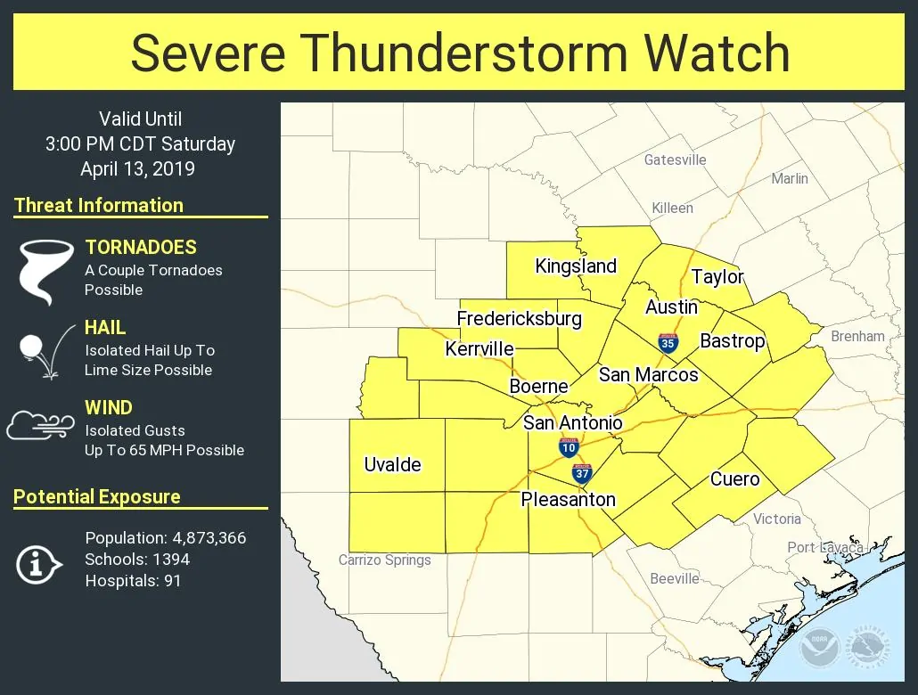
A severe thunderstorm watch is in effect until 3 PM for Central Texas, South-Central Texas, and the western Brazos Valley. This includes Austin, San Marcos, San Antonio, Pleasanton, Cuero, Bastrop, Taylor, Kingsland, Fredricksburg, Kerrville, Boerne, and Uvalde. This watch is in effect because we’re seeing new storms fire up over Central Texas. Most of these new storms (from Austin to Rockdale) are moving north and could produce hail. The ongoing long-live supercell near Hondo continues to move east toward Bexar County with a threat of large hail. A line of strong storms is back off to the west and moving east, although it doesn’t seem to be as organized.
We anticipate a tornado watch will be issued later this morning for southeastern portions of North Texas, the Brazos Valley, and East Texas – including some areas under the severe storm watches now. Please see our detailed forecast for today that we published just a little while ago. You can read it here.
Severe Thunderstorm Watch Number 51
   NWS Storm Prediction Center Norman OK
   835 AM CDT Sat Apr 13 2019

   The NWS Storm Prediction Center has issued a

   * Severe Thunderstorm Watch for portions of
     South-central Texas

   * Effective this Saturday morning and afternoon from 835 AM until
     300 PM CDT.

   * Primary threats include...
     Isolated very large hail events to 2 inches in diameter possible
     Isolated damaging wind gusts to 65 mph possible
     A tornado or two possible

   SUMMARY...Discrete cells ahead of an approaching line of
   thunderstorms will both offer potential for isolated large hail and
   damaging wind gusts into early afternoon. A brief tornado is also
   possible, mainly this morning.


0 Comments