
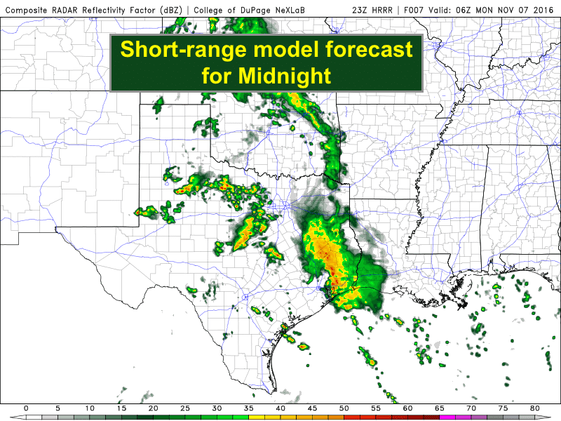
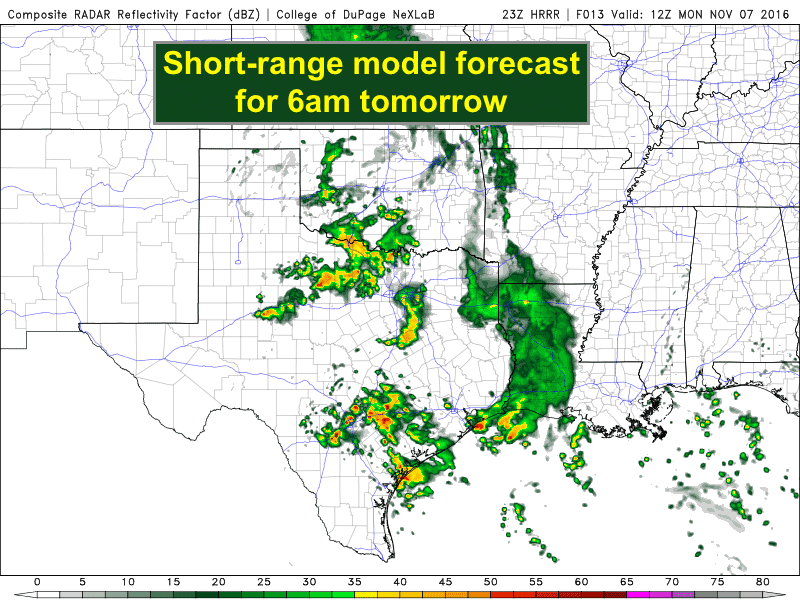
A line of storms is moving into southeast Texas this evening. This is the remainder of the line of organized storms which began life across western Texas earlier today. Moderate to heavy rainfall will accompany this line as it continues to slowly move east/southeast this evening with additional storms coming up from the south off the Gulf of Mexico feeding into it. Rainfall rates per hour are currently averaging just under an inch, with some pockets of 1.5 to 2.5 inch per hour rainfall rates currently noted just south of Navasota. This line is slow moving and will take most of the night to move east of the Houston/Galveston metro area with lingering impacts possible into rush hour tomorrow morning. Plan accordingly!!
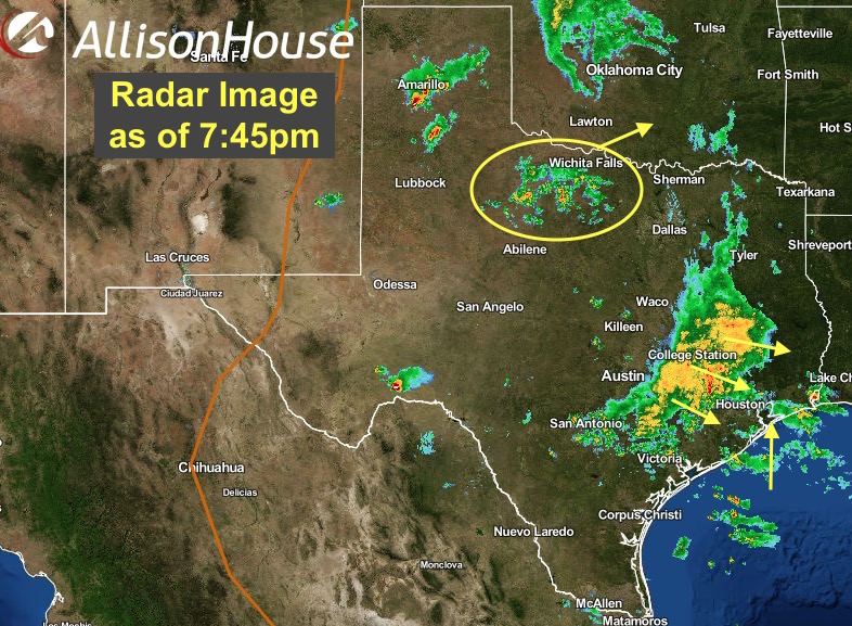
For northern Texas, additional rainfall has developed across western north Texas this evening in the wake of light rainfall which fell during the early part of the afternoon. The current batch of scattered showers will likely skirt just off to the northwest of the Dallas/Ft. Worth metroplex, but additional development will still be likely as a piece of upper level energy currently located across far west Texas lifts northeast overnight. A few of the stronger cells could contain lightning and thunder, but the overall threat for severe weather is very low. For south central Texas, redevelopment of scattered showers and storms will also be likely late tonight and through the morning hours from San Antonio south to Corpus Christi, Victoria and surrounding communities. Moderate to heavy rainfall will also be possible here with isolated flash flooding issues expected in the typically flood-prone areas. Be sure to check the latest forecast before heading out to work tomorrow if you’re in these areas and allow extra time for your morning commute!


0 Comments