
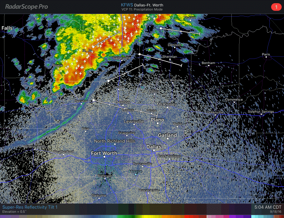
An outflow boundary with gusty winds is pushing southeast into North Texas this morning. At the time of this writing the outflow boundary extended from near Sherman to Denton to Weatherford to Abilene. Gusty north winds up to 45 MPH will be possible as this boundary continues to move south and east this morning. Keep in mind these gusty winds will strike without or well ahead of any rain. The good news is I seriously doubt many folks are on lakes this time of morning. A line of thunderstorms extends from Southeast Oklahoma southwest to Whitesboro, Sanger, to the Denton/Wise county line. This line is moving east/southeast at 40 MPH. The current trajectory of the line would keep it north of a Trophy Club to Lewisville line, but additional southward development of the line is not out of the question. Should we see more storms develop a bit further south they would move into the core of the D/FW Metroplex over the next 30 to 60 minutes. Frequent cloud to ground lighting, gusty winds up to 50 MPH, and heavy rain is occuring with the strongest storms.
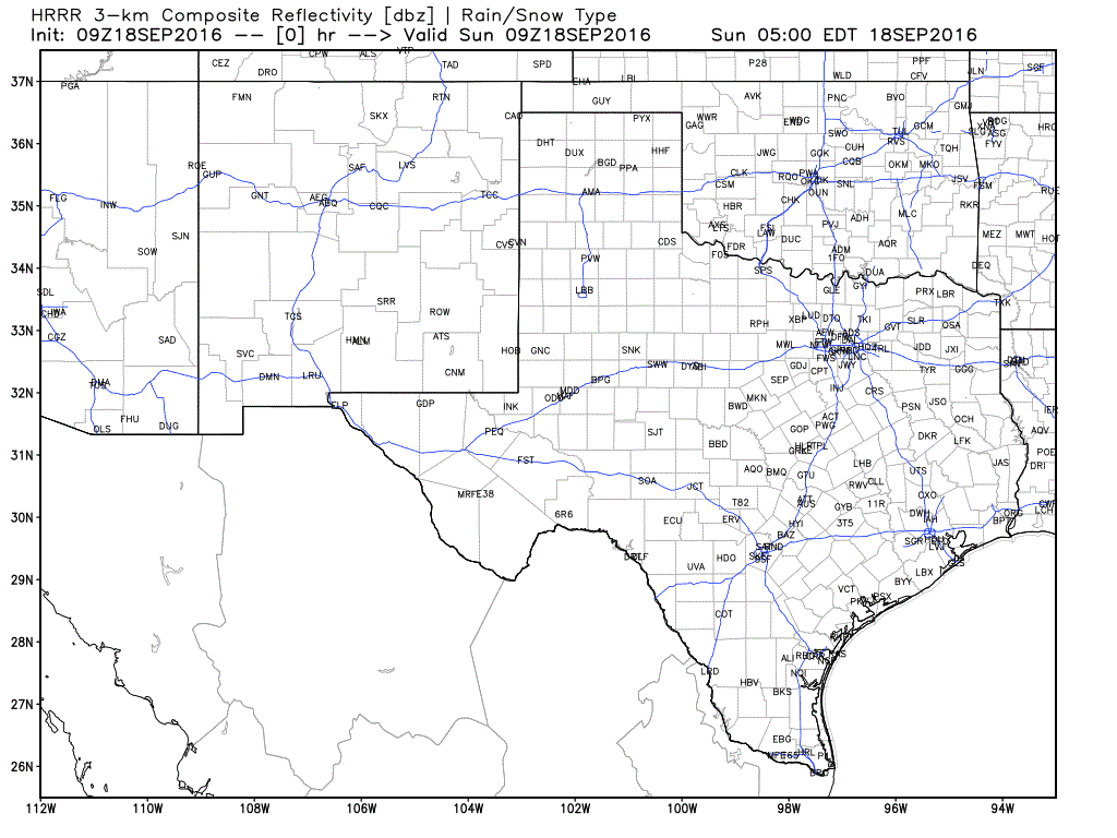
The High Resolution Rapid Refresh model (HRRR) seems to show the situation fairly well this morning. It gradually weakens the line through the late morning as it continues to move to the east/southeast into Northeast and East Texas. I’m not expecting severe weather issues, but lightning will be extremely dangerous to those outdoors.


0 Comments