

Convective inhibition will play a role in keeping thunderstorm coverage isolated in Texas on Tuesday. As the cold front moves southeast during the day it will try to fire off isolated thunderstorms. A mediocre amount of life along with the relatively potent cap will keep thunderstorm coverage isolated. If we’re going to see a few storms develop it’ll likely be across Far Northeast Texas during the morning hours Tuesday. Strong thunderstorms will be underway across Central and Eastern Oklahoma late tonight. Some of those storms may approach the Red River Valley in North and Northeast Texas after 3 AM Tuesday.
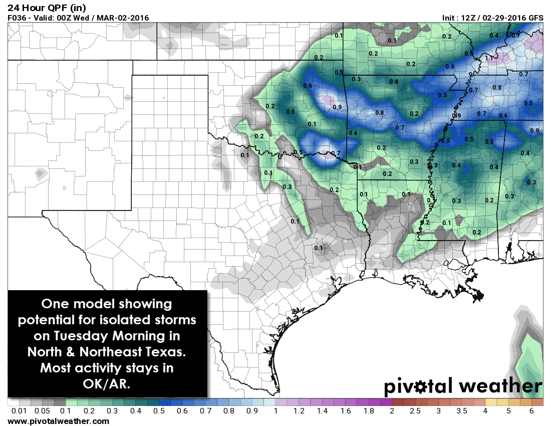
One model run this morning does show a few storms moving across North Texas and Northeast Texas late tonight into the morning hours Tuesday. Should this solution verify some of the storms may be strong with hail up to the size of quarters. Localized gusty winds would be a secondary threat. Other models keep the heaviest storms northeast in Oklahoma and Arkansas. Its entirely possible that we see little storm activity in Texas tomorrow. The highest likelihood for a couple strong storms will be in North Texas during the morning hours Tuesday. The storm threat diminishes as you move south.
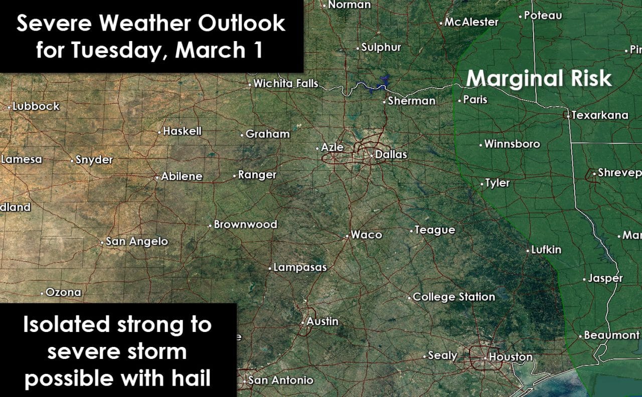
The updated severe weather outlook from the Storm Prediction Center has removed all but far Northeast Texas and East Texas from a marginal severe weather risk on Tuesday. The stronger cap and limited lift will likely prevent thunderstorm development along the cold front.
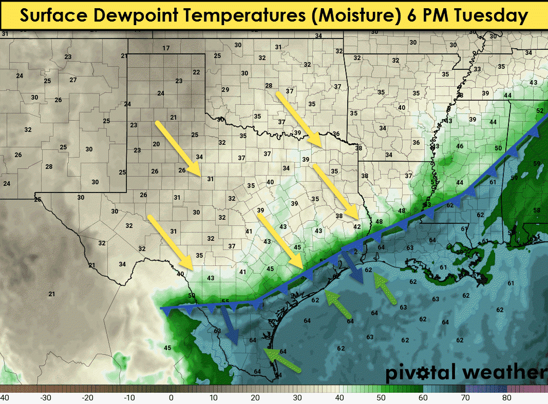
The cold front will move into South and Southeast Texas by sunset Tuesday. Moisture levels behind the cold front will fall off drastically. Dewpoint temperatures, a measure of moisture in the air, will fall back into the 20s and 30s. Dewpoints south of the front will be in the 60s. Temperatures north of the cold front will be 10 to 20 degrees cooler than folks south of the cold front. Considering temperatures south of the front will be in the upper 70s we’re not talking about a huge cool off. Temperatures will simply drop back to seasonal averages. Temperatures will warm right back up on Wednesday. We do note that fire danger will increase behind the cold front tomorrow. Winds will shift to the north/northwest. Temperature-dewpoint spreads will range from 25 to 40 degrees tomorrow afternoon. That spread will result in relative humidity values dropping below 30 percent. Surface fuels are quite dry and will support fast-moving grass fires.


0 Comments