
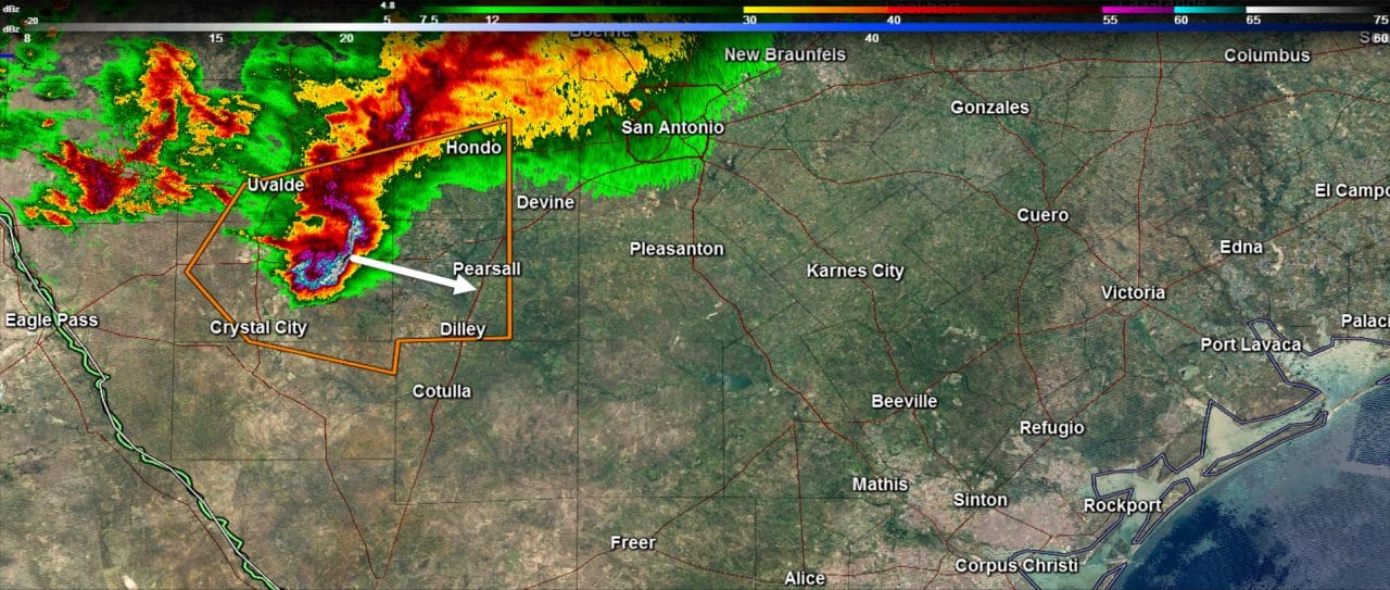
An intense upper level storm system is swinging east across Texas early this morning. A surface low is taking shape in northern Mexico. That low will move into Texas near Laredo in a few hours. That low will move northeast into the Coastal Plains and eventually Southeast Texas by mid-morning. As that occurs the threat for more organized thunderstorms will increase across Southeast Texas. For now the threat for severe weather is concentrated southwest of San Antonio. A complex of thunderstorms with a history of producing wind-driven damaging hail continues to move east/southeast around 45 MPH. At the time of this posting that storm was located southeast of Uvalde or northeast of Crystal City. At current speed the storm will impact Interstate 35 near Pearsall and Dilley. Hail up to the size of golfballs occurred back in Brackettville and wind damage was reported back in Del Rio. This storm is packing a punch and will likely continue to be severe until it reaches the Gulf Coast in a few hours.
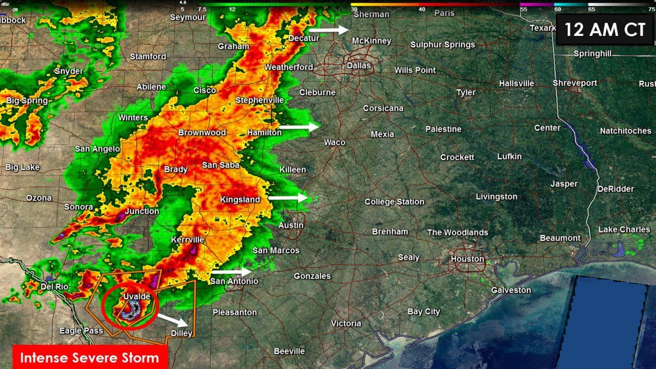
Widespread rain is underway across western North Texas, eastern sections of the Concho Valley, into the Hill Country. This activity is occuring where surface temperatures are in the 50s and with a fairly stable atmosphere. Severe weather is not expected in those regions this morning. What we will see is a good beneficial rain fall through late morning. Activity is moving east and will move into cities along Interstate 35 from the Red River all the way south to San Antonio this morning. We note additional rain forming back in the Permian Basin into Northwest Texas. Some rain is changing over to snow in the western Texas Panhandle.


0 Comments