
Above-average temperatures and fire weather concerns will be the focus of this forecast. Our next storm system will bring a chance of showers and thunderstorms to portions of the state by Sunday and Monday.
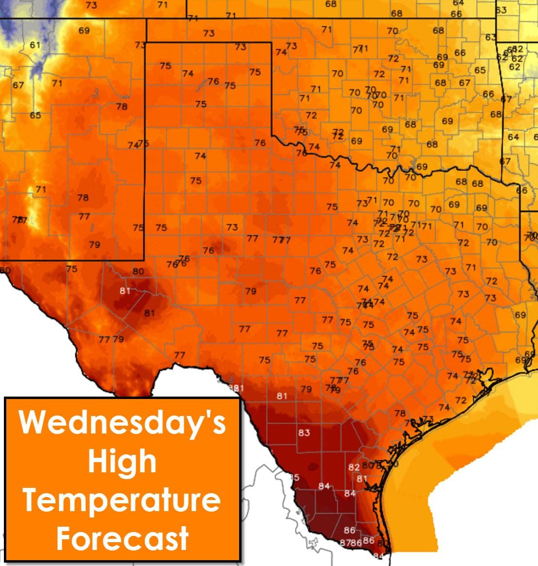
The warmest temperatures today will be across South Texas and the Rio Grande Valley with middle 80s. Locations along and west of Highway 75 and Interstate 45 will top out in the middle to upper 70s this afternoon. El Paso may set a new record high this afternoon with a forecast of 80 degrees. Northeast Texas into Far Southeast Texas will peak in the upper 60s to lower 70s this afternoon. Sunny skies will prevail along with elevated fire danger due to dry grasses.
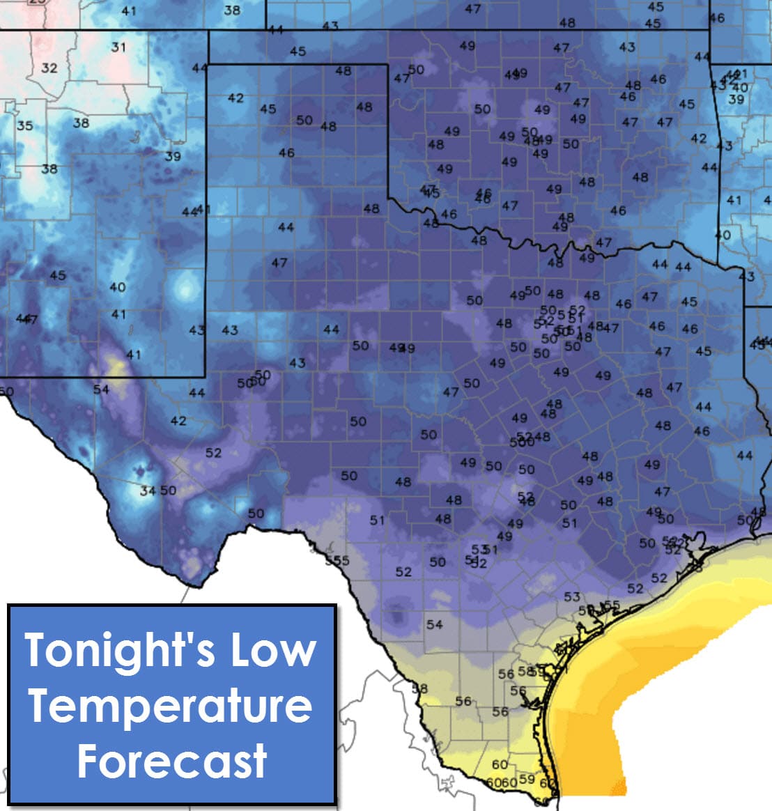
Tonight will be warm for a February night. Low temperatures by sunrise Thursday will range from around 40 degrees up to 60 degrees. Fog will once again be a problem along the coast and in some inland locations. Any fog that does develop will burn off by 10 AM as temperatures soar.
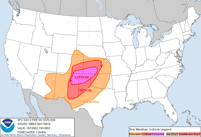
Fire Weather Outlook for Thursday
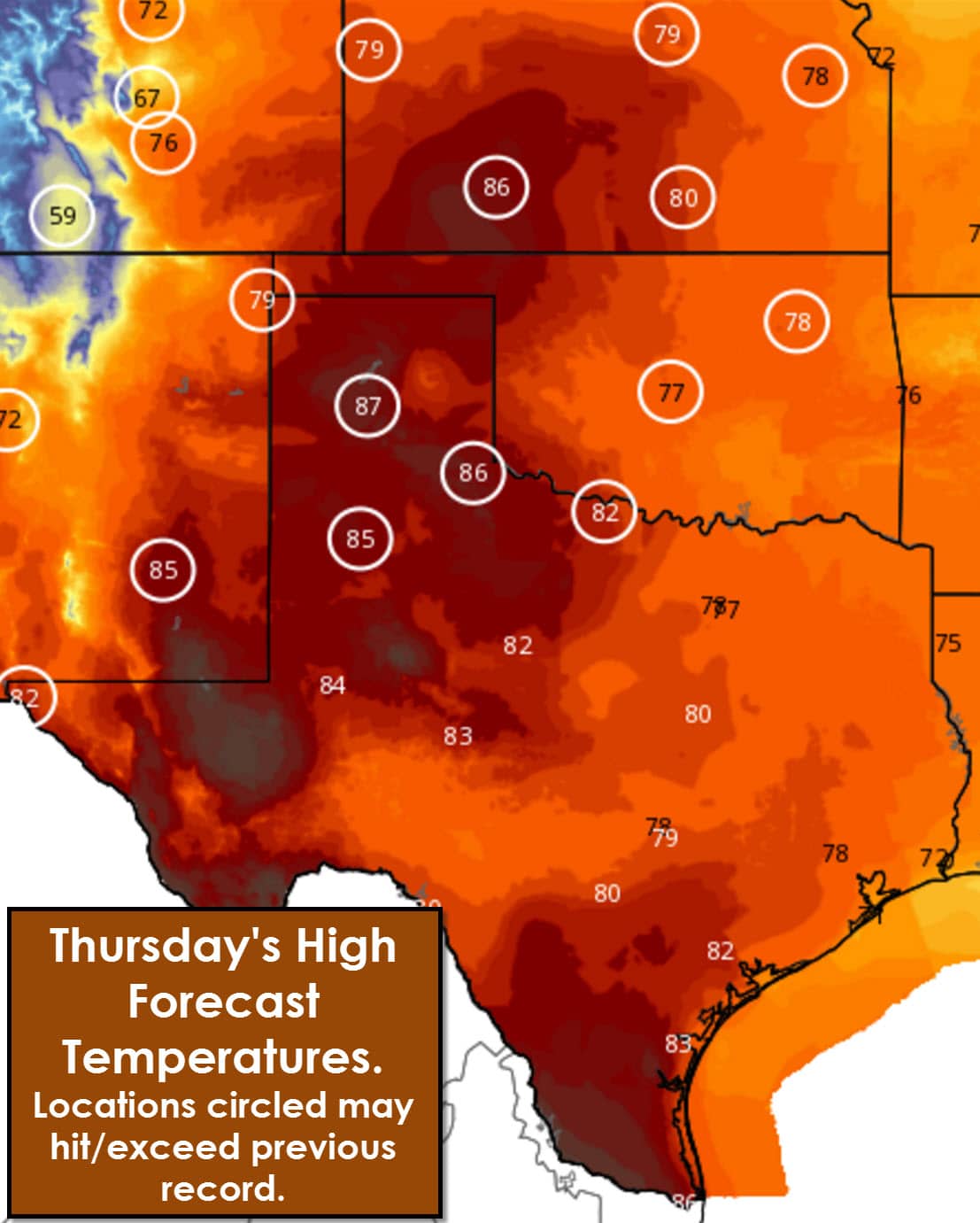
Record warmth and extremely critical fire danger will both exist on Thursday across the Texas Panhandle. Critical fire danger will exist across West Texas, Northwest Texas, into the Big Country. Temperatures across all regions listed above will soar into the middle to upper 80s. Those readings are 30 degrees above average for February 18. Upper 70s to low 08s can be expected for the rest of Texas. We could be dealing with a major fire weather event on Thursday in the Panhandle and surrounding regions. It takes a spark to create a fire so please be extremely careful tomorrow. I plan on publishing a more detailed fire weather forecast this afternoon for Thursday.


0 Comments