

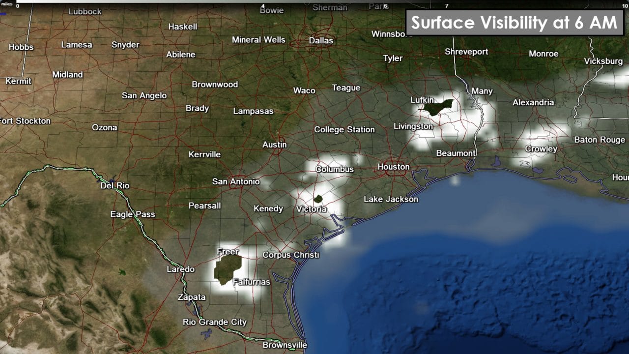
Dense Fog Advisories are in effect for Southeast Texas and the Coastal Plains through 9-10 AM. After over a week of very dry weather we’re starting to see moisture return to Texas. That moisture is evident by morning fog. Diminished visibility is noted on our fog map with increasing whites. Some of the fog will be dense for the morning drive. Safety tips include giving yourself a little extra room between vehicles and not using the high-beams on your headlights. Most fog will burn off by 10 AM as temperatures quickly rise.

Another sunny day with above-average temperatures are expected for your Friday. Truthfully the weather is going to be excellent. The hottest weather will be across South Texas and Deep South Texas where temperatures will soar into the middle 80s. It’ll climb into the 70s as far north as Interstate 20. North of I-20 temperatures will climb into the middle and upper 60s.

Temperatures tonight will fall back into the 20s to low 30s across the Texas Panhandle and South Plains. With temperatures approaching the dewpoint by sunrise we could see pockets of fog. Locations that fall below freezing may have patchy freezing fog. We’ll have to keep an eye on that prospect since it may result in very localized icy spots on bridges in the Panhandle. 30s are expected from the Permian Basin into Northeast Texas. Upper 40s to 50s are forecast across South-Central Texas, the Brazos Valley, and Southeast Texas into South Texas. Fog is also a possibility once again along the coast and in Southeast Texas and South Texas. Unlike the Panhandle temperatures will be safely above freezing.

Saturday will be warm but we start to see changes by Sunday. An upper level storm system and associated surface low will move across the state on Sunday and Monday. A cold front will extend south/southwest of the low. That front will move southeast through Texas in conjunction with the storm system. Precipitation chances increase Sunday Night and Monday Morning along and east of Interstate 35. The best chance for rain will be across Northeast Texas and East Texas before moving into parts of Southeast Texas. At this time severe weather is unlikely due to the time of day and lower instablity values. Most rain totals will remain under one half inch. Isolated totals up to an inch will be possible across East Texas. There will be some forecast refinements as we get closer to Sunday. We’ll have to watch any sort of increase in instablity since that would result in a low-end severe weather threat. After Monday’s system we should experience another multi-day period of dry weather and above-average temperatures.


0 Comments