
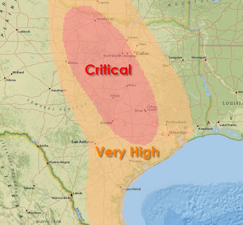
 A significant day of fire activity is possible on Monday. Unlike last week the highest fire danger will spread east to include the Interstate 35 region and some of our larger cities. A cold front will continue to move south tonight. Temperatures won’t be noticeably cooler on Monday but the airmass will be much drier. Sustained north/northwest winds will increase to 15 to 25 MPH by early afternoon. Winds could gust up to 40 MPH. At the same time relative humidity values will drop into the 15-25 percent range. The combination of those two factors will create critical fire danger across Northwest Texas, the Big Country, North Texas, Central Texas, and the Brazos Valley. The highest fire danger will be underway by noon and continue through sunset. After sunset temperatures will diminish resulting in an increase in relative humidity values. Winds will also weaken. An elevated to near-critical fire danger will exist across the Rio Grande Valley, South Texas, Southeast Texas, and East Texas. Vegetation that grew after the October rains is dormant. Officials report fuels are abundant. While vegetation has dried out the ground remains soft and that can easily cause trucks to sink into mud.
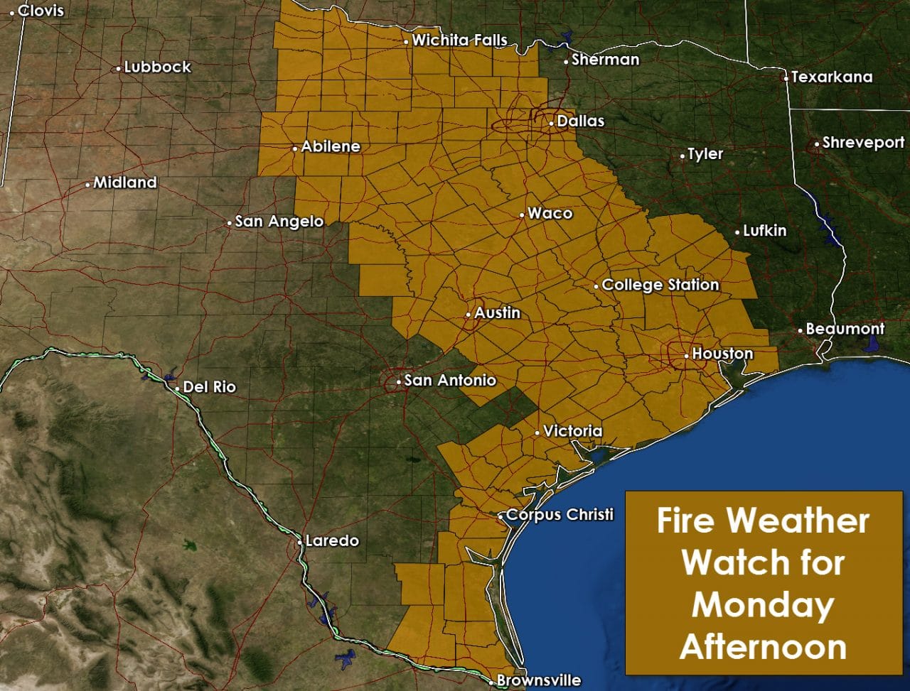
The strong winds tomorrow afternoon could cause a few power lines to come down. Outdoor use of welding equipment could also prove somewhat problematic. With an abundant fuel load and strong winds there is the potential for very active fire behavior. Fire crews could have their hands full but the Texas Forestry Service undoubtedly is ready. Make their jobs easier and don’t do any burning outdoors tomorrow. Be very careful if using any sort of equipment that could produce a spark. Red Flag Warnings will likely be issued for locations included in the Fire Weather Watch.

0 Comments