
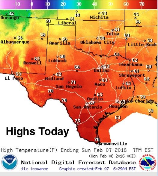
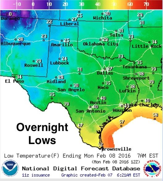
Good morning and happy Sunday! Starting off chilly this morning with patchy fog likely across parts of southern north Texas. Temps will climb into the 50s and 60s across much of the state today…and we’ll even see low to mid 70s across parts of south Texas by this afternoon. Skies will be sunny and winds will be light everywhere except for parts of the panhandle and northern Texas this afternoon as our next cold front moves through. The cold front has already moved into the the panhandle region, but will not have too much of an impact on temperatures later this afternoon. Winds will begin to pick up this afternoon as the front begins to pick up some speed. The front will move through most of the state overnight with a secondary push of colder air arriving tomorrow during the day. Wind speeds will gradually increase across the panhandle this afternoon and evening, then across the remainder of the state overnight. By tomorrow mid-day, we’ll be looking at widespread gusts in the 20 to 30mph range across much of northern and central Texas. Lows tonight will be seasonal and in the 20s across the panhandle and western Texas, in the mid to upper 30s across north and central Texas, with 40s across the coastal plains.
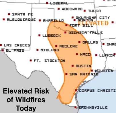
Aside from the cold front, the only other concern to speak of is the elevated wildfire concerns across the central part of the state by this afternoon. Once again, low humidity values, increasing temperatures and the lack of rainfall over the past 30 days will create conditions for the rapid spread of grass fires from northwest Texas through central Texas and down into the south Texas ranchlands. As always, please be careful with anything that could cause a spark or flame. Unfortunately, the long-term outlook for rain continues to be slim to none for this coming work week. The upper-level pattern this week will have us under northwest flow which is typically a very dry pattern for our state. The long-range models are indicating a possible pattern change coming into next weekend which could bring some slight rain chances back into the forecast, but that’s still a ways off. Until then, enjoy the fair winter weather!


0 Comments