

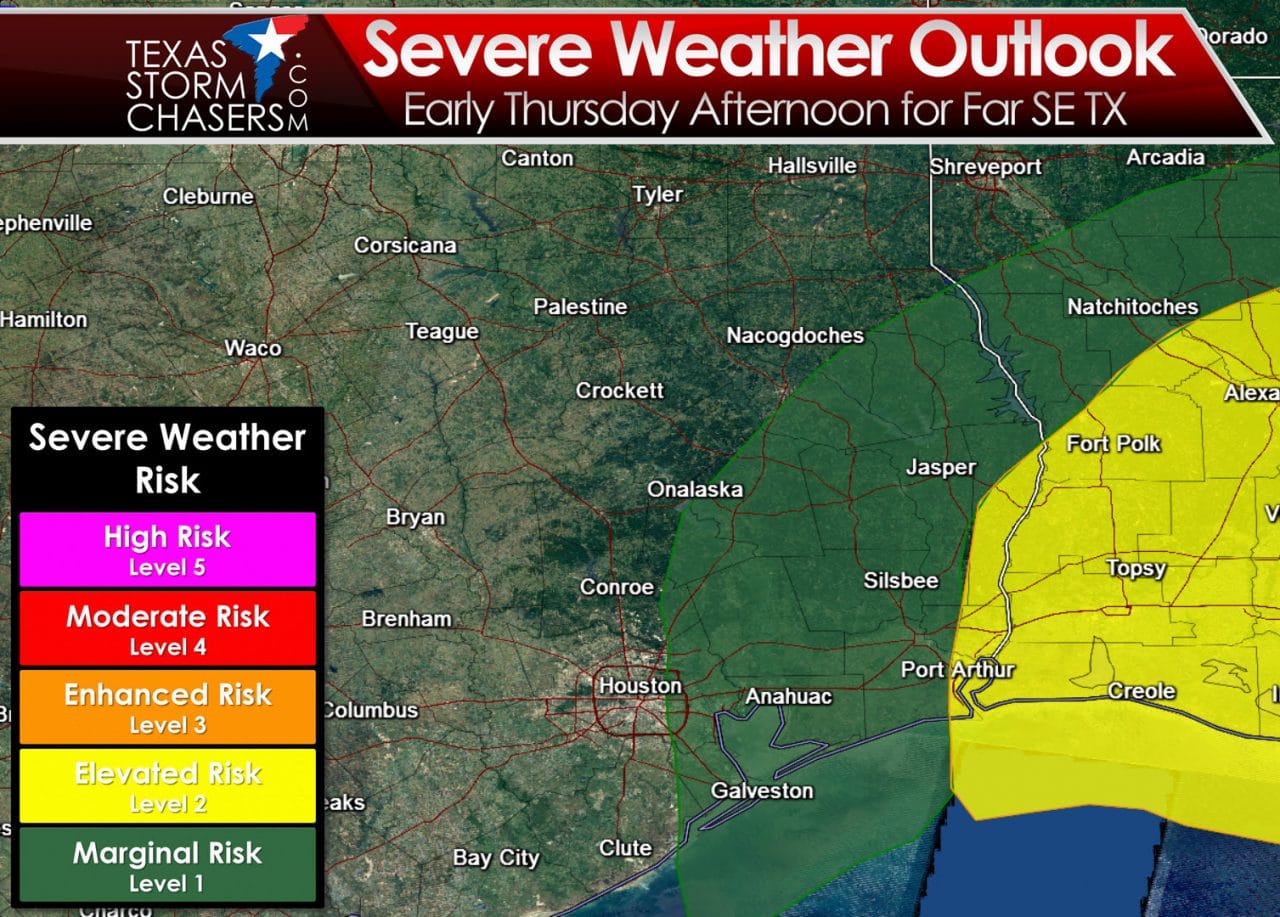
The afternoon update from the Storm Prediction Center maintains a marginal risk of severe weather in Southeast Texas on Thursday. A marginal risk is the lowest of five risk levels and means there is the potential for an isolated severe weather threat. We do note that the elevated risk of severe weather does run up to the Southeast Texas/Louisiana border on Thursday. I think that’s a good call based off the data I’m seeing. It appears that a few strong storms will fire up around lunchtime in Southeast Texas. Those storms would quickly move to the east/northeast and could become severe near the TX/LA border by mid-afternoon. Our neighbors in southern Louisiana should keep up with their local weather updates for tomorrow.
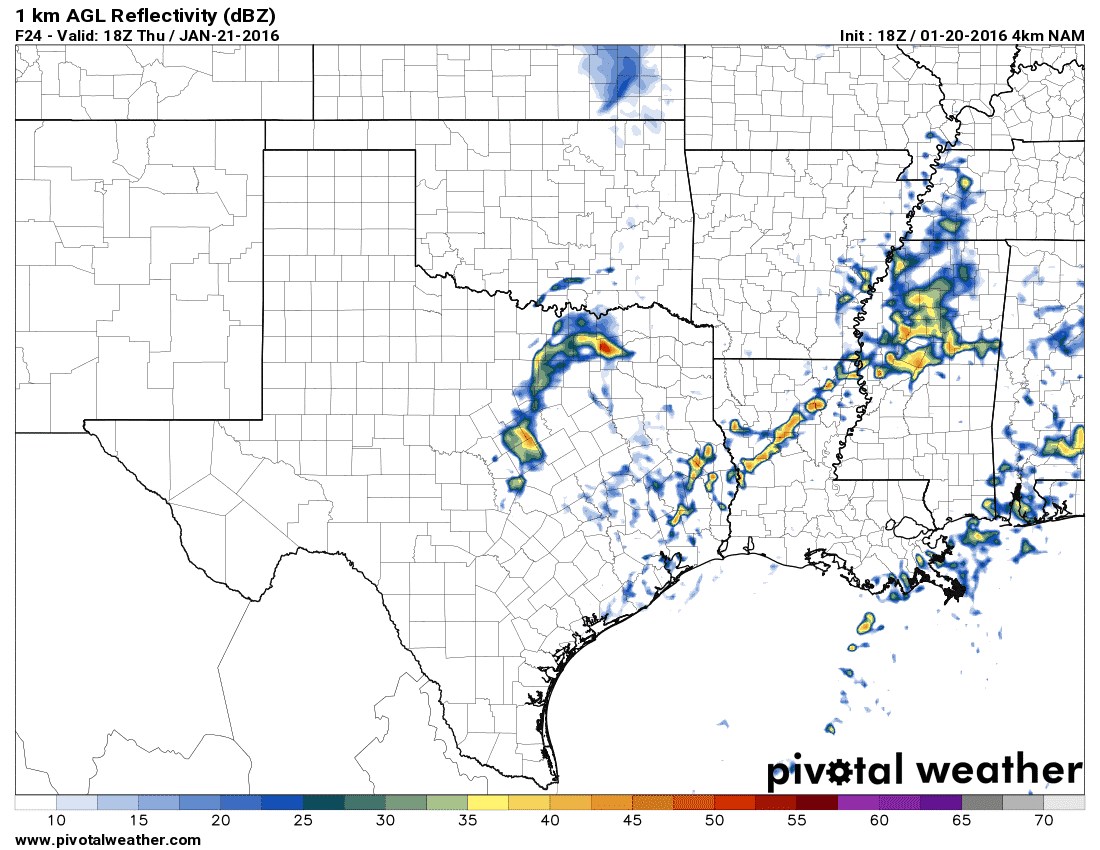
4KM NAM – Simulated radar at 12 PM Thursday
The 18Z run of the 4KM NAM seems to have a good grasp on the potential storm timeline for Thursday. At 12 PM it has a couple isolated storms in Southeast Texas – east of the Houston metro and east of Interstate 45. Those storms may be strong with some hail and strong wind gusts. Showers and perhaps a thunderstorm will be possible back in North Texas. The cold front will have already passed through that region so the storms would be very elevated and not severe. Small hail could occur with a few of those elevated storms tomorrow afternoon though.

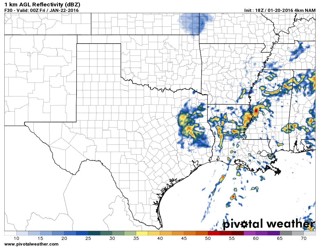
4KM NAM – Simulated radar at 3 PM Thursday
By 3 PM the NAM has the strongest storms east of Texas with showers continuing across Northeast Texas and East Texas. Strong northwest winds will be underway across most of Texas by this point as a cold front brings cooler temperatures. We’ll have to watch the storms early tomorrow afternoon as they could be ramping up in Far Southeast Texas before they exit the state. Damaging wind gusts and the potential for hail would be the greatest hazard. A very low risk for a tornado is possible near the southeast TX/LA border before storms exit our state. The threat for a couple tornadoes will increase as storms move into LA/MS. The threat for severe weather should end for Far Southeast Texas by 4-5 PM CT.
4KM NAM – Simulated radar at 6 PM Thursday
Finally the NAM continues to show showers in East Texas at 6PM Thursday as cooler temperatures continue to filer in. This activity is not expected to pose a threat for severe weather. We note that this model run has a fairly impressive storm near Jackson, Mississippi near dinnertime tomorrow evening. Folks out in southern Louisiana into the southern half of Mississippi will have to be on guard tomorrow afternoon and evening. I wouldn’t be surprised if they deal with a couple of tornadoes.


0 Comments