

I expect most of the daytime hours will be capped with thunderstorms holding off until near or after 5 PM. The experimental HRRR weather model run seems to show the situation well. Several of the past model runs (hourly) begin to develop thunderstorms around the Houston Metro at about 5 PM. Storms would move northeast around 25-35 MPH and expand in both intensity and coverage east of Houston towards Nacogdoches. By 9 PM it looks like several showers and thunderstorms may be underway from near Longview south into Southeast Texas to Beaumont. Activity should continue to move east and exit Texas by midnight. The strongest storms this evening could produce hail up to the size of half-dollars (1.25″ in diameter) and localized wind gusts of 50-60 MPH. The tornado threat is very low but if we were to have a brief tornado it would likely be in Southeast Texas. I wouldn’t be surprised to see the Category 2 risk extended further north into East Texas with the strongest storms capable of producing hail this evening.

Widespread severe weather is not expected with this event but there will likely be a larger area of rain and sub-severe storms. Rain totals across Northeast Texas, East Texas, and Southeast Texas will likely be in the 0.75 to 1.25 inch range. No rain accumulations is expected along or west of Interstate 35. A trace to around a tenth of an inch of liquid-equivalent precipitation is possible across the Texas Panhandle through Friday – most of that will fall as snow.
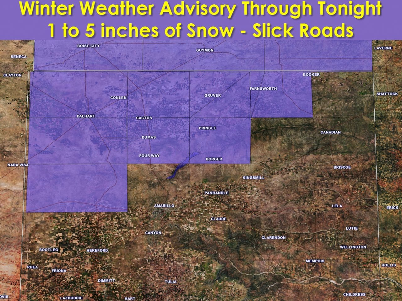
Snow will likely begin to fall across the western Texas Panhandle later this morning. By early afternoon snow will likely be underway across the Northwest Texas Panhandle into the northern Panhandle. Temperatures will be near or just below freezing at that point. Widespread snow will continue through early this evening across the northwest half of the Texas Panhandle. By midnight snow will have decreased in coverage with pockets of light snow possible across all the Panhandle into the Caprock. Snow accumulations up to five inches will be possible across the Northwest Texas Panhandle. A dusting of snow up to an inch will be possible from Amarillo and points west and north. Some of this snow will likely accumulate on roads creating slick conditions this afternoon into tonight.


0 Comments