
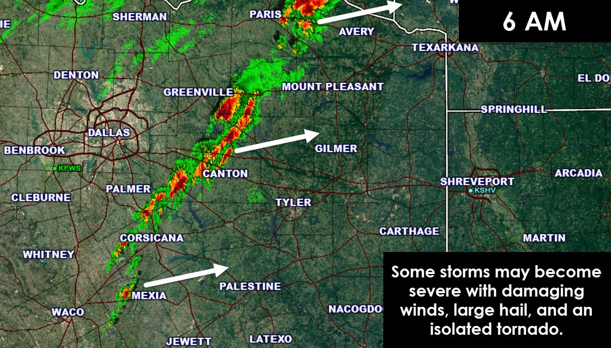
Our first thunderstorms developed a little over two hours ago. Since that point we’ve seen thunderstorms start developing as far south as Corsicana. This broken line of storms is moving east/northeast around 50-55 MPH. The strongest storm at the time of this writing was just east of Paris where a 54 MPH wind gust was produced in town. The rest of the storms near and south of Interstate 20 are less organized at this time. This could be due to a stronger capping inversion. As the storms move east over the next few hours there is a chance some of them could strengthen. A few severe storms are probable with large hail, damaging wind gusts, and an isolated tornado risk. The tornado risk will be ‘highest’ across Far Northeast Texas and East Texas this morning. The storms will really ramp up once they get into Arkansas and Louisiana later today.
We’ll watch the storms closely as they move east into a more favorable environment for severe weather. I would expect a new tornado watch to be issued until lunchtime since storms are now just moving into the western section of the watch. Our focus will be on any discrete cells that can become supercellular and top into the favorable environment this morning.
The threat for thunderstorms has ended along and west of Interstate 35 in North Texas.


0 Comments