
The biggest change with this update compared to earlier blogs is the timing has been pushed back a couple of hours. It looks like thunderstorm initiation may hold off until after midnight – perhaps closer to 2 or 3 AM. There is still some uncertainty on initiation timing but I’ll go ahead and push the time window back to midnight. Any storms that develop should move east of Texas by 9 AM. Let me reiterate that we’re not expecting a line of storms or a widespread event. A couple individual thunderstorms are expected that will quickly race northeast early tomorrow morning. Some of those storms may be supercells and pose a severe weather risk including the possibility of isolated tornadoes in Northeast Texas.
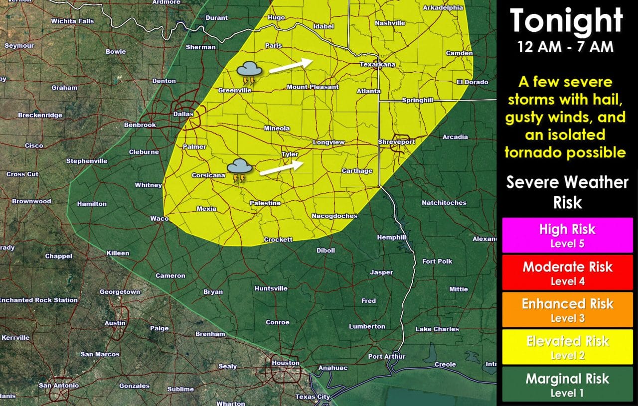
The severe weather outlook has been moved west again with the latest outlook. I think that’s a good move. The past couple runs of high-resolution hourly weather models have shown thunderstorm initiation taking place very near the D/FW Metroplex after midnight. Those storms will book it into Northeast Texas during the pre-dawn hours Wednesday. Storm motion/direction will be northeast around 45 to 50 MPH. The strongest storms could produce large hail, damaging wind gusts, and isolated tornadoes. The severe weather threat won’t be widespread – but I am a little more concerned for Northeast Texas. I doubt I need to say anything about severe weather being possible in December since this is the third severe weather event this fall.


0 Comments