
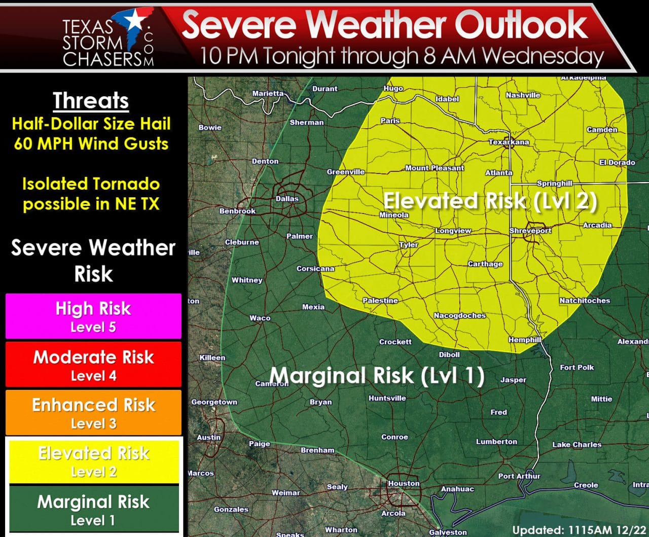
The elevated risk of severe weather has been removed from the D/FW Metroplex and Interstate 35 in North Texas. The risk now runs east of a Paris-Greenville-Corsicana line and north of a Palestine-Hemphill line. All of Northeast Texas is included in this elevated severe weather risk tonight. A marginal risk of severe weather includes portions of North-Central Texas and Southeast Texas. An isolated severe storm is possible tonight into the morning hours Wednesday across the marginal risk zone. A couple of severe thunderstorms are more likely in the elevated risk area across Northeast Texas. The primary hazard from the stronger storms tonight will be large hail up to the size of half-dollars and localized wind gusts over 60 MPH. An isolated tornado threat cannot be ruled out across Northeast Texas. I would put the timeframe for severe thunderstorms tonight from 11 PM through 6 AM – although I can’t rule out activity on either side of that window.
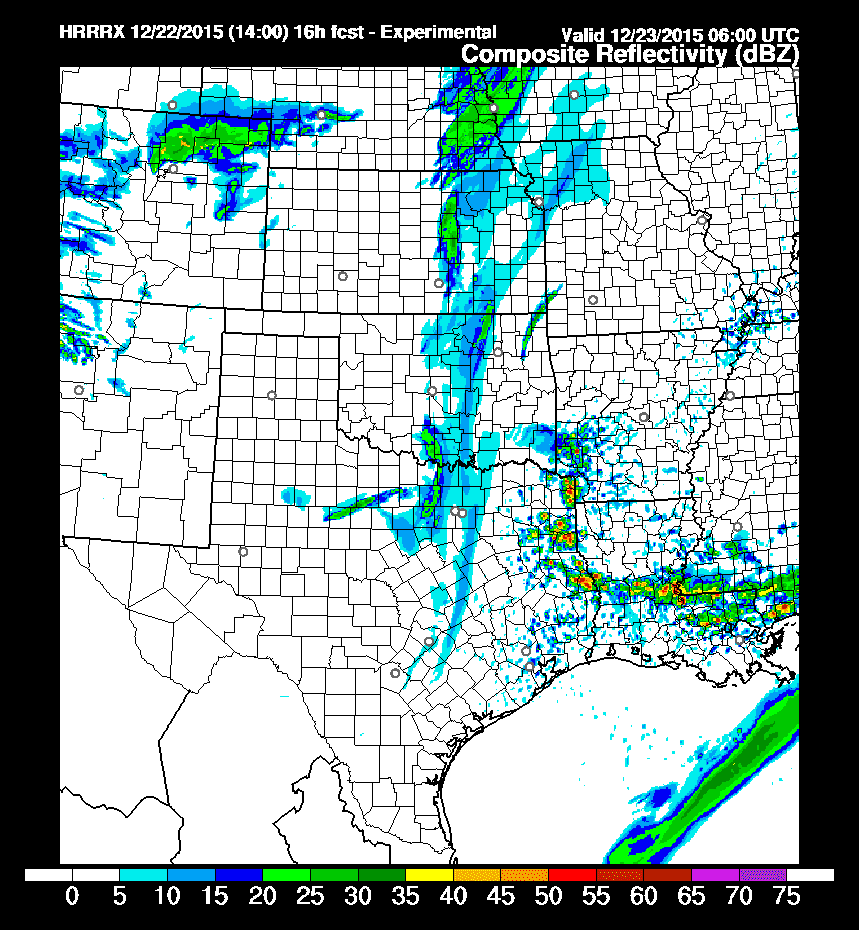
14Z HRRR Model showing simulated radar at 12 AM Tonight
The 14Z High Resolution Rapid Refresh (HRRR) experimental model has been trending east with thunderstorm initiation tonight. This model has thunderstorms developing across far Northeast Texas and East Texas. Should this occur the threat for severe weather will be ‘confined’ to those areas and Arkansas + Louisiana. The threat for strong thunderstorms is decreasing for North Texas. Should the east trend continue we should be able to trim back the western edge of the severe weather outlook later this afternoon. Don’t let your guard down yet though since a number of mesoscale factors could cause storm development further west. We’ll be watching for all the possibilities.
0 Comments