

With the nearly stationary cold front across West Texas the state will be divided by seasons once again. On the west side of the front temperatures will be on the cool side today with high temperatures in the 40s to low 50s. Winds will increase this afternoon in the Texas Panhandle and West Texas. West winds will gust up to 45 MPH causing wind chills to fall into the 30s. Compare that to South Texas and Southeast Texas who will make it into the upper 70s this afternoon. The Rio Grande Valley will be pushing 85 degrees for high temperatures! Folks in the Hill Country up to Texoma and into Northeast Texas will enjoy a pleasant day with temperatures warming into the 60s.
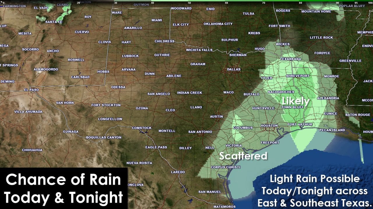
Moisture levels ahead of the cold front have not had time to recover after the cold front this past weekend. We expect light rain to develop across parts of the Brazos Valley, Southeast Texas, and East Texas later this afternoon and tonight. It’ll be enough to dampen the ground but overall rain totals will remain light. Most folks will get under a quarter inch of rain and we don’t expect any severe weather or flash flooding.
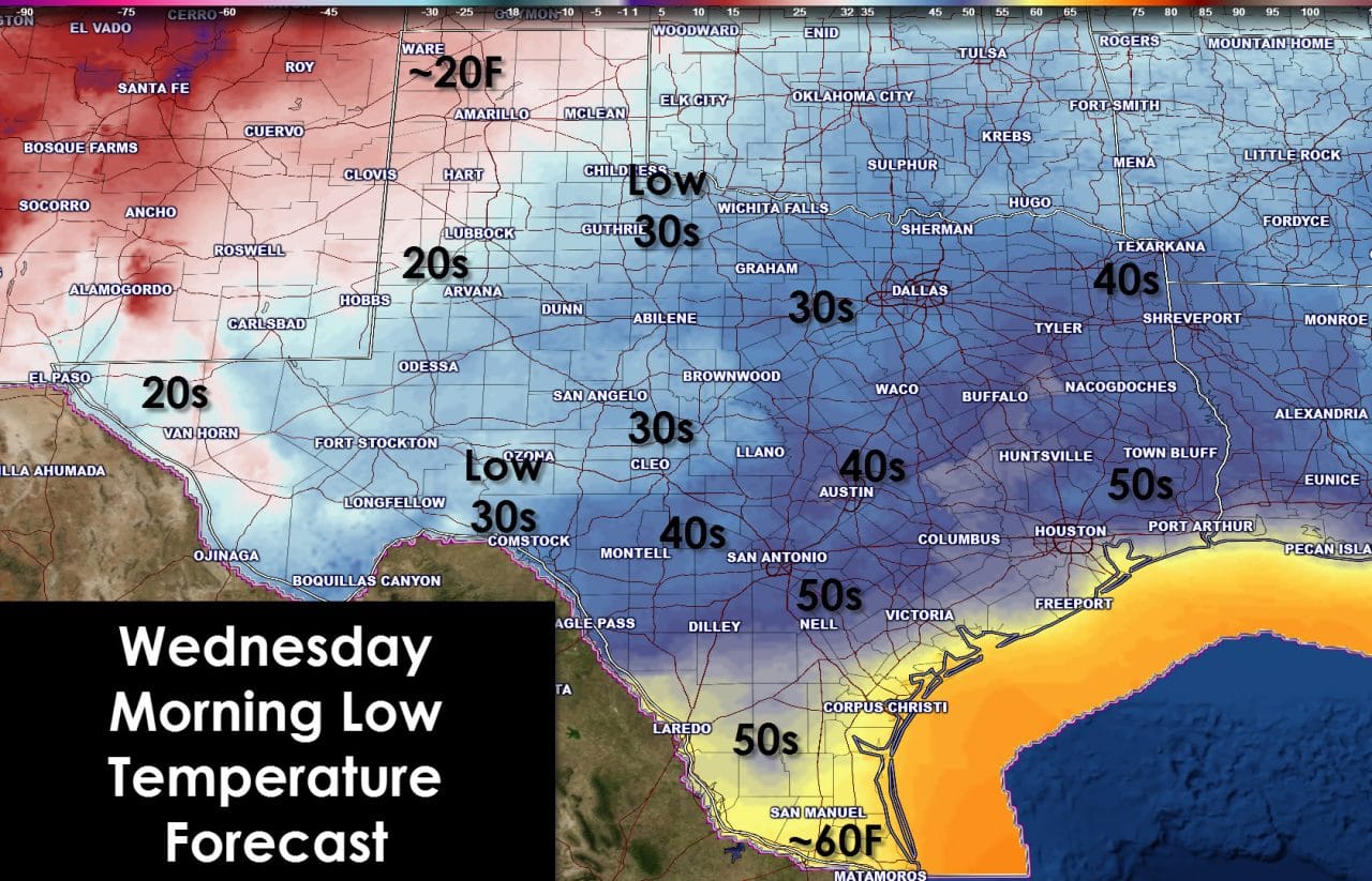
The cold front will resume its forward momentum this evening helping to bring colder temperatures to more of the state. Low temperatures by Wednesday morning will be in the upper teens to right around twenty degrees across the Texas Panhandle into the South Plains. The Concho Valley, Big Country, Northwest Texas, and Permian Basin will make it into the low and mid 30s. Texoma into North Texas (north/west of D/FW) will drop off into the 30s as well. 40s can be expected in Central Texas into Northeast Texas with 50s across South Texas where the cold front will be later to arrive. The Rio Grande Valley will only get down to 60 degrees tonight. If you’re looking to enjoy the warm weather as long as possible that’s where you need to head!
Our next potential storm system could arrive on Sunday into Monday. At this time it does look capable of bringing some rain to parts of the state. We don’t see any arctic intrusions in our future. Most extended range weather model guidance looks warm for Christmas so I wouldn’t get your hopes up for any wintery mischief. Sorry snow fans!


0 Comments